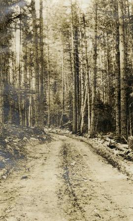
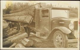
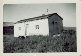
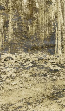
Showing 126 results

Archival description
Spruce-Balsam Type, Giscome
2007.1.25.3.19.01 · Part · 1924
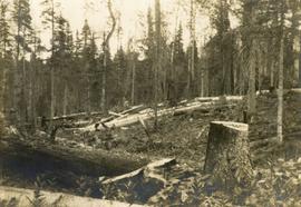
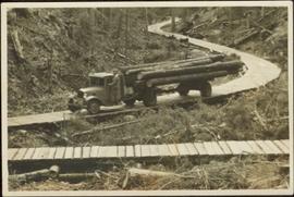
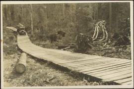
Part of Aleza Lake Research Forest fonds

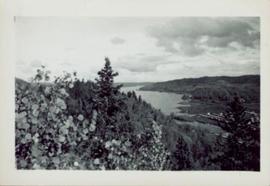
Original photographic print included in "Northern Interior Forest Experiment Station: Report of Preliminary Investigations" by Percy Barr. Photograph depicts mature spruce and balsam reproduction.

2011.12.05 · Stuk · [ca. September 1950- June 1951]
Part of Giscome, BC Historical Photograph collection

Photograph of various plant life with Eagle Lake visible in the background. Handwritten annotation in pen on verso reads: “Eagle Lake from the top of the bluff. Eagle Lake is about 7 miles long & about 1 mile wide. It is a fair sized lake.”

2011.12.25 · Stuk · [ca. September 1950- June 1951]
Part of Giscome, BC Historical Photograph collection

Photograph of the front of Brown's General Store. Handwritten annotation in pen on verso reads: “Brown’s General Store. The wheelbarrow is for bringing the groceries and mail over from the train. Also if you buy a great quantity of things you wheel it home and then bring back the barrow (Taken on Sunday).”

2011.12.09 · Stuk · [ca. September 1950- June 1951]
Part of Giscome, BC Historical Photograph collection

Street view featuring a dirt road leading directly to Giscome School, a three room institution. On the right the steeple of the Catholic church is visible, beside which was Neff’s (sp?) corner store. Handwritten annotation in pen on verso reads: “Looking up our street. The school is at the end.”

Teacherage outhouse
2011.12.21 · Stuk · [ca. September 1950- June 1951]
Part of Giscome, BC Historical Photograph collection

Small wooden outhouse with wooden planked pathway sits in an open field behind the Teacherage. Handwritten annotation in pen on verso reads: “Behind the teacherage. Guess what?”

2023.10.1 · Stuk · July 1952
Part of Torajiro Sasaki Collection

This 16mm film of Eagle Lake Sawmills was produced by Torajiro Sasaki in July 1952, likely commissioned or with permission from the sawmill owners, the Spurs. The film depicts logging and sawmilling operations at the Eagle Lake Sawmill, as well as shots of the bunkhouses, exterior shots of the mill, and the beehive burner. Employees of the mill are shown at work. In 1952, Eagle Lake Sawmill used both machinery and horses in their operations.

Zonder titel
Open Field in Giscome
2012.13.1.87.069 · Stuk · [between 1975 and 1995]
Part of J. Kent Sedgwick fonds

Image depicts a field in Giscome, B.C. On the right side of the image, in the background, is a grey strip that appears to be a mine, possibly the quarry at Eaglet Lake in Giscome, B.C. Map coordinates 54°03'52.9"N 122°22'10.0"W

Houses in Giscome
2012.13.1.87.072 · Stuk · [between 1975 and 1995]
Part of J. Kent Sedgwick fonds

Image depicts the Giscome B.C. townsite from across the railroad tracks looking southeast. Map coordinates 54°04'19.7"N 122°22'04.7"W

House - Elevated Main Floor
2012.13.1.87.079 · Stuk · [between 1975 and 1995]
Part of J. Kent Sedgwick fonds

Image depicts a house with the main floor and entrance high off the ground. The location is uncertain, likely Giscome, B.C.

Giscome Dairy Farm
2012.13.1.87.083 · Stuk · [between 1975 and 1995]
Part of J. Kent Sedgwick fonds

Image depicts a large, old and collapsing barn, as well as a nearby house of the dairy farm in Giscome, B.C. Map coordinates 54°03'53.3"N 122°21'22.6"W

Giscome Sawmill
2012.13.1.87.167 · Stuk · [between 1975 and 1995]
Part of J. Kent Sedgwick fonds

Image depicts the mill site at Giscome, B.C. Map coordinates 54°04'19.7"N 122°22'04.7"W

Giscome Sawmill
2012.13.1.87.171 · Stuk · [between 1975 and 1995]
Part of J. Kent Sedgwick fonds

Image depicts the mill site at Giscome, B.C. A sign in the foreground reads "Maynard's Industrial Auctioneers." Map coordinates 54°04'19.7"N 122°22'04.7"W