Affichage de 482 résultats

Archival description
482 résultats avec objets numériques Afficher les résultats avec des objets numériques
"Prince George B.C."
2012.13.2.21.08.1 · Pièce · 26 Apr. 1967
Fait partie de J. Kent Sedgwick fonds

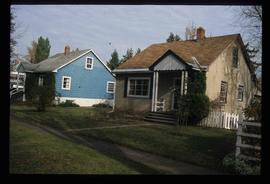
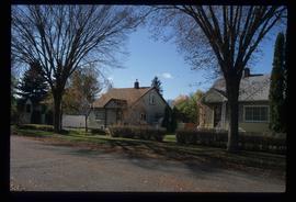
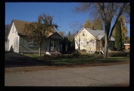
This very large drawing shows CN leases and private property buildings on Island Cache in detail.

Sans titre
1690 Dogwood Street
2012.13.1.24.32 · Pièce · 2000
Fait partie de J. Kent Sedgwick fonds

Image depicts 1690 Dogwood Street, on the corner of 17th Ave and Dogwood St. in Prince George, B.C. Also depicts a portion of 1670 Dogwood Street at left.

Houses on Dogwood Street
2012.13.1.24.34 · Pièce · 2000
Fait partie de J. Kent Sedgwick fonds

Image depicts houses on Dogwood Street in the Millar Addition neighbourhood of Prince George, B.C. On the left is 1610 Dogwood Street and 1630 Dogwood Street is the middle house; 1650 Dogwood Street is the blue house on the right.

Fort George Park
2012.13.1.3.073 · Pièce · Oct. 1983
Fait partie de J. Kent Sedgwick fonds

Image depicts the Fort George Park. Map coordinates 53°54'30.2"N 122°43'57.4"W

View from Gunn Point
2012.13.1.3.067 · Pièce · Nov. 1979
Fait partie de J. Kent Sedgwick fonds

Image depicts a view of Prince George from Gunn Point in the L.C. Gunn Park looking north. Map coordinates 53°54'26.2"N 122°43'35.8"W.

View from Gunn Point
2012.13.1.3.066 · Pièce · Nov. 1979
Fait partie de J. Kent Sedgwick fonds

Image depicts a view of Prince George from Gunn Point in the L.C. Gunn Park looking north. Map coordinates 53°54'26.2"N 122°43'35.8"W.

View from Gunn Point
2012.13.1.3.065 · Pièce · Nov. 1979
Fait partie de J. Kent Sedgwick fonds

Image depicts a view of Prince George from Gunn Point in the L.C. Gunn Park looking north. Map coordinates 53°54'26.2"N 122°43'35.8"W.

View from Gunn Point
2012.13.1.3.064 · Pièce · Nov. 1979
Fait partie de J. Kent Sedgwick fonds

Image depicts a view of Prince George from Gunn Point in the L.C. Gunn Park looking north. Map coordinates 53°54'26.2"N 122°43'35.8"W.

View from Gunn Point
2012.13.1.3.063 · Pièce · Nov. 1979
Fait partie de J. Kent Sedgwick fonds

Image depicts a view of Prince George from Gunn Point in the L.C. Gunn Park looking north. Map coordinates 53°54'26.2"N 122°43'35.8"W.

View from Gunn Point
2012.13.1.3.062 · Pièce · Nov. 1979
Fait partie de J. Kent Sedgwick fonds

Image depicts a view of Prince George from Gunn Point in the L.C. Gunn Park looking north. Map coordinates 53°54'26.2"N 122°43'35.8"W.

View from Gunn Point
2012.13.1.3.061 · Pièce · Nov. 1979
Fait partie de J. Kent Sedgwick fonds

Image depicts a view of Prince George from Gunn Point in the L.C. Gunn Park looking north. Map coordinates 53°54'26.2"N 122°43'35.8"W.

View from Gunn Point
2012.13.1.3.060 · Pièce · Nov. 1979
Fait partie de J. Kent Sedgwick fonds

Image depicts a view of Prince George from Gunn Point in the L.C. Gunn Park looking north. Map coordinates 53°54'26.2"N 122°43'35.8"W.

View from Gunn Point
2012.13.1.3.058 · Pièce · Nov. 1979
Fait partie de J. Kent Sedgwick fonds

Image depicts a view of Prince George from Gunn Point in the L.C. Gunn Park looking north. Map coordinates 53°54'26.2"N 122°43'35.8"W.

Central Business District
2012.13.1.3.057 · Pièce · July 1979
Fait partie de J. Kent Sedgwick fonds

Image depicts the Central Business District of Prince George looking north from Connaught Hill. Map coordinates 53°54'41.4"N 122°44'58.5"W

Prince George
2012.13.1.3.046 · Pièce · Jan. 1978
Fait partie de J. Kent Sedgwick fonds

Image depicts a view of Prince George from City Hall looking northeast along George Street. Map coordinates 53°54'46.3"N 122°44'41.9"W

View from City Hall
2012.13.1.3.045 · Pièce · Jan. 1978
Fait partie de J. Kent Sedgwick fonds

Image depicts a view of Prince George from City Hall looking northeast with the pulp mills in the background. Map coordinates 53°54'46.3"N 122°44'41.9"W

View from Gunn Point
2012.13.1.3.059 · Pièce · Nov. 1979
Fait partie de J. Kent Sedgwick fonds

Image depicts a view of Prince George from Gunn Point in the L.C. Gunn Park looking north. Map coordinates 53°54'26.2"N 122°43'35.8"W.

Fort George Regional Museum
2012.13.1.3.071 · Pièce · Oct. 1983
Fait partie de J. Kent Sedgwick fonds

Image depicts the Fort George Regional Museum (now known as The Exploration Place) in Prince George, B.C. Map coordinates 53°54'18.6"N 122°44'09.8"W

Forestry Heavy Machinery
2012.13.1.122.30 · Pièce · May 1980
Fait partie de J. Kent Sedgwick fonds

Image depicts several pieces of heavy machinery used in forestry. The Coast Inn of the North is seen in the background.

Forestry Heavy Machinery
2012.13.1.122.29 · Pièce · May 1980
Fait partie de J. Kent Sedgwick fonds

Image depicts several pieces of heavy machinery used in forestry. The Coast Inn of the North is seen in the background.

Sawmill - Interior
2012.13.1.122.24 · Pièce · June 1980
Fait partie de J. Kent Sedgwick fonds

Image depicts logs being cut into planks in the interior of a saw mill somewhere in Prince George, B.C.

Sawmill - People and Logs
2012.13.1.122.22 · Pièce · June 1980
Fait partie de J. Kent Sedgwick fonds

Image depicts numerous stripped logs and several unidentified individuals in hard hats at a saw mill somewhere in Prince George, B.C.

Sawmill - Saw
2012.13.1.122.18 · Pièce · June 1980
Fait partie de J. Kent Sedgwick fonds

Image depicts a saw cutting a log in half at a saw mill in Prince George, B.C.

Sawmill
2012.13.1.122.15 · Pièce · [1979?]
Fait partie de J. Kent Sedgwick fonds

Image depicts logs being stripped of their bark at a saw mill in Prince George, B.C.

Sawmill - Lakeland Mills?
2012.13.1.122.07 · Pièce · Oct. 1975
Fait partie de J. Kent Sedgwick fonds

Image depicts a saw mill, possibly Lakeland Mills, with a beehive burner and numerous piles of logs in the foreground, in Prince George, B.C.

Sawmill - Wood Planks
2012.13.1.122.10 · Pièce · Oct. 1975
Fait partie de J. Kent Sedgwick fonds

Image depicts numerous blocks of wood planks at a saw mill, possibly Lakeland Mills, somewhere in Prince George, B.C.

Suspended Trailer
2012.13.1.122.09 · Pièce · Oct. 1975
Fait partie de J. Kent Sedgwick fonds

Image depicts a trailer for a logging truck suspended off the ground by a wooden structure. This is used to load the trailer onto the back of the truck. The name on the truck says "Rormarniewich Trucking Ltd."

Canadian National Railway Yards
2012.13.1.122.14 · Pièce · 1979
Fait partie de J. Kent Sedgwick fonds

Image depicts numerous piles of wood planks at the Canadian National Railway Yards in Prince George, B.C. The cutbanks are seen in the background.

Studio 2880 Arts Complex
2012.13.1.3.170 · Pièce · Apr. 2003
Fait partie de J. Kent Sedgwick fonds

Image depicts Studio 2880 Arts Complex in Prince George, B.C. Map coordinates 53°54'36.9"N 122°46'30.3"W