Mostrando 265 resultados

Archival description
Cassiar Land
2000.1.1.3.25 · Dossiê · 1979 - 1983
Parte de Cassiar Asbestos Corporation Ltd. fonds

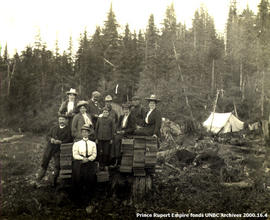
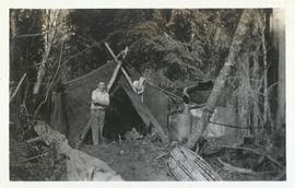
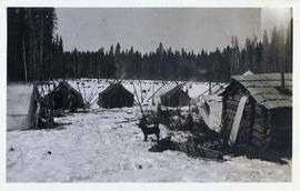
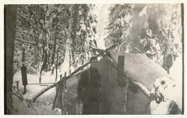
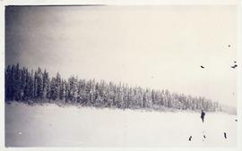
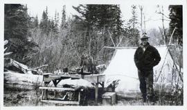
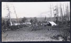
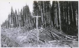
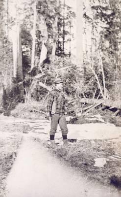
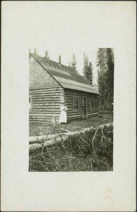
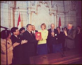
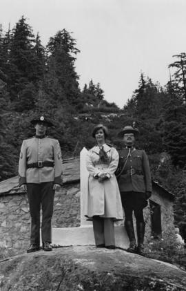
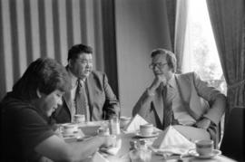
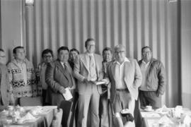
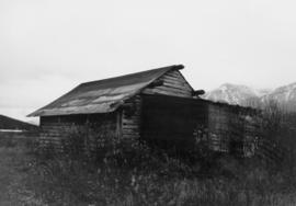
This file contains images of a land dispute around Cassiar. The photographs depict a cabin on a lot, a destroyed cabin, and outhouses. The accompanied documents in the original file refer to the subjects of "Claims, Leases, and Land lots," and it is implied that there were issues of squatters, illegal occupation, and mineral claims.

2000.16.2.4 · Item · 1906
Parte de Prince Rupert Empire collection

Item is a copy print of a photograph of a group of people in a cleared area with a small tent in the background in Prince Rupert on June 1, 1906. The people in the photograph are identified as: Mrs. J.L. Williams, Jack or Jock Williams, Mrs. Porter, Miss Mai Johnston, Mrs. R.L. McIntosh, J.H. Pillsbury, Mr. Pinder ? (Engineer), Captain Jenner ?, Mrs. S.G. Harris, and Cannon Rushbrook.

Hudson's Hope
2000.19.2.33 · Item · 29 Aug. 1927-26 Sept. 1927
Parte de Prentiss Gray Collection

Photograph depicts the townsite of Hudson's Hope featuring a number of small wooden buildings clustered in a field. The Hudson's Bay post is building visible on far left.

2001.1.1.2 · Item · 31 Jan. 1869
Parte de NBCA Document and Ephemera Collection

Item consists of a letter written by John McCormick to a person named James; it is not made clear if James is a friend or relative. In both his letter to James, John McCormick makes several references to Victoria. His familiarity with Victoria suggests that he may have travelled from Victoria to Barkerville to mine for gold. In his letters to James, John McCormick describes having no money and living under poor conditions. He mentions the great fire that swept through Barkerville and that he lost nothing due to its distance from his house. McCormick also mentions that the Indians are dying quickly of Small Pox in Victoria.

Second Street in Fort George, BC
2006.20.11.2 · Item · [ca. 1900]
Parte de Northern BC Archives Historical Photograph Collection

Photograph depicts a street scene along Second St. in Fort George. Wagons line the dirt road which is flanked by wooden buildings. A group of unidentified men stand on the boardwalk outside of Rigg's Restaurant. Handwritten annotation along bottom of photograph: "Second St. Ft. George".

Taku River Survey - Two Men at Flag
2006.20.3.26 · Item · [between 23 May 1906 and 15 October 1906]
Parte de Northern BC Archives Historical Photograph Collection

Photograph depicts two unidentified men standing to right of flag mounted in rock pile.

Image is one of 65 photos documenting a survey of the Canada-Alaska Boundary, Taku River area, May 23 to Oct. 15, 1906.
This particular photo is one of 13 found in original enclosure with the following handwritten annotation: "SOME OTHERS." See also items 2006.20.3.22 - 2006.20.3.34.

Taku River Survey - Two Men at Flag
2006.20.3.55 · Item · [between 23 May 1906 and 15 October 1906]
Parte de Northern BC Archives Historical Photograph Collection

Photograph depicts two unidentified men standing to right of flag mounted in rock pile.

Image is one of 65 photos documenting a survey of the Canada-Alaska Boundary, Taku River area, May 23 to Oct. 15, 1906. This particular photo is one of 10 found in original enclosure with the following handwritten annotation: "From [Wahut?]-Azmuth and Koshu.” See also items 2006.20.3.47 - 2006.20.3.56.

2006.20.3.61 · Item · [between 23 May 1906 and 15 October 1906]
Parte de Northern BC Archives Historical Photograph Collection

Photograph depicts two men on either side of camera on tripod, flag visible behind them. Mountain range and glacier in background.

Image is one of 65 photos documenting a survey of the Canada-Alaska Boundary, Taku River area, May 23 to Oct. 15, 1906. This particular photo is one of 9 found in original enclosure with the following handwritten annotation: "Pictures of different members of ‘our’ party.” See also items 2006.20.3.57 - 2006.20.3.65.

2009.5.2.8 · Item · [ca. 1911]
Parte de Taylor-Baxter Family Photograph Collection

Photograph depicts Sarah Glassey, holding her fox terrier, and standing at corner of log house. Felled trees in foreground, forest trees in background. Photograph believed to have been taken on the 160 acres of land which Sarah purchased in the Kispiox Valley in 1911. She became the first single woman to pre-empt land in British Columbia. This house was built in a year with the help of a Gitxsan Elder.

2009.6.1.543 · Item · 1999
Parte de The Honourable Iona Campagnolo fonds

The group stands in front of an ornate stone wall and two Canadian flags.

Handwritten annotation on photograph enclosure reads: “8/6/99. Dear Lady, When I saw this photograph I knew there was a certain person who would truly appreciate and ‘feel’ its significance. Not many steps left to take now . . . . your unwavering support is never more appreciated. best personal regards, Peter”; handwritten annotation on verso reads: “Nisga’a”.

First pile driven at Prince Rupert BC
2009.7.1.246 · Item · 8 June 1906
Parte de Archdeacon W. H. Collison fonds

Pile driver situated on Prince Rupert shoreline. Tents and wooden buildings visible on rocky background. Printed annotations on recto of photograph read: "First pile driven at Prince Rupert BC. June 8 '06."

2009.7.1.247 · Item · ca. 1880-1920
Parte de Archdeacon W. H. Collison fonds

Photo of entire ship building plant, including several vessels in the foreground. Hills are visible in the background. Annotation on recto reads: "Prince Rupert Ship Repair and Ship Building Plant. Prince Rupert BC. Frank E Kirby, William T Donnelly, Engineers. 17 Battery Place. NYC."

Centre Street Prince Rupert
2009.7.1.251 · Item · ca. 1880-1920
Parte de Archdeacon W. H. Collison fonds

Photograph of residents in motion on Centre Street in Prince Rupert. Buildings are visible on either side of the street and a railway track runs down the length of the road. Annotation on recto reads: "Centre Street, Prince Rupert, BC. 1664."

After the blast 24 April 1913
2009.7.1.260 · Item · 24 April 1913
Parte de Archdeacon W. H. Collison fonds

Foreground shows a rocky shore covered in debris. A small crowd is visible along the coastline, and there are foggy outlines of hills beyond the water. Annotation on recto reads: "McRae Bros After the Blast 24th Apr. 13."

3rd 4th Aves and Fullton Street
2009.7.1.261 · Item · 8 August 1909
Parte de Archdeacon W. H. Collison fonds

Photograph shows two men and a cart full of lumber at a street intersection. Various residential buildings are visible in the background and atop a large clear cut hill. Annotation on recto reads: "3rd, 4th Aves and Fullton St. Prince Rupert. BC. Allen Photo 8/Aug/09."

The last big blast 21 January 1914
2009.7.1.263 · Item · 21 January 1914
Parte de Archdeacon W. H. Collison fonds

Photograph of a large explosion next to a huge pile of debris. Buildings are visible on either side and railroad track can be seen in the foreground. Annotation on recto reads: "The Last Big Blast, Prince Rupert BC 21 Jan 1914 McRae Bros. Photo"