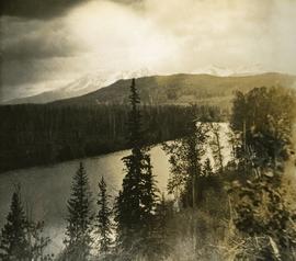
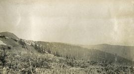
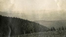
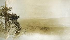
Showing 3619 results

Archival description
View of Seton Lake area
2020.08.77 · Item · [between 1911 and 1915]
Part of Pacific Great Eastern Railway Region Photograph Collection

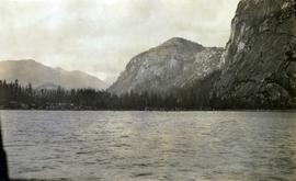
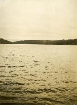
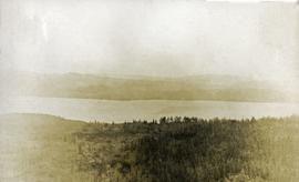
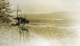
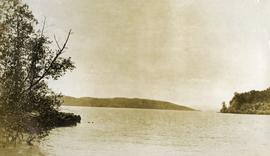
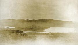
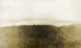
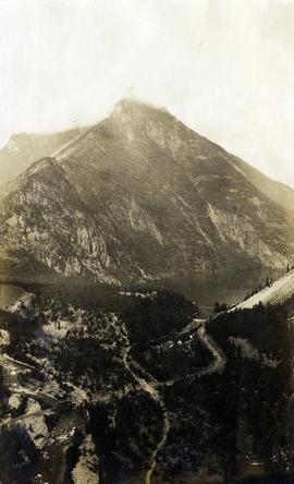
Photograph depicts a view of Seton Lake and the surrounding area, including the Pacific Great Eastern railway line. The railway grade is visible at left. Also visible is the Seton Lake fish hatchery at the east end of the lake and its employee boarding house, superintendent's cottage, and weir at the head of what was then referred to as "Lake Creek". The road seen in the centre foreground travelled from Lillooet to Seton Lake then to Golden Cache Mine.

2020.08.06 · Item · [between 1914 and 1923]
Part of Pacific Great Eastern Railway Region Photograph Collection

Photograph depicts a view of St'a7mes village looking north, taken from the original Government Wharf in Squamish (Newport). This wharf was built in 1902 and was temporarily replaced by other docks to the west built by the PGE Railway in 1913-14. This photograph was taken after 1914, since the houses in the photo were built by the PGE Railway Company as part of the 1914 reserves sale deal.

Further details that date this photograph between late 1914 and 1920:

  • the Merrill & Ring logging operation beach camp is not depicted (opened in 1926)
  • the dock from which the photo is taken fell into disrepair after 1914 and was not rebuilt until 1929.
View of Summit Lake
2005.3.50 · Item · [ca. 1945]
Part of John Hart Highway Photograph Collection

Handwritten caption beside this photo reads: "Sumit Lake." Trees can be seen on shore jutting into the lake on left, as well as on opposite shore in distant background. Unidentified objects can be seen in distance, possibly buildings on far shore.

2006.20.12.35 · Item · [ca. 1940]
Part of Northern BC Archives Historical Photograph Collection

Handwritten photo album caption below this photo reads: "Above the Rockies at 12 000 feet." Photograph depicts the Rocky Mountains from a distance. As the photograph was taken from the inside of an airplane, the plane's wing tip can be seen on the far right of the image. A sun circle is also visible in the top center.

Royal Canadian Air Force
View of Wrangell, Alaska
2009.7.1.158 · Item · 1877
Part of Archdeacon W. H. Collison fonds

Photograph depicts community buildings on shoreline, water in foreground.

Handwritten annotation on image reads: "Wrangle, Alaska."; on verso: "Fort Wrangle, Alaska Territory. visited by W.H.Collison, C.M.S. 1877. Prior to the establishment of any mission, [...? illegible] 1875 - 1876. Presbyterian. Insert this illustration of Wrangle on Page 77 as marked."

View South - Trees
2012.13.1.41.23 · Item · 2002
Part of J. Kent Sedgwick fonds

Image depicts a view south, possibly of an abandoned grade for the BCR; possibly somewhere near Woodpecker, B.C.

2006.20.11.29 · Item · 9 August 1949
Part of Northern BC Archives Historical Photograph Collection

Postcard overview of the Bulkley River running closely past the village of Telkwa. Handwritten annotation in pen on verso reads: "Don Choracy [?] Prince Rupert, B.C. c/o Wrathall's Photo Shop. Aug. 9 Lake Kaetlyn. We had to drive all the way to Telkwa the other nite for postcards, imagine. We were sure glad and surprised to see Jack & Dick drive in at 7 to-nite. Just like being home. We are having so much fun. The boys are out on Lake to-nite, went to visit Dr. Macdonald's me thinks. I have bad head cold so have to stay home first nite at home I've since we came, Dieks is taking me on Lake tomorrow I hope, Love Bea-P."

2009.5.1.16 · Item · 1928
Part of Taylor-Baxter Family Photograph Collection

Twenty-three year old Violet stands wearing a polka dot dress in a group of unidentified men, women and children. Body of water and tree-covered hill on opposite shore in background. Handwritten caption below this photo reads: "Pr. Rupert, 1928 End of Road Construction".