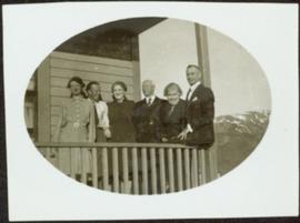
Showing 4377 results

Archival description
3218 results with digital objects Show results with digital objects
"Rose Prince"
2012.13.3.1.25.1 · Item · 25 Apr. 2010
Part of J. Kent Sedgwick fonds

The item is a DVD-R containing two video files taking up a total of 2GB.

2012.13.1.135.01.05 · Item · [between 1980 and 2000]
Part of J. Kent Sedgwick fonds

Photograph depicts Rosel's restaurant at 1624 7th Avenue. Rosel's restaurant was owned and operated by Wilfred and Rosel Vogt from 1981 to 1997. The building was built in 1916 and was originally owned by Dr. Carl Ewart and later owned by Hubert King of Wilson, King and Company, the oldest law firm in Prince George, after 1946. The building is now a designated heritage building.

2009.5.1.81 · Item · [ca. 1910]
Part of Taylor-Baxter Family Photograph Collection

Photograph depicts team of horses pulling heavily loaded wagon with the sign: "RUDDY & MACKAY. BAGGAGE. STAGE & TRANSFER." One man stands holding head of horse and smoking a pipe. A second man sits in wagon holding reigns, (believed to be same man featured in items 2009.5.1.79 & 2009.5.1.80). Large "Grand Trunk Pacific" building can be seen in background, as well as a smaller building with the sign "HAZELTON" hanging from its eaves.

Rudi's Bridge
2012.13.1.50.059 · Item · 1978
Part of J. Kent Sedgwick fonds

Image depicts a small foot bridge at an unknown location. The slide is simply labelled "Rudi's Bridge."

Ruined Cars
2012.13.1.22.16 · Item · 1970
Part of J. Kent Sedgwick fonds

Image depicts several old, ruined cars and an unknown individual in Island Cache.

2012.13.2.16.46 · File · 2003-2007
Part of J. Kent Sedgwick fonds

File consists of notes, clippings, and reproductions relating to rural schools in the Prince George region. Includes photographs depicting the first and second school buildings for the North Nechako school; one was sold and the other has been closed (2005).

Salvation Army
2012.13.1.3.112 · Item · 12 Oct. 1989
Part of J. Kent Sedgwick fonds

Image depicts the Salvation Army on Ospika Boulevard in Prince George, B.C. Map coordinates 53°55'02.6"N 122°47'41.6"W.

Salvation Army
2012.13.1.3.114 · Item · 12 Oct. 1989
Part of J. Kent Sedgwick fonds

Image depicts the Salvation Army on Ospika Boulevard in Prince George, B.C. Map coordinates 53°55'02.6"N 122°47'41.6"W

2008.3.1.22.2 · Item · 6 July 1979
Part of Bridget Moran fonds

Polaroid photograph depicting large building with the sign "TRADES SHOP". Power line and red car in foreground; hill and trees in background. Handwritten annotation on verso of photograph: "The Sanatorium. Fort Qu'Appelle - July 6/79".

2009.5.3.72 · Item · [ca. 1912]
Part of Taylor-Baxter Family Photograph Collection

Photograph depicts small log buildings and loaded wagons in cleared dirt area. Building on far left has the sign "POOL HALL" posted on front . Treetops, lumber piles, and hills in background. Mountains can be seen in distance. Handwritten annotation on verso of photograph reads: "Sand Creek. B.C."

2009.5.2.16 · Item · [ca. 1934]
Part of Taylor-Baxter Family Photograph Collection

Photograph depicts Sarah and H.F. Glassey standing on wood sidewalk in hats and long jackets, unidentified house in background. Handwritten annotation on recto of photograph: "Sarah & Bert Glassey". Photograph speculated to have been taken near the Glassey home at Atlin, BC.