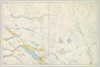
Colour-coded topographic map depicting lands surveyed as alienated, available for purchase or lease under Land Act, or reserved. Depicts land district boundaries, land recording divisions, provincial forest boundaries, HBC posts, triangulation stations, telephone lines, communities, bodies of water, and transport routes.
3 resultados com objetos digitais
Mostrar resultados com objetos digitais
2008.2.1.22
·
Item
·
1 August 1940
Parte de Northern BC Cartographic Collection
2008.2.1.09
·
Item
·
1 December 1923
Parte de Northern BC Cartographic Collection
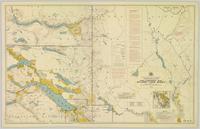
Colour-coded topographic map depicting lands surveyed as alienated, reserved, or statutory timber land. Depicts land district boundaries, land recording divisions, HBC posts, triangulation stations, telephone lines, communities, bodies of water, and transport routes. Defines resource type areas (“Land Form,” “Soil,” “Forest Cover,” “Grazing,” “Geological & Mineralogical,” “Fur-Bearing Animals & Game”). Includes explanatory “Natural Resources Reference.”
2008.2.1.01
·
Item
·
31 July 1914
Parte de Northern BC Cartographic Collection
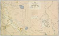
Colour-coded map depicting lands open for preemption, in “University Reserve,” or reserved for public auction. Depicts land recording divisions, communities, bodies of water, and transport routes.


