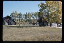
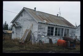
Subseries contains material collected and created by Kent Sedgwick for research regarding various areas surrounding Prince George. Includes materials on the Crooked River area; Summit Lake; Ferguson Lake; Chief Lake; Salmon Valley; Mud River; Beaverly; Buckwater; Chilako River; Indian Reserve no. 4; Blackburn; Pineview; Stone Creek; Red Rock; Woodpecker; and Hixon. The files primarily consist of research notes and photographs depicting the communities.
7 results with digital objects
Show results with digital objects
2012.13.2.18
·
Subseries
·
1979-2010
Part of J. Kent Sedgwick fonds
2012.13.1.20.26
·
Item
·
2003
Part of J. Kent Sedgwick fonds
Image depicts Bellos Road, most likely in Red Rock, B.C.
2012.13.1.20.25
·
Item
·
2003
Part of J. Kent Sedgwick fonds
Image depicts Bellos Road, most likely in Red Rock, B.C.
2012.13.1.4.33
·
Item
·
[2000?]
Part of J. Kent Sedgwick fonds
Image depicts a road, forest, and hill rise in an uncertain location possibly near Red Rock, B.C.
2012.13.1.021
·
Subseries
·
[between 1980 and 2003]
Part of J. Kent Sedgwick fonds
File contains slides depicting places in or around Red Rock, Hixon, and Woodpecker, B.C.
2012.13.1.020
·
Subseries
·
[between 1980 and 2004]
Part of J. Kent Sedgwick fonds
File contains slides depicting images of places in or around Red Rock, Hixon, and Woodpecker, B.C.
2012.13.1.2.020
·
Item
·
Mar. 2003
Part of J. Kent Sedgwick fonds
Image depicts a the teacherage building in Red Rock.
2012.13.1.2.019
·
Item
·
Mar. 2003
Part of J. Kent Sedgwick fonds
Image depicts a building in Red Rock.
2012.13.1.2.018
·
Item
·
Mar. 2003
Part of J. Kent Sedgwick fonds
Image depicts a building in Red Rock.
2012.13.1.2.011
·
Item
·
Nov. 2001
Part of J. Kent Sedgwick fonds
Image depicts the Red Rock School.