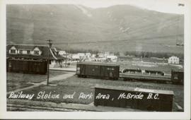
Map depicting surveyed lands, statutory timber lands, land recording divisions, game reserves, communities, bodies of water, and transport routes. Includes inset of McBride townsite.
Photograph depicts the CNR depot in McBride. It was built by the Grand Trunk Pacific Railway in 1919 according to an individual design.
File contains postcard photographs portraying life in various Northern BC Communities. Images depict buildings and streets, church structures, harbours and docks, and views of the shore from the water to name a few.
Photograph of several vehicles parked along a road. A large crowd is visible gathering in the background. Printed annotation on recto reads: "Elks Flag Day, McBride, B.C." Handwritten annotation on verso reads: "Jan. 5th 1945. Dear Dad, Am working in a lumber camp, advised by Prof. Johnson and Prof Casey. Altitude about 2,300. Think I will like it, if they don't make me work to[sic] heavy. the Climate and the grub is swell. Otherwise not so hot. Bye for now. Love Will." Postcard is addressed: "To: Mr. A.W. Hockin Big Valley, Alberta. From. W. Hockin c/o E.U. Lamming McBride, B.C."
Image depicts the Rocky Mountain Trench from McBride, B.C.
Image depicts a view of what is either the Rocky Mountains or possibly the Columbia Mountains from McBride, B.C.
Image depicts a view of what is either the Rocky Mountains or possibly the Columbia Mountains near McBride, B.C.
Image depicts a view of an area somewhere near McBride in the Rocky Mountain Trench.
Image depicts the CN Station in McBride, B.C.
Image depicts the rear-end of the CN Station in McBride, B.C.
Image depicts an abandoned building on the corner of a street in McBride, B.C.
Image depicts a street in McBride, B.C.
Image depicts an old house somewhere in McBride, B.C.
Image depicts a machine shop somewhere in McBride, B.C. The sign above the door reads "McBride Air Cooled Engine Services Ltd."
Image depicts the Elks Hall in McBride, B.C.
File consists of a transcript of an oral history interview with Myra and Glen Hooker.
File consists of a transcript of an oral history interview with Jack and Sarah Marsh.
File consists of a transcript of an oral history interview with Anson Phillips.
File consists of a transcript of an oral history interview with Glen Stanley.
File consists of a transcript of an oral history interview with June Vandermark.
File consists of a transcript of an oral history interview with Ray Williston.
The Upper Fraser Historical Geography Project was conducted by UNBC faculty and a team of researchers between 1999 and 2002. The lead researchers were Aileen Espritiu, Gail Fondahl, Greg Halseth, Debra Straussfogel, and Tracy Summerville. The project resulted in the creation of 93 oral history records and their transcripts. Participants included regional forest industry executives, politicians (including former MLA Ray Williston, local mayors and Fraser Fort George Regional District representatives), forest industry workers, and former and contemporary Upper Fraser community residents. The oral histories document the rise, consolidation and demise of the forestry-based settlements along the Upper Fraser River between 1915 and 2000.
File consists of an audio recording of an interview with John Broderick. Includes one copy of the original recorded audio cassette; the original recording is not held by the archives.
File consists of an audio recording of an interview with John and Elizabeth Haan. Includes two copies of the original recorded audio cassette; the original recording is not held by the archives.
File consists of an audio recording of an interview with Steve Kolida. Includes one original recorded audio cassettes and three copies.
File consists of an audio recording of an interview with Janet and Robert O'Lennick. Includes one original recorded audio cassette and one copy.
File consists of an audio recording of an interview with Marilyn Wheeler. Includes two original recorded audio cassettes and two copies.
File consists of an audio recording of an interview with Frank Willinger. Includes one copy of the original recorded audio cassette; the original recording is not held by the archives.
File consists of a transcript of an oral history interview with John Broderick.
File consists of trail maps and recreation guides from various places in British Columbia, especially Northern British Columbia. Maps include:
- British Columbia Road Map and Parks Guide
- Northwood Pulp and Timber Limited Forest Operations Recreation Map
- Provincial Parks of Northern British Columbia
- Visitor's Guide: Mackenzie Woodlands
- Visitors Guide: Mackenzie Woodlands
- Mackenzie Forest District Recreation Map
- Dawson Creek Forest District Recreation Map
- Morice Forest District Recreation Map
- Fort St. James Forest District Recreation Map
- Lakes Forest District Recreation Map
- Cariboo Forest Region Recreation Map
- Lakes District Visitors Map
- Prince George Forest District Recreation Map
- Vanderhoof Forest District Recreation Map
- Fort St. John Forest District Recreation Map
- Cariboo Forest Region Recreation Map (East)
- Robson Valley Forest District Recreation Map
- Fort Nelson Forest District Recreation Map
- Forest Service Recreation Sites: Valemount - Blue River
- Forest Service Recreation Sites: McBride - Goat River
- Forest Service Recreation Sites: Prince George West
- Forest Service Recreation Sites: Moberly - Sukunka
- Forest Service Recreation Sites: Nation - Takla
- Forest Service Recreation Sites: Murrat - Kiskatinaw
- Recreation Road Map for the Prince George Forest Area (1987-1988)
- Recreation Road Map for the Prince George Forest Area (1997)
- The Bobtail Forest Service Road Tour
- Forest Recreation Map: Northwood Pulp and Timber Limited
- Forest Operations Recreation Map: Northwood pulp and timber limited
- Forest Service: Recreation Sites Williston/Mackenzie
- Forest Service Recreation Sites Prince George West
- The Official Prince George Tourist Street Map
- Ecological Reserves in British Columbia (July 1990)
- Prince George Forest District map (April 1990) with annotations regarding trials.
This photograph album consists of photographs of remote police barracks at Mile 47 and Mile 29; early settlements and/or mercantile stores at Tete Jaune Cache, McBride, Sand Creek, Fort George and South Fort George; Grand Trunk Pacific Railway forestry and railway camps; scows and paddlewheel conveyors on the Fraser River; automobiles; community leisure activities; as well as, images of the Bourchier family. The following South Fort George establishments are identifiable within these photographs: Empress Hotel, Ah Yee General Merchant, German Bakery, Northern Hotel, South Fort George Drug Store & Post Office, St. Michael’s Church, Prince George Hotel, Ford Monarch dealership, Astoria Hotel, and King George V Elementary School. Identified geographic locations featured in these photographs include: Tete Jaune, Upper Fraser, Mile 47, Mile 29, Fraser River, Mt. Robson, McBride, Sand Creek, Glacier Mountain, Moose River, Giscome Portage, Pott Falls, Red Deer River, Grand Canyon, Summit Lake, Canoe Pass, Connaught Hill, Nechako Bridge, and Island Cache.
Sem títuloFile consists of a transcript of an oral history interview with the Groenvelds.
File consists of a transcript of an oral history interview with Jim and Dianne Humphreys.
File consists of a transcript of an oral history interview with Virginia Karr.
File consists of a transcript of an oral history interview with Jack Long.
File consists of a transcript of an oral history interview with Alice Sanregret.
Image depicts what is either the Rocky Mountains or possibly the Columbia Mountains, from McBride, B.C.
Image depicts a view of either the Rocky Mountains or possibly the Columbia Mountains near McBride, B.C.
Image depicts a view of what is either the Rocky Mountains or possibly the Columbia Mountains near McBride, B.C.
Image depicts a church somewhere in McBride, B.C. The sign in front possibly reads "St. Patrick's Church."
Image depicts an abandoned building on the corner of a street in McBride, B.C. The faded letters on the side read: "McBride Trading Co. Mens Wear, Drugs, Equipment."
Photograph depicts the details of the east side of the McBride depot.
File consists of an audio recording of an interview with Myra and Glen Hooker. Includes one original recorded audio cassette and one copy.
File consists of an audio recording of an interview with Virginia Karr. Includes one original recorded audio cassette and one copy.
File consists of an audio recording of an interview with Alice Sanregret. Includes one original recorded audio cassette and one copy.
File consists of an audio recording of an interview with Ray Williston. Includes three original recorded audio cassettes and three copies.
Item consists of transcript of recorded interview with Reverend Francis Edward Runnalls who discusses his career as a United Church minister in Prince George c.1920s-1940s. Also discusses his historical works written about Northern British Columbia and Prince George.
Slightly oblique front view of railway cars on a track. Buildings and hills can be seen in the background. Printed annotation on recto reads: "Railway Station and Park Area, McBride, B.C."