Affichage de 22 résultats

Archival description
18 résultats avec objets numériques Afficher les résultats avec des objets numériques
Trail Maps and Recreation Guides
2016.5.5.01 · Dossier · [19-?]
Fait partie de Harry Coates fonds

File consists of trail maps and recreation guides from various places in British Columbia, especially Northern British Columbia. Maps include:

  • British Columbia Road Map and Parks Guide
  • Northwood Pulp and Timber Limited Forest Operations Recreation Map
  • Provincial Parks of Northern British Columbia
  • Visitor's Guide: Mackenzie Woodlands
  • Visitors Guide: Mackenzie Woodlands
  • Mackenzie Forest District Recreation Map
  • Dawson Creek Forest District Recreation Map
  • Morice Forest District Recreation Map
  • Fort St. James Forest District Recreation Map
  • Lakes Forest District Recreation Map
  • Cariboo Forest Region Recreation Map
  • Lakes District Visitors Map
  • Prince George Forest District Recreation Map
  • Vanderhoof Forest District Recreation Map
  • Fort St. John Forest District Recreation Map
  • Cariboo Forest Region Recreation Map (East)
  • Robson Valley Forest District Recreation Map
  • Fort Nelson Forest District Recreation Map
  • Forest Service Recreation Sites: Valemount - Blue River
  • Forest Service Recreation Sites: McBride - Goat River
  • Forest Service Recreation Sites: Prince George West
  • Forest Service Recreation Sites: Moberly - Sukunka
  • Forest Service Recreation Sites: Nation - Takla
  • Forest Service Recreation Sites: Murrat - Kiskatinaw
  • Recreation Road Map for the Prince George Forest Area (1987-1988)
  • Recreation Road Map for the Prince George Forest Area (1997)
  • The Bobtail Forest Service Road Tour
  • Forest Recreation Map: Northwood Pulp and Timber Limited
  • Forest Operations Recreation Map: Northwood pulp and timber limited
  • Forest Service: Recreation Sites Williston/Mackenzie
  • Forest Service Recreation Sites Prince George West
  • The Official Prince George Tourist Street Map
  • Ecological Reserves in British Columbia (July 1990)
  • Prince George Forest District map (April 1990) with annotations regarding trials.
British Columbia: Satellite Image Map
2009.6.13.45.19 · Pièce · 1975
Fait partie de The Honourable Iona Campagnolo fonds

Map depicts annotations marking the major freight-ways: Garnet Ent. Truck Haul from Vancouver to Terrace, Canada Freightways Lyndon Trucking from Vancouver-Edmonton-Alaska Highway, Lindsays Transfer from Terrace to Dease Lake and Telegraph Creek, and the Northland Navigation roll-on and roll-off service. The cities and towns of Vancouver, Prince George, Dawson Creek, Terrace, Kitimat and Whitehorse are noted.

Military
2006.20.12 · Dossier · ca. 1940
Fait partie de Northern BC Archives Historical Photograph Collection

Photographs within this file document Canadian military service, training activities, military institutions, bases and site; individuals and organizations (eg. veterans, military personnel, militia, cadets), military vehicles and ships, equipment, weapons, uniforms, artifacts and legislation as it pertains to Northern British Columbia.

Geographic Features
2006.20.11 · Dossier · [ca. 1890 - 1940]
Fait partie de Northern BC Archives Historical Photograph Collection

Photographs within this file document natural and artificial features across the landscape of Northern British Columbia. This landscape also includes the physical, built, urban and industrial landscapes; topography; site plans; boundaries, districts, reserves, parks, sanctuaries, towns, villages and cities, etc.

Dawson Creek
2012.13.1.91.01 · Pièce · Sep. 1974
Fait partie de J. Kent Sedgwick fonds

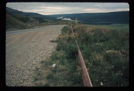
Image depicts a road with a guardrail and open fields somewhere near Dawson Creek, B.C.

Dunlevy Barn
2012.13.1.50.146 · Pièce · 2006
Fait partie de J. Kent Sedgwick fonds

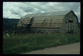
Image depicts an old barn located somewhere near Dunlevy Creek in the Dawson Creek area.

Dunlevy Creek?
2012.13.1.50.138 · Pièce · 2006
Fait partie de J. Kent Sedgwick fonds

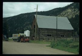
Image depicts the Dunlevy Creek area somewhere near Dawson Creek, B.C. The slide is simply labelled "Dunlevy irrigation" for uncertain reasons.

Dunlevy Creek?
2012.13.1.50.137 · Pièce · 2006
Fait partie de J. Kent Sedgwick fonds

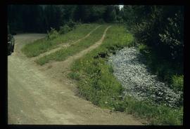
Image depicts the Dunlevy Creek area somewhere near Dawson Creek, B.C. The slide is simply labelled "Dunlevy irrigation" for uncertain reasons.