Previsualizar a impressão Fechar

Mostrar 79 resultados

Archival description
62 resultados com objetos digitais Mostrar resultados com objetos digitais
BC and Alberta Locations and Topics
2012.13.2.19 · Subsérie · 1955-2011
Parte de J. Kent Sedgwick fonds

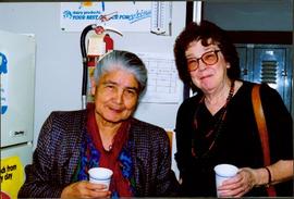
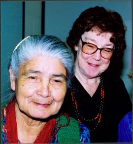
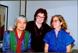
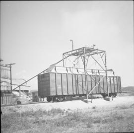
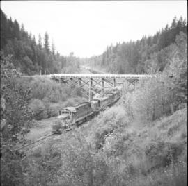
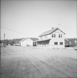
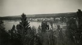
Subseries contains material collected and created by Kent Sedgwick for research on various areas in British Columbia and Alberta. Includes written notes by Kent Sedgwick, pamphlets, and newspaper clippings relating to towns and settlements. These areas include Quesnel, Likely, the Yukon Telegraph Trail, Barkerville, Wells, the Cariboo region, Fort Alexandria, Soda Creek, the Chilcotin region, Jasper, the Rocky Mountains, Mackenzie, Tumbler Ridge, the Peace River region, Fort St. James, the Omineca region, Kitimat, Lethbridge, the Bulkley Valley, and Fort Mcleod. These files cover a variety of topics including Chinese people in British Columbia, land settlement, tourism, and historic information on the regions.

Oral History: Bea Dezell
2014.6.1.14 · Dossiê/Processo · 2004
Parte de Rustad & Dezell Family fonds

File consists of an electronic oral history transcript documenting the life of Bea Dezell from approximately 189? to 2004. Interview conducted in May and June 2004 by Denise Torgerson and transcript prepared by Elaine Hauck, both of Prince George Oral History Group.

Bridget Moran & Mary John at Cariboo College
2008.3.1.19.3 · Item · March 1992
Parte de Bridget Moran fonds

Photograph depicts Bridget Moran standing behind Mary John in unknown room. Unidentified woman semi-visible on far right (see item 2008.3.1.19.2). Accompanying photo caption: "Caribou College, Quesnel, March /92".

2012.13.2.21.01 · Dossiê/Processo · 1983-1991
Parte de J. Kent Sedgwick fonds

File consists of records created or collected by Kent Sedgwick relating to various community projects associated with river parks. Example projects included in the file are a proposed Carrier village at Hudson Bay Slough, a Cottonwood Island park, proposed commercial boat tours on the Nechako and Fraser River, and the Quesnel Paddlewheel Park. Includes a project proposal document by the Fort George Band entitled "Establishing a Permanent Carrier Village in Prince George" (1990); a 1991 meeting package of the Nechako and Fraser River Valleys Committee (regarding the Cottonwood Island property and development of the Heritage River Trails System); a 1991 memorandum entitled "Prince George River Runners - Proposed commercial boat tours on the Nechako and Fraser River"; a 1983 "Submission to Rivers Committee Public Hearings by Heritage Advisory Committee, City of Prince George" describing the various river-adjacent heritage sites in Prince George; and documentation from the Quesnel Paddlewheel Association.

Cottonwood House
2012.13.1.126.49 · Item · [1990?]
Parte de J. Kent Sedgwick fonds

Image depicts the Cottonwood House Historic Site along Barkerville Highway, east of Quesnel, B.C. A sign posted by the fence reads: "For over half a century the Boyd family operated this haven for man and beast. Here weary travellers found lodging, food, and drink. Here fresh horses were hitched to stage-coaches and miners bought supplies. This historic road-house, built in 1864, stood as an oasis of civilization on the frontier of a rich new land."

Bob Harkins interview with Ivor Guest
2002.12.5.2 · Item · c.1970 - c.1989
Parte de Bob Harkins fonds

Item consists of typed transcript of interview with Ivor Guest discussing his early memories of Prince George as a river man and logging. Includes discussion of Cataline, and Quaw family.

Sem título
Taped interview with Branwen Patenaude
2006.9.20 · Dossiê/Processo · 1982
Parte de Bob Harkins fonds

File consists of 1 audiocassette of interview by Gil McCall with Branwen Patenaude who discusses her self-published book, “Because of Gold” about the history of gold mining and its impact on Quesnel's history. She also discusses the challenges of the publishing industry.

James Joseph Claxton Photograph Collection
2007.17 · Coleção · 1920-01-01 - 1982-12-31

Collection consists of 140 photographs pertaining to the life and pursuits of James Joseph Claxton over the course of sixty years. Subject areas identified within this collection include: quartz and placer mining in the Cariboo; Kingcome Village; the Royal Irish Contabulary; Roderick's Jewelers, New Westminster; the "M.S. Columbia III"; Kwakiutl petrographs in Fort Rupert; totem poles at Alert Bay; and the Salmon Arm Boy Scouts of Canada group.

Sem título
Bob Harkins interview with Tom Payne
2002.12.21 · Item · 1979
Parte de Bob Harkins fonds

Item consists of transcript and tape summary of interview with Tom Payne who discusses his life, emigration from England, service in World War I, and career as shoemaker in Quesnel. Also discusses his subsequent work at the Experimental Farm in Prince George

Sem título
Dairy Farm - Barn Interior
2012.13.1.50.072 · Item · [1978?]
Parte de J. Kent Sedgwick fonds

Image depicts the interior of a barn at a dairy farm located somewhere near Quesnel, B.C. Numerous unknown individuals are present.

Dairy Farm - Interior
2012.13.1.50.073 · Item · [1978?]
Parte de J. Kent Sedgwick fonds

Image depicts numerous pieces of machinery in the interior of a building at a dairy farm, located somewhere near Quesnel, B.C. Several unknown individuals are present.

Farm
2012.13.1.50.067 · Item · 1978
Parte de J. Kent Sedgwick fonds

Image depicts a farm on the west side of the Fraser, south of Quesnel, B.C.

Irrigation Pipes
2012.13.1.50.074 · Item · [1978?]
Parte de J. Kent Sedgwick fonds

Image depicts a pile of irrigation pipes on a dairy farm somewhere near Quesnel, B.C.

P.G. C.I. Geomorph
2012.13.1.124 · Subsérie · [between 1970 and 1977]
Parte de J. Kent Sedgwick fonds

File contains slides depicting landforms at various locations.

Diamond Island
2012.13.1.50.042 · Item · 1975
Parte de J. Kent Sedgwick fonds

Image depicts an aerial view of Diamond Island, near Quesnel, B.C.

Cottonwood House Picnic Site
2012.13.1.126.07 · Item · May 1974
Parte de J. Kent Sedgwick fonds

Image depicts the picnic site of the Cottonwood House Historic Site, located on the Barkerville Highway, east of Quesnel, B.C.

PGE Quesnel
2013.6.36.1.045.30 · Item · 1966
Parte de David Davies Railway Collection

Photograph location is unknown, but Davies stated it to be possibly somewhere north of Quesnel. A bridge is visible.

PGE Quesnel
2013.6.36.1.045.40 · Item · [July 1966]
Parte de David Davies Railway Collection

Photograph depicts a chip car #9581 loading at a sawmill on the northern outskirts of Quesnel.

PGE Quesnel
2013.6.36.1.045.39 · Item · [July 1966]
Parte de David Davies Railway Collection

Photograph depicts a down freight of 75 cars passing under the Quesnel to Barkerville road about 4 miles out of Quesnel.

Gordon Wyness Album
2020.05 · Coleção · 1936

In 1936, Gordon Young Wyness was employed by Philip M. Monckton, a B.C. Land Surveyor. Between June 5 and October 8, Wyness joined Monckton and a group of others on a land survey expedition in northwestern BC. The survey crew travelled to various locations in the area including Telkwa, Hazelton, Burns Lake, Francoise Lake, Vanderhoof, Prince George, Quesnel, Lytton, and Hope. Wyness documented their journey in this photograph album. Based on the photographs, it appears that the crew led by Philip Monckton consisted of Jack Lee and Gordon Wyness; Mrs. Lavender Monckton (nee O'Hara) also accompanied the group.

In addition to the 50 photographs included in the album, this collection also includes five additional unique photographs that accompanied the album.

Sem título
Gordon Wyness by heritage artefacts and cairn in Quesnel
2020.05.44 · Item · 1936
Parte de Gordon Wyness Album

Photograph depicts Gordon Wyness sitting on a historic boat, which he described as built ca. 1860 and could carry "7 Indians" and 5000 lbs of freight up the river. Located nearby is a telegraph cairn erected to commemorate the Collins Overland Telegraph lines that began in Quesnel in 1865. Until 1907, Quesnel was the terminus for the telegraph line. Behind Wyness is a replica of a Cornish water wheel that was originally located at Williams Creek in Barkerville. This location is now called Ceal Tingley Memorial Park-Heritage Corner and is located along Front Street in Quesnel, near the Fraser River Bridge. The cairn and water wheel still stand in this location, however the boat was removed around 1941.

According to additional information from Quesnel & District Museum & Archives, Wyness may have been provided with inaccurate information about the canoe depicted. The canoe believed to have been located at that spot was actually created in 1905 to pack out the Grand Trunk Preliminary Survey Team, which was led by J.M. Rolston.

View of Quesnel and Fraser River Bridge
2020.05.45 · Item · 1936
Parte de Gordon Wyness Album

Photograph depicts a view of the town of Quesnel from a southeast hill. Fraser River and the Fraser River Bridge are visible at left, the Quesnel River at right.