File consists of a transcript of an oral history interview with Ray Williston.
File consists of a transcript of an oral history interview with Bill Wade.
File consists of a transcript of an oral history interview with Horst Sander. Also includes photocopies of Horst Sander's personal records, such as a tree farm license.
File consists of a transcript of an oral history interview with Earl Lousier and Harry Gairns.
File consists of a transcript of an oral history interview with Jim Burbee.
File consists of a transcript of an oral history interview with Ivan Andersen.
File consists of an audio recording of an interview with Ray Williston. Includes three original recorded audio cassettes and three copies.
File consists of an audio recording of an interview with Bill Wade. Includes one original recorded audio cassette and one copy.
File consists of an audio recording of an interview with Horst Sander. Includes two original recorded audio cassettes and two copies.
File consists of an audio recording of an interview with Earl Lousier and Harry Gairns. Includes two original recorded audio cassettes.
File consists of an audio recording of an interview with Jim Burbee. Includes one original recorded audio cassette and one copy.
File consists of an audio recording of an interview with Ivan Andersen. Includes one original recorded audio cassette and one copy.
This short colour film depicts logging and sawmill operations at Ferguson Lake in March 1959. Scenes include tree felling, log hauling equipment, the Ferguson Lake lumber yard, use of Ferguson Lake to float logs, and the inside operations of the Ferguson Lake sawmill. Film also includes a brief clip of family film footage of the McKay family home and garden on Melville Street in Prince George with scenes showing a Newfoundland dog named Barney with Donald McKay and Joan McKay.
Item is McNaughton Lake, B.C. Map 83D and Part of 83C Second Status Edition (1975) from "Classification and Interpretation of some Ecosystems of the Rocky Mountain Trench, Prince George Forest Region, British Columbia: First Approximation" (1984).
File consists of trail maps and recreation guides from various places in British Columbia, especially Northern British Columbia. Maps include:
- British Columbia Road Map and Parks Guide
- Northwood Pulp and Timber Limited Forest Operations Recreation Map
- Provincial Parks of Northern British Columbia
- Visitor's Guide: Mackenzie Woodlands
- Visitors Guide: Mackenzie Woodlands
- Mackenzie Forest District Recreation Map
- Dawson Creek Forest District Recreation Map
- Morice Forest District Recreation Map
- Fort St. James Forest District Recreation Map
- Lakes Forest District Recreation Map
- Cariboo Forest Region Recreation Map
- Lakes District Visitors Map
- Prince George Forest District Recreation Map
- Vanderhoof Forest District Recreation Map
- Fort St. John Forest District Recreation Map
- Cariboo Forest Region Recreation Map (East)
- Robson Valley Forest District Recreation Map
- Fort Nelson Forest District Recreation Map
- Forest Service Recreation Sites: Valemount - Blue River
- Forest Service Recreation Sites: McBride - Goat River
- Forest Service Recreation Sites: Prince George West
- Forest Service Recreation Sites: Moberly - Sukunka
- Forest Service Recreation Sites: Nation - Takla
- Forest Service Recreation Sites: Murrat - Kiskatinaw
- Recreation Road Map for the Prince George Forest Area (1987-1988)
- Recreation Road Map for the Prince George Forest Area (1997)
- The Bobtail Forest Service Road Tour
- Forest Recreation Map: Northwood Pulp and Timber Limited
- Forest Operations Recreation Map: Northwood pulp and timber limited
- Forest Service: Recreation Sites Williston/Mackenzie
- Forest Service Recreation Sites Prince George West
- The Official Prince George Tourist Street Map
- Ecological Reserves in British Columbia (July 1990)
- Prince George Forest District map (April 1990) with annotations regarding trials.
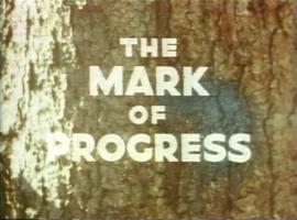
A VHS tape containing "The Mark of Progress" film created by the British Columbia Forest Service and first played for a live audience in 1959 in Prince George, BC.
File consists of two videos:
- A VHS video tape containing "Mark of Progress" promotional and possible training video for the BC forest industry in and around Prince George
- A VHS tape "Reforestation in British Columbia: A Growing Success" published by the Province of British Columbia Ministry of Forests.
File consists of recreational guides from various places in British Columbia, especially Northern British Columbia. Guides include:
- The North Ridge Ecr-Trail Guide: Aleza Lake Research Forest
- Cluculz Lake Silviculture Demonstration Area: Trail Guide
- Willow River Interpretive Trail
- Crooked River Forest Self-Guided Circle Tour
- Forests for the World Interpretive Trail Guide
- Cottonwood Island Nature Park: Habitat Enhancement.
File consists of one VHS tape showing the building of the Northwood Pulp Mill in Prince George. Video has no sound.
Series consists of records reflecting the activities of the Dezell and Rustad families. Series include mayoral records from Bea and Garvin Dezell when Garvin served as Mayor of Prince George. Series includes materials celebrating Bea Dezell's life created by her family. Series also includes fundraising efforts for the Northern Medical Programs Trust. Finally, series includes a collection of "spruce" dollars and commemorative coins.
Photograph depicts four men pulling a long canoe across a clearing on a wheeled trailer.
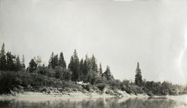
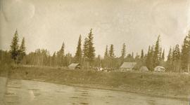
Photograph depicts a wide expanse of river in the foreground looking across the water to a narrow clearing along the opposite riverbank. A few building are scattered across the clearing. There is forest in the background.
Photograph depicts a view from the river looking at the river bank. There is a canvas tent with forest in the background.
Photograph depicts a man bathing himself while standing in a small metal tub. Photograph description in album notes this as "His 'Semi Annual'" [bath]. On the left is a log structure, presumably a cache building. A large clearing surrounds the building and bathing man. There is a forest and bluff in the background. Possibly located near Giscome Portage.
Photograph depicts seven or more men relaxing near a canvas tent. Some of the men appear to be whittling wood. Long underwear dry on a tent rope and wood smoke drifts past the men and tent to the forest behind.
Photograph depicts several canvas tents set in lush vegetation near dusk.
Photograph depicts a view of a lake from a row boat. The back of one male boat passenger and oars are in the foreground.
Photograph depicts a view from a hill of a river winding through the forest with marshlands nearby. This may be a double exposure and there is an indiscernible image in the center of the photo.
Photograph depicts a view from a hill of a river winding through the forest with marshlands nearby.
Photograph depicts a view from a high hill, looking down on the Nechako river. There is forest and low rolling hills in the background.
Photograph depicts a view from a high hill looking down on the Nechako river. There is forest and low rolling hills in the background.
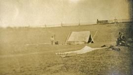
Photograph depicts a tarp spread out on the grass, two men sit nearby the tarp. There is a canvas tent in the background with a man standing beside it. Behind the tent is a low hill with a fence bordering the top of the hill. There are blankets drying on the fence.
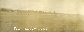
Photograph depicts several people in a large field. There are buildings and trees in the background.
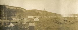
Photograph depicts scattered buildings, an outhouse, and tents on a rough clearing. A river and its cutbacks are in the background.
Photograph depicts eighteen or more canvas tents scattered on the river shore next to rough cabins and an outhouse.
Photograph depicts twenty-eight or more people standing on the river's edge, a stack of wood is ready for loading on the steamer that is anchored near the shore.
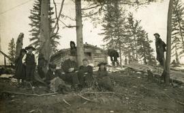
Photograph depicts six adults and three or more children sitting on the ground with a log cabin in the background. Snow scatters the ground in small patches.
Photograph depicts a view of the river shore, a few scattered buildings and tents are near the shore. A footpath leads from the water's edge between the dwellings and through the newly cleared land.
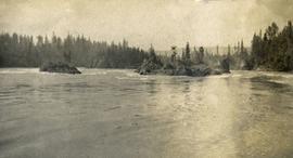
Photograph depicts the rough waters and rocks at Fort George Canyon.
Photograph depicts nine or more people watching a steamer navigate the rough waters of Fort George Canyon from the river shore.
Photograph depicts one man standing on the bank of a river, forest in the background. The image is not in focus or possibly a double exposure.
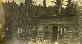
Photograph depicts six men standing outside a small log building. A sawhorse in the foreground, a tall pole "cache" and forest in the background.
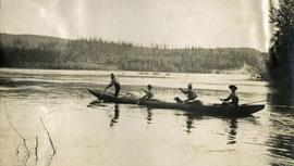
Photograph depicts four men paddling a long canoe. The canoe is loaded with supplies and a dog, river and forest in the background.
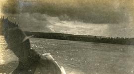
Photograph depicts view of the river from a boat. There is a silhouette of a person wearing a hat in the foreground.
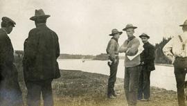
Photograph depicts several men standing on the river bank. Possibly A.H. Holland in center of photo.
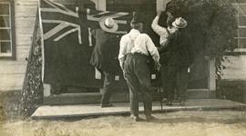
Photograph depicts four men pinning a "Union Jack" flag to the exterior of a building.
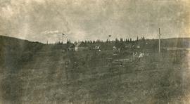
Photograph depicts Lheidli T'enneh Nation burial grounds in foreground, Hudson Bay Company buildings in background.
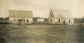
Photograph depicts a large white building surrounded by a fence.
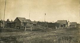
Photograph depicts a cluster of wooden buildings including a flagpole and church spire at a Lheidli T'enneh village site. Original photo identified this image as "Indian Village, Fort George".
Photograph depicts a small cluster of buildings near the river bank.
