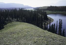
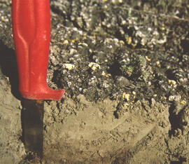
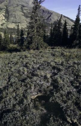
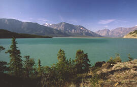
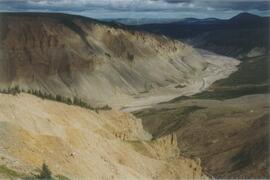
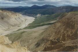
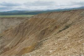
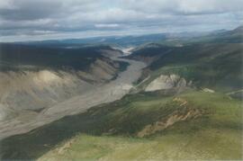
Slide roll contains the following photographs:
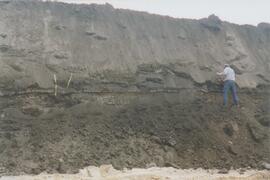
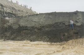
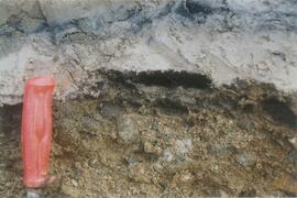
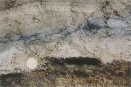
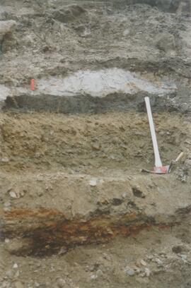
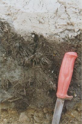
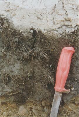
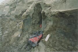
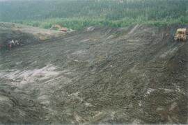
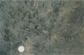
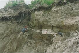
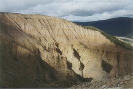
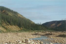
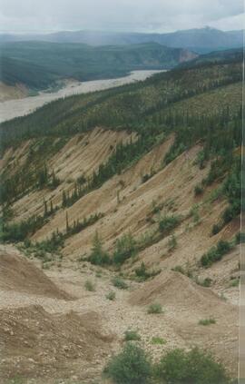
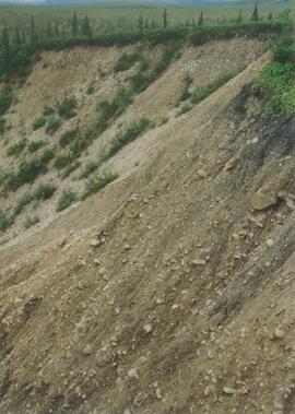
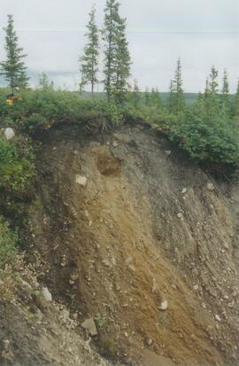
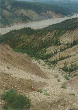
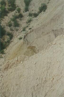
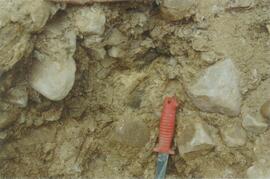
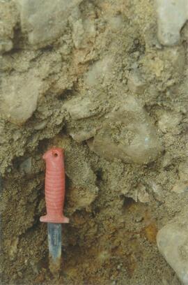
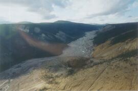
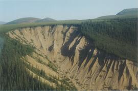
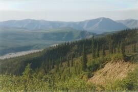
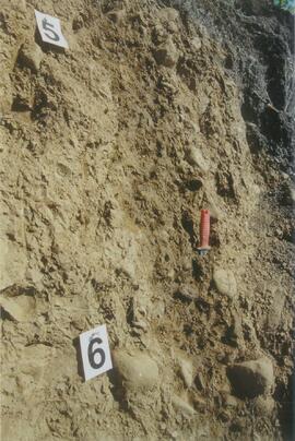
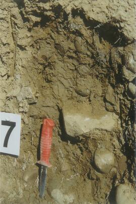
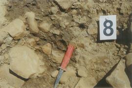
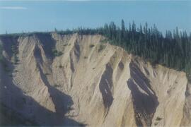
Y03-11 (Silver City road section)
Date: August 12, 2003
Location Coordinates: 61° 2’ 3.6” N, 138° 22’ 48.8” W, 806.7 m asl (± 8.7 m)
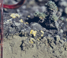
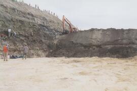
Site Description: roadcut through SW-facing hill exposes loess over glaciofluvial gravel, with 4 paleosols in colluviated loess
Sample Depths & Descriptions:
- Y03-11-01 - 0-18 cm - ACk (fresh loess)
- Y03-11-02 - 18-47 cm - Soil 1 – Bmk
- Y03-11-03 - 47-100 cm - Loess
- Y03-11-04 - 100-110 cm - Soil 2 – includes charcoal
- Y03-11-05 - 110-160 cm - Loess with secondary carbonate in root channel
- Y03-11-06 - 160-170 cm - Soil 3 – Ahk with charcoal
- Y03-11-07 - 160-170 cm - Soil 3 – Bmk
- Y03-11-08 - 170-198 cm - Loess with secondary carbonate in root channel
- Y03-11-09 - 198-202 cm - Soil 4 – Ahk – laterally continuous for ~ 1.5 m
- Y03-11-10 - 202-230 cm - Loess with secondary carbonates in roots
- Y03-11-11 - 230-255 cm - Soil 5 – Ahk – includes abundant charcoal bands
- Y03-11-12 - 230-255 cm - Soil 5 – Bmk – infilled squirrel burrows immediately below
- Y03-11-13 - 255-300 cm+ - Loess
Additional notes on modern soil & paleosols:
Soil 1 - consists of Bmk horizon material with 2 distinct colours: 7.5YR 4/3 d & 10YR 4/3 d
- loess between Soils 1 & 3 is sandier
Soil 2 - 90% Ahk material, 2-10 cm thick
- Ahk – 10YR 3/2 d
- Bmk – 7.5YR 4/2 d
- less abundant carbonate than in paleosols & loess below
Soil 3 - most of exposure has Ahk (2-5 cm thick) over Bmk (4-10 cm thick), with carbonates as for Soil 5
Soil 4 - mostly Ahk (10YR 3/2 d) material 2-8 cm thick, some Bmk (10YR 4/2 d) < 2 cm thick, with carbonates as for Soil 5
Soil 5 - complex intermixing of Ahk & Bmk material, charcoal most abundant in Ahk
- individual colour bands 2-10 cm thick
- overall dip of horizons (10° to W) is parallel to surface
- similar size & density of secondary carbonates as in loess above & below; associated with root channels, < 5 mm diameter, covering ~ 5% of surface
Slide roll 4, #36-32 (corresponding prints and negatives: Print roll 5, #26-30)
Y03-12 (island off Slims River delta)
Date: August 13, 2003
Location Coordinates: 61° 1’ 9.1” N, 138° 29’ 27.9” W, 819 m asl (± 6.0 m)
Site Description: good grassland development on undulating aeolian veneer over bedrock, SW aspect; vegetation: A. frigida, C. purpurescens, P. glauca, Erigeron, Plantago, Oxytropis; good crust cover, mossy on more northerly aspects
Sample Depths & Descriptions:
- Y03-12-01 - Crust
- Y03-12-02 - 0-10 cm - ACk
Slide roll 4, #31-10 (miscellaneous site views of Y03-12 & Slims R delta island)
This file contains the following photographs in both print photograph and negative format:
Slims River delta
Date: August 10, 2003
Location Coordinates: 61° 00’ 16.5” N, 138° 30’ 45.6” W, 790 m asl (± 11.0 m)
Print roll 3, #5A-6A: delta surface with salt efflorescences (Deschampsia caespitosa, Puchinella nuttalli, Aster siberica, Triglauca palustre); Juncus & Ranunculus on more active surface near river.
7A-9A: moister Deschampsia site, polygonal cracking patterns (W side of highway)
10A-12A: closeups of efflorescences
Cultus Bay / Rat Lake
Date: August 10, 2003
Location Coordinates: 61° 09’ 57.1” N, 138° 25’ 25.5” W, 806 m asl (± 6.2 m)
Slides #17-15: Rat Lake area (corresponding prints and negatives: Print roll 3, #13A-16A)
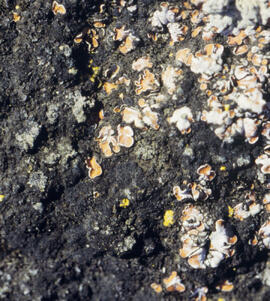
Print roll 3, #17A-19A: Collema & Psora crusts on exposed ridge on coarser substrate where loess has blown off (Corresponding slides: Slide Roll 2 #14-13)
Y03-03 (Rat Lake)
Date: August 10, 2003
Location Coordinates: 61° 10’ 3.5” N, 138° 25’ 37.2” W, 798.3 m asl (± 13.0 m)
Site Description: SW aspect, 45% slope; vegetation: Carex filifolia, A. frigida, Elymus trachycaulis
Sample Depths & Descriptions:
- Y03-03-01 - Crust
- Y03-03-02 - 0-9 cm - Ahk (10YR 4/2 m; weak-moderate, fine granular)
- Y03-03-03 - 9-53 cm+ - Ck (2.5Y 6/3 m; massive)
Print roll 3, #20A-22A (Corresponding slides: Slide Roll 2: #12-10)
Y03-04 (Rat Lake)
Date: August 10, 2003
Location Coordinates: 61° 10’ 10.5” N, 138° 26’ 3.7” W, 800.2 m asl (± 8.7 m)
Site Description: S aspect, 40% slope; vegetation: Elymus, Artemisia, flax, Penstemon, Linum lewisii
Sample Depths & Descriptions:
- Y03-04-01 - Crust
- Y03-04-02 - 0-6 cm - Ck (strongly effervescent)
- Y03-04-03 - 6-16 cm - Ahkb
- Y03-04-04 -16-75 cm+ - Ck (strongly effervescent; includes Bmk pockets)
Print roll 3, #25A-28A (Corresponding Slides: Slide Roll 2: #9-7)
Y03-05 (SE of Rat Lake)
Date: August 10, 2003
Location Coordinates: 61° 9’ 43.2” N, 138° 25’ 34.8” W, 811.5 m asl (± 8.9 m)
Site Description: upper slope / crest; recent local sandy eolian veneer over older loess; vegetation: Carex, Elymus, Poa, Erigeron
Sample Depths & Descriptions:
- Y03-05-01 - Crust
- Y03-05-02 - 0-5 cm - Ahk
- Y03-05-03 - 5-19 cm - Ck1
- Y03-05-04 - 19-31 cm - Ahkb (siltier)
- Y03-05-05 - 31-50 cm+ - Ck2
Print roll 3, #34A-#E (Corresponding Slides: Slide Roll 2: Slides #6-1)
This file contains the following photographs in both print photograph and negative format:
Y03-06
Date: August 10, 2003
Location Coordinates: 61° 4’ 1.5” N, 138° 21’ 57.4” W, 825.3 m asl (± 9.5 m)
Site Description: top of slope, E aspect
Sample Depths & Descriptions:
- Y03-06-01 - Crust
- Y03-06-02 - 0-6 cm - Ahk (10YR 3/2 m; strongly effervescent)
- Y03-06-03 - 6-14 cm - Bmk (2.5Y 3/3 m; strongly effervescent)
- Y03-06-04 - 14 cm+ - IICk (strongly effervescent)
Print roll 4, #1-2 (Corresponding slides: Slide roll 3 #36-35)
Y03-07 (peninsula near Kluane visitor centre, Sheep Mt.)
Date: August 11, 2003
Location Coordinates: 61° 1’ 42.8” N, 138° 29’ 36.2” W, 786.7 m asl (± 5.7 m)
Site Description:
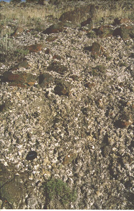
- recent (?) landslide with loess accumulation in pockets, thinner on boulder surfaces, dominated by dark cyanobacteria crusts
- limited loess accumulation due to exposure of site
- crust is calcareous at surface
Sample Depths & Descriptions: - Y03-07-01 - Crust
- Y03-07-02 - 0-6 cm - Ck
- Y03-07-03 - 6-9 cm - Ahkb
- Y03-07-03 - 9 cm+ - Rock
Print roll 4, #3-10 (Corresponding slides: Slide roll 3 #34-30)
Lower Slims River (lookout knoll at parking lot N of visitor centre)
Date: August 11, 2003
Location Coordinates: 60° 59’ 56.4” N, 138° 33’ 36.4” W, 844.8 m asl (± 7.3 m)
Site Description: some fire disturbance, but lower slopes have more intact crusts on loess (calcareous to surface)
Print roll 4, #11-17 (Corresponding slides: Slide roll 3 #29-26)
Lower Slims R (lowest bench below lookout knoll)
Date: August 11, 2003
Location Coordinates: 60° 59’ 51.8” N, 138° 33’ 36.2” W, 814.3 m asl (± 7.9 m)
Site Description: not burned; good intact crust; vegetation: A. frigida, Calamogrostis purpurea, Erigeron caespitosus, Linnaea, Carex filifolia (sparse cover ~ 50%)
Print roll 4, #18-20 (Corresponding slides: Slide roll 3, #25-23)
Slims Soil
(Holocene paleosol with well-developed B horizon under Neoglacial calcareous loess – location not recorded, but likely from roadcut exposure along main Slims R trail)
Print roll 4, #21 (Corresponding slides: Slides roll 3, #22)
S-facing opening above main trail
Date: August 11, 2003
Location Coordinates: 60° 59’ 53.1” N, 138° 34’ 9.0” W, 822.9 m asl (± 15.0 m)
Site Description:
- Nostoc crust, also with Collema
- calcareous to surface
- site has later successional stage, with Arctostaphylos & Juniperus starting to move in
Print roll 4, # 22-25
Lower end of Sheep Creek
Date: August 11, 2003
Misc. views of grassland vegetation and landscape (locations not recorded)
Print roll 4, #26-33 (Corresponding slides: Slides roll 3, #21-18)
Overlook at lower end of Sheep Creek canyon
Date: August 11, 2003
Location Coordinates: 60° 59’ 42.2” N, 138° 34’ 38.1” W, 878.0 m asl (± 9.5 m)
Site Description: heavy use by sheep (abundant droppings) but still has ~ 50% crust coverage
Print roll 4, #34-35 (Corresponding slides: Slides roll 3, #17-16)
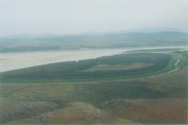
Downvalley view toward Slims R delta, near Sheep Creek (?)
Date: August 11, 2003
(location not recorded)
Print roll 4, #36-E
File consists of notes and reproductions relating to the Northern Dairies milk shipping company and William Binney Milner, a Vancouver-based financier who purchased Northern Dairies Ltd. In 1956.
File consists of submissions to the Aleza Lake Research Forest logo contest.
Data set consists of lab data for sites Y04-01 to Y04-04. Original data set created in 2004; an update was provided in March 2023 but horizon designations were not updated to be consistent with the paper.
