File contents relate to: Mine Maintenance Issues. Document type(s) include: report. Notes: budget for project.
Item is an original map depicting the Bateman forestry route. Map includes pen markings.
File consists of biographical information about Australian anthropologist, Daisy May Bates.
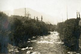
Photograph depicts three or more people bathing in a stream surrounded by forest.
Information brochures pertain to the regional flora and fauna of Bathurst Inlet as well as introducing the Lodge itself
Lateral detail of <i>Castilleja</i> in flower,Bathurst Inlet, Nunavut
Shoreline perspective of settlements and boats, Bathurst Inlet, Nunavut
Habit of <i>Castilleja</i> in flower, Nunavut
File contains a 4 batik artworks gifted to UNBC.
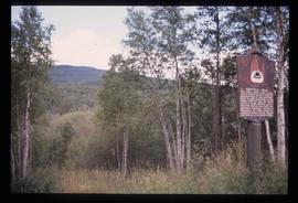
Image depicts the Battle Hill National Historic Site in Kitwanga, B.C.. The sign located there says: "The small knoll in the valley was a native fortress. Legends maintain that it was man-made: built to repel marauding coastal tribes. The hill was the scene of local tribal battles, and at one time was crowned with the defenders' buildings. Known as Dhawdezp, the unique mound is a prominent feature in the legends and history of the Indian people."
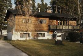
Image depicts a Bavarian style house at College Heights in Prince George, B.C.
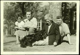
Handwritten annotation on recto of photograph: "Edna & Alan Baxter - [guided?] with A. Hanson. Bob & Violet Baxter - Bob delivered mail to & from Quesnel in the 1940s." Young Edna sits on Alan's knee. Bob sits behind Violet as she pets the Cocker Spaniel. Large tree trunk stands behind Bob and Violet. A cabin and gate-like structure are semi-visible in background against forest. It is believed that this photograph was taken at Cluculz Lake, BC. Note on negative envelope: "Edna, Alan, Bob & self. Darkie at the Lake."
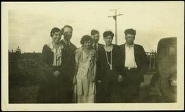
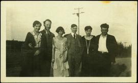
Left to right: Margaret (nee Baxter) and husband Gus Lund, Bea Baxter and beau, Violet and Bob Baxter. The group stands on road wearing formal attire. Rear of car can be seen in foreground on right; power poles, log building, and unidentified structure stand in front of forest in background.
Left to right: Margaret (nee Baxter) and husband Gus Lund, Bea Baxter and beau, Violet and Bob Baxter. The group stands on road wearing formal attire. Power poles, log building, and forest in background.
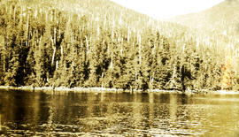
Photograph depicts looking toward a treed shoreline from the water. Klemtu was also known as China Hat due to the shape of Cone Island, which protects it from the open water. Handwritten annotation below photograph reads, "Bay at China Hat, BC Coast".
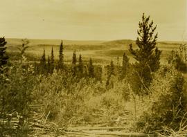
Bay beyond rocky shore, Nunavut
Nunavut
Nova Scotia
A b&w elevation plan drafted on a tracing paper. The plan represents roads such as Queens Way Street, Milburn Avenue, Strathcona Avenue as well as residential subdivisions. Produced by Central Planning and Management Consulting LTD. Prince George B.C. Canada.
- Invitation for the Old Timers Reunion to meet up with “old friends [such] as Alex Moffat, Billy Fraser, Fred Burden and L.C. Gunn.”
- Invitation signed by the Premier of BC: W.A.C Bennett.
Series consists of records created and collected by Gary Runka during and after his time with the British Columbia Agricultural Land Commission. In the early 1970s, Runka served as the first general manager of the BC Agricultural Land Commission, the independent provincial body that has administered BC's Agricultural Land Reserve (ALR) for over 40 years. As the first manager, Runka spearheaded the establishment of the ALR undertaking the technical tasks of setting ALR agricultural use boundaries, policies and procedures, as well as the building awareness and support for farmland preservation within government and with the public. He later served as Commission chair. Records include correspondence, informational material, publications, clippings, news releases, memoranda, symposium/conference material, reports, speech notes, and other textual material. Also includes seven maps, two buttons, six floppies, eighty slides, and one audio cassette tape.
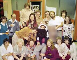
Photograph is a group portrait of BC Agricultural Land Commission staff members at a Christmas party. Back row, left to right: Patti, Terry Lewis, unknown, Julie Glover, Gordon Gram, Gary Holisko, Kirk Miller, unknown, Shirley Brightman. Middle row, left to right: Eve Lew, Jim Plotnikoff (Santa). Front row, left to right: Verona Hoosen, unknown, Jane Perch, Denise Jankovich, unknown, unknown.
Subseries contains material collected and created by Kent Sedgwick for research on various areas in British Columbia and Alberta. Includes written notes by Kent Sedgwick, pamphlets, and newspaper clippings relating to towns and settlements. These areas include Quesnel, Likely, the Yukon Telegraph Trail, Barkerville, Wells, the Cariboo region, Fort Alexandria, Soda Creek, the Chilcotin region, Jasper, the Rocky Mountains, Mackenzie, Tumbler Ridge, the Peace River region, Fort St. James, the Omineca region, Kitimat, Lethbridge, the Bulkley Valley, and Fort Mcleod. These files cover a variety of topics including Chinese people in British Columbia, land settlement, tourism, and historic information on the regions.
File consists of:
- Informational material about visiting BC Archives
- Computer print-outs of BC Archives searches and finding aids relating to Aleza Lake archival material
- Copy of the Access to Personal Information Agreement signed by David Mills to access records at BC Archives
- Correspondence to David Mills from BC Archives
- Copy of the "British Columbia Archives Research Orientation Guide"
File consists of photocopied material regarding the Aleza Lake Experimental Station from BC Archives.
File consists of photocopied material regarding the Aleza Lake Experimental Station from BC Archives.
File consists of photocopied material regarding the Aleza Lake Experimental Station from BC Archives.
File consists of photocopied material regarding the Aleza Lake Experimental Station from BC Archives.
File consists of photocopied material regarding the Aleza Lake Experimental Station from BC Archives.
File consists of photocopied material regarding the Aleza Lake Experimental Station from BC Archives.
File consists of photocopied material regarding the Aleza Lake Experimental Station from BC Archives.
File consists of photocopied material regarding the Aleza Lake Experimental Station from BC Archives.
File consists of photocopied material regarding the Aleza Lake Experimental Station from BC Archives.
File consists of photocopied material regarding the Aleza Lake Experimental Station from BC Archives.
File consists of photocopied material regarding the Aleza Lake Experimental Station from BC Archives.
File consists of photocopied material regarding the Aleza Lake Experimental Station from BC Archives.
File consists of photocopied material regarding the Aleza Lake Experimental Station from BC Archives.
File consists of photocopied material regarding the Aleza Lake Experimental Station from BC Archives.
File consists of photocopied material regarding the Aleza Lake Experimental Station from BC Archives.
File consists of photocopied material regarding the Aleza Lake Experimental Station from BC Archives.
File consists of photocopied material regarding the Aleza Lake Experimental Station from BC Archives.
File consists of archival research on British Columbian pioneer women including photocopies of archival materials and handwritten notes.
File contains slides depicting maps from the B.C. Atlas.
File contains correspondence, clippings, and pamphlets relating to the BC Book Prizes which were won by authors published by Barry McKinnon with Gorse Press.
File contains correspondence dated 1986, from BC Book Prizes to Brian Fawcett. The items are a letter notifying Fawcett that he has been awarded the runner up prize for the BC Book Prize, Ethel Wilson Fiction Award, and correspondence dated 1989, to Fawcett regarding judging for the BC Book Prizes Awards, and a listing of the authors/books selected for judging.
File contains Brian Fawcett's certificate for winning the BC Book Prizes 1986 Ethel Wilson Fiction Prize for "The Secret Journal of Alexander Mackenzie".
File consists of issues of the literary periodical entitled "BC Bookworld".
Includes a copy of B.C. Bookworld, vol. 21, no.4, winter 2007-2008 with a feature interview with Ann Walsh.
