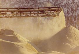
Photograph collection of trip report to Nordenhem Finishing Mill in Germany.
Photograph of automatic recorder from front angle. Part of trip report to Nordenham Finishing Mill.
Photograph of deduster screen cleaner at Nordenham Finishing Mill in Germany. Part of trip report.
Photographs from Cassiar trip report to Demona plant of Friction Materials Corporation in Israel. This plant makes only brake linings and they use a blend of blend of fibre and rayon in production. Labelled Appendix J, this collection includes landscape photos of the plant.
Photographs from Cassiar trip report to Kaiser Resources and Fording Coal near Sparwood, British Columbia. This collection depicts equipment in the field such as a backhoe, shovel loader, trucks, mobile service trailer for shovel maintenance, dragline bucket and exploration tank drill. there are also landscape photographs of the mine area.
Photographs depict different construction projects at separate locations in Cassiar. Photographs were originally housed in envelopes with the following annotations: "POLICE STATION. July 15, 1977."; "Aggregates and Concrete (PERMASTEEL)"; "Fibre Storage and Handling"; "Powerhouse Expansion"; "Sewage Collection Plant."; "Sewage Treatment Plant"; "Single Person Accommodations - Site Work."; "Outside Work - Camp Nos. 1,2,3." Photos generally feature the work sites, supplies, vehicles, machinery, and work in progress at each location.
Additional photographs integrated into file include maintenance project on lining of tubes, lining of aspiration hood, and lining of willow fiberizer. Also five photographs of maintenance in the townsite to fix in ground piping.
File consists of material relating to the Pacific Great Eastern Railway Company. Chartered as a private company in 1912 as the Pacific Great Eastern Railway (PGE), the company was acquired by the BC provincial government in 1918. In 1972 it was renamed as the British Columbia Railway and in 1984 it took on its present name of BC Rail. Materials include newspaper clippings, a report, correspondence, maps, a brief, reproductions of articles, a booklet, and a proposal. Highlights include:
- Hi-Ballers Railroad Club, "The Pacific Great Eastern Railway Company", Vol. 3 No. 1 1960 (reproduction from magazine)
- Province of British Columbia Department of Railways, "Pacific Great Eastern Railway also Proposed Extensions and Potential Resources of Central Interior and Northern British Columbia, 1949" (reproduction)
- Province of British Columbia, "Royal Commission on British Columbia Railway, Interim Report on the Future of the Fort Nelson Extension", 1977 (booklet)
- Ministry of Mines and Petroleum Resources, "Mineral Deposit-Land use Map - Figure 1", 1977 (map)
- Ministry of Mines and Petroleum Resources, "Mineral Deposit-Land use Map - Figure 2", 1977 (map)
- Ministry of Mines and Petroleum Resources, "Mineral Deposit-Land use Map - Figure 4", 1977 (map)
- Ministry of Mines and Petroleum Resources, "A Brief Submitted to the Royal Commission on the British Columbia Railway", 1977 (booklet)
The map depicts mineral deposits in Northern British Columbia.
Publication contains an abridged version of the publication entitled "Termpol Assessment of the Navigational and Environmental Risks Associated with the Proposal of Kitimat Pipe Line Ltd. to Construct a Marine Oil Terminal at Kitimat, B.C." published by Transport Canada Coast Guard.
Image depicts the Britannia Mine, which closed in 1974 and is now a museum. "Anaconda" was the last operating owner.
Sign in foreground reads: “Stop Bull Shitting, [Phoney (crossed out)] Ioney”.
Handwritten annotation on verso reads: “The Kitimat Oil Port Environmental Lobby, didn’t believe I killed it. I did!”
Map depicts existing oil lines, oil lines proposed or under construction, product lines, existing gas lines, gas lines proposed or under construction, LPG lines, and LPG lines proposed in Canada and Northern USA.
Image depicts what appears to be the old, abandoned mill in Lamming Mills, B.C.
Photograph of equipment in tailings pile.
Map depicts the whole of Canada and notes: gas pipelines, gas gathering lines, proposed gas pipelines, oil pipelines, oil gathering lines, proposed oil pipelines, gas fields, oil fields, refining centres, extraction plants, and oil sands. There is a smaller subsequent map of Alberta highlighting these features in greater detail.
Map depicts existing harbour development in Stewart, with an enlargement of the west side of the harbour.
Satellite map of the district of Kitimat for the purpose of developing an industrial corridor.
Image depicts what appears to be a part of the old, abandoned mill in Lamming Mills, B.C.
"The Asbestos Sheet" is a newspaper that documents the community and work life of the residents of Cassiar BC. Content includes text and photographs, as well as jokes, comics, and games.
File consists of booklets, pamphlets, newspaper clippings, and reports on fishing in British Columbia. Highlights include:
- Government of Canada, "Salmonid Enhancement", [after 1977] (pamphlet)
- Province of British Columbia, "Angling Data Northern British Columbia", 1976 (booklet)
- Sportguide Series Special Interest Supplement to TV Week Family Magazine, "The Salt Chucker", Vol. 2, 1978 (magazine)
- Government of Canada Fisheries and Oceans, "Where and When to See Salmon", 1998 (pamphlet)
Semi-visible sign reads: “Supertanks - Pipelines S.O.S.”
Map depicts various gas projects across North America including: the "El Paso Project" along American and Mexican boarder; the "Arctic Gas Project" which runs from the Beaufort Sea through Alberta towards San Francisco and Chicago; the "Alcan Project" which runs through Alaska, British Columbia, Alberta and onwards to San Francisco and Chicago; the "Maple Leaf Project" which runs from the Beaufort Sea into Alberta; and the "Polar Gas Project" which runs from the Parry Islands and circles the Hudson Bay towards Quebec.
Image depicts what appears to be a small mill in the community of Crescent Spur, B.C.
This photograph is part of tramline study of bucket loads. It depicts the tramline station at the top of the mountain and terrain it runs above.
Photograph depicts crowd with individuals holding protest signs.
Publication contains report entitled "General Description of Ridley Island Coal Terminal Facilities, Prince Rupert, B.C." for Neptune Bulk Terminals Ltd.
Map depicts the regional district of Kitmat, but is extensively annotated showing the proposed route of the Kitmat Truck Ferry, running through Terrace and up into the "Yukon Markets," and the Kispiox Connector, running from Prince Rupert to Hazelton and further East along Highway 16 and north along the Kispiox River.
Map depicts south eastern British Columbia, with highlighted annotations by Davies to emphasize location of rail lines.
Image depicts what appears to be a small mill in the community of Crescent Spur, B.C.
File contains:
- B.C. Forest Service, "Site Index: A Growing Issue" pamphlet, 1986
- The Working Forest Project, "Clearcuts don't stay cleared... End of argument." pamphlet, 1994
- Forest Engineering Research Institute of Canada, "Handbook for Ground Skidding and Road Building in the Kootenay Area of British Columbia", 1976
- Canadian Pulp and Paper Association, "From Watershed to Watermark: The pulp and paper industry of Canada", 1987
- Forest Productivity Councils of British Columbia, "Forest Growth and Yield in British Columbia - Vision" pamphlet
- Prepared for BC Ministry of Forests and Range by Laszlo Orbay and Derek Goudie or Forintek Canada Corp., "Values and Volumes of Lumber Recovered from Mountain Pine Beetle Killed Wood", 2006
Photograph depicts tail rotor of helicopter in left foreground, as helicopter ascends or descends. It is possible that this photo may have been taken at Clinton Creek, Y.T. rather than Cassiar, B.C.
Photograph depicts row of houses behind trees. Power line, road, and vehicles in foreground; mountain in background.
Map depicts the Coast of British Columbia and Federal and Provincial proposed fishing boundaries, including the 200 mile limit.
Image depicts a Beehive Burner along the Nechako on River Road. Map coordinates 53°55'34.1"N 122°44'58.0"W
Image depicts a bee-hive burner beside a rail-road track at an unidentified mill somewhere in Prince George, B.C.
Image depicts the BCR tracks passing through a mill somewhere near the 100 Mile.
Image depicts an aerial view of the Gibraltar mine site's pits and waste dumps, north of Williams Lake, B.C.
Image depicts numerous tree logs floating on a body of water. The location is uncertain, but is likely Eaglet Lake.
Image depicts the mill site at Giscome, B.C. Map coordinates 54°04'19.7"N 122°22'04.7"W
Image depicts the mill site at Giscome, B.C. A sign in the foreground reads "Maynard's Industrial Auctioneers." Map coordinates 54°04'19.7"N 122°22'04.7"W
Image depicts a food stand at the mill site at Giscome, B.C. Map coordinates 54°04'19.7"N 122°22'04.7"W
Photograph depicts crusher plant in centre foreground. Shifter shack and vehicles can be seen in front of pit area. West Peak semi-visible in right midground. Mine valley an northwestern mountain range in background.
Photograph depicts plant buildings below, tailings pile in foreground. Valley and mountains in background. Handwritten annotation on recto of photograph: "CASSIAR".
Photograph depicts plant buildings in front of tailings pile in midground. Forest, power line, and tramline in foreground; south mountains in background.
Publication is entitled "Prince Rupert Bulk Loading Facility: Phase 2 Environmental Assessment of Alternatives" by the Northcoast Environmental Analysis Team.
Map depicts locations of all mining properties in British Columbia. Includes index with names of owners of properties.
Image depicts Upper Fraser mill yard with log deck and beehive burner in silhouette across railroad tracks. Located in Upper Fraser, B.C. Map coordinates 54°07'01.5"N 121°56'29.6"W
Image depicts numerous log decks at the Upper Fraser sawmill. Map coordinates 54°07'10.8"N 121°56'51.7"W
Image depicts the mill site at Giscome, B.C. Map coordinates 54°04'19.7"N 122°22'04.7"W