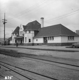
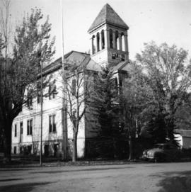
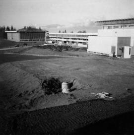
Photograph depicts Simon Fraser University in Burnaby, B.C. The view is looking northwest from the science complex towards the gymnasium.
Photograph depicts a horse drawn hay rack in a field on the north slopes of Vedder Mountain, near Yarrow.
Photograph depicts Craigellachie station, a famous spot on the C.P.R. line. The trans-continental line was joined here on November 7, 1885, about 250 yards down the track just beyond the right hand colour aspect signal. The depot house is not manned, used by the line side crews to store equipment. In former days it was a passing point, but there are very few houses in the area now.
Photograph depicts the C.P.R. depot at Princeton, looking east.
Photograph depicts the C.P.R. freight depot at Spences Bridge. It also shows caboose #436581, built in 1913. The view is facing east towards Merritt.
Photograph depicts a view looking east from the end of the C.P.R. track at Coal Harbour in Vancouver, B.C.
Photograph depicts the C.P.R. Cowichan depot on Vancouver Island. The view is looking south.
Photograph depicts the C.P.R. depot at Slocan City. At the left beyond the photo is the ferry slip on Slocan Lake.
Photograph depicts the B.C. Electric Railway workshops at the south end of the Burrard bridge in Vancouver. The view is looking west and depicts caboose A10 in the background.
Photograph depicts the C.P.R. depot at New Westminster.
Photograph depicts a former car barn of the B.C. Electric Railway at New Westminster. Newly aligned track to doors (from left) #3 and #5.
Photograph depicts the rear and side view of the abandoned Sumas electrical substation on the B.C. Electric Railway at Vedder Mountain.
Photograph depicts the derelict electricity station of the B.C. Electric Railway at Cloverdale.
Photograph depicts the track transfer transporter at the Canadian National Railway (CN) repair shops at Port Mann, showing the east face of the main building.
Photograph depicts Canadian National Railway (CN) freight crossing Powell St. near Raymur Ave.
Photograph depicts the demolition of a Great Northern Railway depot in Vancouver.
Photograph depicts a partially demolished Great Northern Railway depot and Canadian National Railway (CN) depot behind it, in Vancouver.
Photograph depicts a railcar and possible shed or depot. Location and details unknown.
Photograph depicts the St. Helen's Anglican Church on Old Yale Rd. (overlooking the Patullo Bridge) in South Westminster, Surrey.
Photograph depicts a home located at 1459 Robson St., at the northeastern intersection of Robson and Nicola, in Vancouver B.C.
Photograph depicts a store 50 yards south of the B.C. Electric Railway on the west side of the Vedder crossing road in Sardis, Chilliwack, B.C.
Photograph depicts a barn in the Upper Fraser Valley, west of the Vedder crossing and southwest of Atchelitz.
Photograph depicts the city hall in Pitt Meadows in the Fraser Valley.
Photograph depicts a disused lumber storage and rail loading shed beside the Pacific Great Eastern, on the property of the Lions Gate Lumber Co. at the foot of Lloyd St. in North Vancouver.
Photograph depicts Hamilton St. in Vancouver, looking northeast.
Photograph depicts a former C.P.R. connection between the False Creek yards and the south side of Vancouver harbour on West Pender St. in Vancouver, B.C. This spur used daily to get cars into the B.C. Electric Rail yard at the Georgia Viaduct from the C.P.R. False Creek yards.
Photograph depicts Mainland St. in Vancouver, B.C. , looking northeast with Helmken St. intersecting.
Photograph depicts the Kaslo city hall built in 1898.
Photograph depicts St. Margaret's Anglican Church on Bradner Rd., 3 miles northeast of Aldergrove in the Fraser Valley.
Photograph depicts a fire hall for fire float VFD "J.H. Carlisle" at False Creek. It is on the north shore and in line with Willow St., Vancouver.
Photograph depicts the house opposite an 1876 church in Nicola village, 7 miles northeast of Merritt. It may be the manse.
Photograph depicts a church built in 1876 in Nicola, 7 miles northeast of Merritt. It was originally a Presbyterian church and is one of the oldest in the interior, though it is now infrequently used.
Photograph depicts a derelict building on the old Main St in Slocan City, northwest of Nelson.
Photograph depicts the derelict Langham Hotel at Kaslo, B.C. on Kootenay Lake.
Photograph depicts a church on Wood St. in Greenwood, which is between Oliver and Grand Forks. The church may have been Roman Catholic.
Photograph depicts stores in Kaslo on Kootenay Lake, 40 miles northeast of Nelson. This town still has 15 miles of dirt road leading to it.
Photograph depicts a cattle shelter/ barn at the head of Nicola Lake, 20 miles east of Merritt, near the Douglas Lake road turnoff.
Photograph depicts the city hall in Rossland, B.C. built in 1990, during its heyday.
Photograph depicts peat barns on the New Westminster Highway on Lulu Island, near the #8 Rd., half a mile west of rail crossing.
Photograph depicts a house and barns on River Rd. in Surrey, 1 mile east of Deas Island Tunnel.
Photograph depicts the building for the Vancouver Supply Company located at 25 Alexander St. in Vancouver, B.C. It is at the center of the old downtown and may have been a former fire hall.
Photograph depicts the former C.P.R. route connecting existing False Creek rail yards and the Burrard shoreline main line. The view is looking southwest from the intersection of Powell St. (in foreground) and Columbia St. (not seen) in Vancouver.
Photograph depicts an unused church at Clayburn, near Abbotsford, B.C. The church and about half the buildings in the village are made of brick.
Photograph depicts the schoolhouse of Chinatown in Nanaimo, B.C. It is the only surviving building; the others were destroyed by a fire.
Photograph depicts the Grand Central Hotel at the intersection of Marpole Ave and Hudson St. in south Vancouver. The hotel was built in 1912 by J.J. Graver and run from 1913-1915. It re-opened in 1920 as a home for incurables (veterans). In 1937 it became the provincial infirmary and closed in May 1965.
Photograph depicts a corner building on Chilco and West Georgia St. facing Stanley Park in Vancouver, B.C. The view is looking east across Chilco St.
Photograph depicts the site of a former C.P.R. connection between the mainline into Vancouver and False Creek yards at West Pender St. In Vancouver. The rails are not used but still appear in the street and on the parking lot on the far side. Another parallel set of tracks 30 yards to the east are in daily use.
Photograph depicts the Silver Ledge Hotel, Ainsworth Hot Springs, on the west side of Kootenay Lake, north of Nelson.
Photograph depicts a barn at Darfield, near Barriere, about 35 miles north of Kamloops. The English timbered cottage developed from this architectural form.
Photograph depicts East Pender St., looking west towards the Vancouver Sun newspaper office near Abbot St. in Vancouver, B.C.