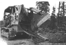
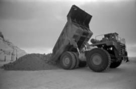
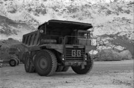
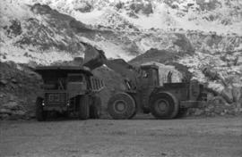
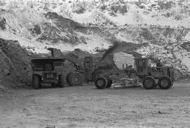
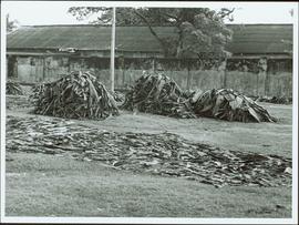
Item is a photograph of piles of bark in a field.
Item is a photograph of construction of the W.A.C. Bennett Dam.
Item is a photograph of a small mill operation.
Item is a photograph of a truck hauling logs from the shores of a lake.
Item is a photograph of a forested area with a partially frozen river, exact location unknown.
Item is a photograph of a large tree cutting machine.
Photograph depicts two men at a sawmill. A beehive burner is in the background.
Item is a photograph of a bulldozer removing debris from train tracks on August 27, 1956 location unknown.
Photograph depicts three men with fishing gear. Trees and mountains in background. Left to right: Plato Malezemoff (holding fish), Jack Christian, Tam Zimmermann.
Photograph depicts three men fishing from shore. Water and trees in background. Left to right: Jack Christian, Plato Malezemoff, Tam Zimmermann.
Photograph depicts man standing among six snow-covered buildings in what is believed to be a railway construction camp. Power line in foreground, forest trees in background.
Reclamation is the process of recovering disturbed land to its former state or other productive uses. This collection of photographs depicts men at work instituting a project on the control of erosion and to restore the mined areas to a condition in keeping with the environmental standards.
File contains photographs depicting individuals at Cassiar on strike in the winter time, marching down roads, holding picket signs, carrying small children who hold signs, and driving cars covered with strike slogans. Many of the signs read "U.S.W.A. LOCAL 6536" (United Steel Workers of America).
- Two photographs depict a man with a video recorder. Some photos feature plant buildings, two were taken at night. One photograph depicts a note that reads: "THERE WILL BE NO AFTERNOON SHIFT THURSDAY NOVEMBER 5th 1970."
- Many photos depict areas in the mine showing snow impacts, fissures in the mountain, asbestos evidence and other environmental activity. The picket signs contain protests regarding contracts, safety, environment, and ethics.
- Handwritten annotation on original envelope containing photographs: "Pictures 1970 Strike."
- Integrated into file are fourteen photos from file marked "Mr. B. Pewsey" that depict an area where a large rock fell, measuring tape, and protest sign.
File contains photographs pertaining to the transportation of asbestos fibre.
- These include portraits of Clinton trailer trucks, trucks from the Cassiar Transport Division at Mile 860 on the Alaskan Highway, the assembly of large freight trucks, an unidentified bridge, and ships and buildings at the Cassiar Shipping Facilities at Pier 94 on the Asbestos Warf in North Vancouver, B.C.
- Twenty-three photographs dated 1982 depict asbestos fiber bales on pallets and inside shipping containers, with accompanying annotations commenting on the quality of the packing. Several images show fibre bales broken during shipment. An accompanying note reads: "SMD - please ensure this cannot reoccur.", and a photo caption reads: "pierced bags are resulting as an environmental problem as fibre is beginning to build up in certain containers." One of the photographs depicting the Cassiar Transport Division was used for promotional posters with the following commentary: "The Cassiar Transport Division operates out of Whitehorse, Yukon Territory and is responsible for delivering the asbestos to the White Pass and Yukon Route terminal in Whitehorse. Fuel oil and supplies are backhauled to the mines. By the end of 1967, the fleet will consist of 65 tractor-trailer units, each of which will carry 23 tons of asbestos. The distance from Whitehorse to Cassiar is 357 miles and Clinton is 403 miles. During the past year, the Division's trucks traveled 2,213,534 miles and handled 75,100 tons, and the mileage to 3.5 million miles. This is a year-round operation and convoys arrive at the mine daily in spite of the long difficult haul. The Division currently employs 43 drivers and 35 mechanics and operates its own maintenance and rebuild facilities in Whitehorse. Over the years these men have established and enviable record of safety, cost and performance."
- Additional photographs that have been integrated depict the Asbestos wharf and its condition, 31 slides of wharf, maps of shipping routes, storage, forklifts, shipping trucks, and packaged asbestos.
- Also included in this file are two copies of a "Photo Survey - Cassiar Ton Units - "Amstelveld & Trojoland" on arrival to Brisbane & Sidney - August 1967." This collection of photographs is a part of an assessment of the efficiency of shipping and transport to Australia from Cassiar. Pictures include: loading, forklifts, storage, ripped bags, broken straps, wharfs, trucks, slings. There are accompanied annotations with each of the photos explaining the safety hazards or inefficiency of the situation. This report was found inside a box linked to James Hardie Industries Ltd. This company is not mentioned in the photograph annotations, but could be related to the report since James Hardie Industries Ltd. was a key player in asbestos mining and manufacturing in Australia.
- Collection of photos of roadside spill of Asbestos, depicting a man with shovel cleaning up on 5 June 1985
- Photos from Eternit Societe Anonyme (a European company that Cassiar shipped to) of packaged Asbestos in storage in 1967
- Collection of photos of James Hardie Coy. Pty. Ltd. shipment of asbestos that was not stored or transported effectively. Many photos depict broken bags as a result of inadequate storage and forklift punctures.
- Collection of photos of Cassiar/Stewart Road Proposal. Photos depict tests of the various stages of shipping and transportation process including forklift tests, Marineo Sling tests, stacking tests, durability tests, container loading tests, problems with current units etc. Also included is a marketing drawing if proposed shipping plan - drawn by "Stewart 1977."
- Photos of shipping process of Turners Asbestos Fibres Lmt. Photos depict lowering asbestos pallets onto barge with swing, and storage on barge.
- Collection of photos of a shipment of asbestos, but the bags of fibre are not identified as a Cassiar shipment therefore the location is unknown.
Cassiar Asbestos Corporation Ltd opened a second mine in 1967 at what became the one-industry town of Clinton Creek, Y.T. File contains photographs depicting different areas of operations at Clinton Creek. Locations include the mine, plant, town, tailings pile, main office, the 40 Mile River, and surrounding area. Town photos depict the grocery store, cafeteria, medical clinic, school, auditorium residential area, Connell Street and power house. File also includes aerial photographs and images depicting forest fighting, photographers capturing the tailings pile, asbestos samples, mining machinery, staff offices, and operations in the mill, lab, and garage.
Additional photographs integrated into file depict Clinton Creek's surrounding area, and three slides of a tailing pile explosion believed to be Clinton Creek.
Photograph depicts unidentified man standing in change house located at the new Mine Dry building. This change house utilized baskets which could be lowered under hinged covers, while the previous change house used baskets which could be raised by chains.
Plant buildings stand in midground. Conveyor believed to be leading to tailings pile can be seen in foreground. Valley and mountains in background.
Mill building in left midground. Conveyor believed to be leading to tailings pile can be seen in foreground. Valley and mountains in background.
Photograph depicts crusher buildings in left foreground, located west of mine on McDame Mountain. Southeast mountain range in background.
Photograph depicts a Euclid ore haulage truck dumping material on pile in left foreground.
Photograph depicts a Euclid ore haulage truck in foreground. Shovel and unidentified caterpillar machine can be seen in background.
Photograph depicts a shovel loading what appears to be a Euclid ore haulage truck in excavation area of mine.
Photograph depicts a shovel loading what appears to be a Euclid ore haulage truck on left. Unidentified Caterpillar machine in foreground.
Photograph depicts blasthole drill on left, bulldozer in centre, and shovel loading ore haulage truck in background. Second haul truck is semi-visible on far right. Hose equipment can be seen in foreground.
Photograph depicts the Cassiar mine on McDame Mountain. Blasthole drills and ore haulage trucks visible below in open pit and on switchback road.
Photograph depicts the Cassiar mine on McDame Mountain. West peak semi-visible in foreground. Drills and ore haulage trucks visible below in pit and on switchback roads.
Photograph depicts group of men and women on rocky shore, pile of fish in foreground. Photo speculated to have been taken in the Telegraph Creek area, possibly at the Tahltan or Stikine River, B.C.
Photograph depicts two unidentified individuals in canoe on Boya Lake, B.C. (formerly known as Chain Lakes). Foliage silhouetted in foreground; forest and hills on opposite shore in background.
Photograph depicts Joseph wearing safety gear while standing at testing equipment on raised sampling station. Sign below Joseph reads "DO NOT DISTURB / SAMPLING IN PROGRESS / PROPERTY OF ENVIRONMENTAL CONTROL DEPT. / CASSIAR ASBESTOS LTD." Helen Joseph took air quality tests in the working areas and town (see item 2000.1.1.3.19.135). Power lines, unidentified building, and mountain base visible in background. Photo was taken during winter.
Photograph depicts mobile home modified for Cassiar winters (steeply sloped roof added). Yellow suburban parked in driveway in left foreground. Forest trees and mountainside visible in background. Sign reading "686" posted on tree in left foreground. Believed to be the home of Gerry Cooper.
Photograph depicts three women wearing white aprons while conducting tests on asbestos fibre in lab area, miscellaneous equipment throughout room.
Photograph depicts woman wearing safety gear in second floor of mill building, holding unidentified instruments. Helen Joseph took air quality tests in the working areas and town (see item 2000.1.1.3.19.147).
Photograph depicts palletizer machinery, where bags of asbestos fibre were shrink-wrapped and made ready for shipping pallets. Palletizer was located near shipping (believed to be in mill building). Unidentified man visible in machinery on far left.
Photograph depicts Zora Ivanovska in safety gear, vaccuming asbestos dust from "hall screen" in mill (slanted vibrating tables with varying mesh sizes, used to separate different lengths of fibre). Mill General Foreman Tony Pinto is visible on far right, with unidentified man.
Photograph depicts part of the vacuum dust control and removal system in the Cassiar mill building. Unidentified man can be seen at rotary air-lock, in which heavy blown dust would collect before dropping to plenum conveyor resting just above floor. From here, the dust would eventually be expelled at the tailings pile outside of the mill. Second unidentified man can be seen climbing steps in background. This section of the mill was located above the lab.
Photograph depicts machinery in snowy area of mine. Euclid ore haulage truck in foreground, cassiar pickup truck visible in lower area in midground. Blasthole drill in front of track shovel in left background, Wabco ore haulage truck visible behind other machinery in right background.
Photograph depicts wheel bulldozer in snowy unknown area of mine.
Photograph depicts mine area. Switchback road and higher benches in background. Blasthole drills, track shovels, and ore haulage trucks can be seen on level in foreground and higher bench in background. Mountains visible in distance. Benches in background speculated to be located on the mine's West Peak.
Photograph depicts shovel in excavation area of mine, loading ore haulage truck believed to be a Wabco "haul pak".
Photograph depicts a Chevrolet pickup truck on highway to right of Mud Lake, at Km 632 on the Stewart-Cassiar Highway. Forest on hillside in background.
Photograph depicts plant buildings in front of tailings pile in midground. Forest, power line, and tramline in foreground; south mountains in background.
Photograph depicts plant buildings below, tailings pile in foreground. Valley and mountains in background. Handwritten annotation on recto of photograph: "CASSIAR".
Photograph depicts mine valley and road in foreground. Cassiar plant and tailings pile visible in left midground, townsite in right midground. Mountainside of McDame Mountain in foreground, southern mountain range in background.
Photograph depicts the West Peak of the Cassiar mine on McDame Mountain. Pit area visible between West Peak and road in foreground. Mine valley and north mountain range in background. Photo speculated to have been taken from a point on or near the South or North Peak.
Photograph depicts crusher plant in centre foreground. Shifter shack and vehicles can be seen in front of pit area. West Peak semi-visible in right midground. Mine valley an northwestern mountain range in background.
Photograph depicts yellow daffodils planted in dirt outside of main office building. Handwritten annotation on verso of photograph: "Cassiar June 15 71".
Photograph depicts flowing water speculated to be Troutline Creek which ran south of Cassiar, B.C. Forest on opposite shore and mountains in background. Handwritten annotation on verso of photograph: "Cassiar June 15 71".
Photograph depicts flowing water believed to be Troutline Creek which ran south of Cassiar, B.C. Tailings pile and plant buildings visible behind forest in midground, northern mountain range in background. Handwritten annotation on verso of photograph: "Cassiar June 15 71".