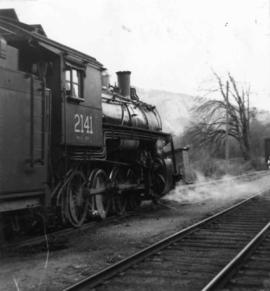
Map depicts the City of Squamish, Howe Sound, and the Britannia Mine.
Photograph depicts a locomotive near Cowichan Bay, B.C.
Map depicts the growth of Vancouver's street car system as from the laying of the first tracks in 1889 to the last section laid (Clark Dr., Hastings to Venables).
File consists of original Canadian Pacific Railway Pacific Region Timetables 102 (27 Sept. 1953) and 108 (30 Sept. 1956).
Map depicts the Cowichan Lake area, including rail trackage for the Western Forest Industries Logging Railway, the Canadian National Railway, and the BC Forest Products Logging Railway.
File consists of a May 1952 special edition of the Northwest Digest that features the Pacific Great Eastern Railway.
Map depicts the CNR system in Canada and the United States and all of its connecting lines, including the Central Vermont Railway, the Grand Trunk Western Railroad, and the Duluth Winnipeg & Pacific Railway.
Technical drawing of Kettle Valley Railway depicts trackage and a gradient profile for the line.
Postcard depicts a CPR streamliner crossing the Canadian Rocky Mountains.
Postcard depicts a CPR diesel electric train and Mt. Eisenhower in the Canadian Rockies.
Postcard depicts the CPR main line near Yoho, BC
Postcard depicts Cathedral Mountain viewed from a tunnel in the Canadian Rockies.
Postcard depicts a spiral tunnel near Field B.C. Mount Stephen visible.
Postcard depicts a general view of new grade reduction loops and spiral tunnels near Field B.C., Canadian Rockies.
Postcard depicts spiral tunnels.
Postcard depicts Kicking Horse Canyon in the Canadian Rockies.
Postcard depicts Kicking Horse Canyon.
Postcard depicts lower Kicking Horse Canyon, on the CPR line.
Postcard depicts Glacier House and Great Glacier House built in 1886 as one of three similar hotels, the other two being Mt. Stephen House in Field, and Fraser Canyon Hotel in North Bend. Business fell off rapidly in 1916 when tracks were relocated into a new tunnel. Buildings were demolished in 1930.
Postcard depicts a train oustide a snowshed in Glacier, BC. It was thought the view was looking south with Glacier Hotel in the middle distance at the head of the 180 degree loop. Outside trackage was built alongside sheds in the summit area of Rogers Pass.
Postcard depicts the entrance to the east end of the Connaught Tunnel.
Postcard depicts Illecillewaet Glacier from the Railway. "One of the chief attractions for tourists is the Illecillewaet Glacier, and, while not the largest in the Canadian Rockies, it is the most accessible and in every way representative of these most interesting natural phenomena. A trip across its face leaves a lasting impression on one's memory. The Illecillewaet River takes its rise from the great glacier of the Selkirks."
Postcard depicts the crossing of "The Loop."
Postcard depicts the CPR station at Albert Canyon, BC, circa 1900.
Postcard depicts the east portal of the Connaught Tunnel and Mount Macdonald.
Postcard depicts Sicamous Station and Hotel, circa 1910. "Sicamous became a favorite statring point for fishermen to the Shuswap Lake and junction for the fruit growing Okanagan Valley. The first station in Sicamous, built in 1890, burned down in 1900. A new one was built, modernized in 1908, and torn down in the 1960s."
Postcard depicts Main Street (Victoria West) Kamloops in 1910.
Postcard depicts the Thompson River, 6 miles north of Spences Bridge, on the Okanagan Trail.
Postcard depicts the CPR crossing Skuzzy River, Fraser Canyon, BC
Postcard depicts Fraser River Canyon, near North Bend, BC
Postcard depicts the Four Tunnels on the CPR line through the Rocky Mountains.
Postcard depicts the Four Tunnels over Fraser River, BC
Postcard depicts Fraser Canyon in the Canadian Rockies.
Postcard depicts Fraser River in the Canadian Rockies.
Postcard depicts Cantilever Bridge near Cisco, BC
Postcard depicts Vancouver's "Old 374" crossing the Spuzzum River, Fraser Canyon, BC
Postcard depicts Fraser River Canyon, showing Cariboo Highway, CPR and CNR Railways, British Columbia, Canada.
Postcard depicts spiral tunnels near Yoho National Park, BC
Postcard depicts Mt. Stephen.
Postcard depicts Mt. Stephen and Kicking Horse River.
Postcard depicts Kicking Horse Pass, Golden B.C.
Postcard depicts the Kicking Horse Canyon near Yoho National Park.
Postcard depicts Stoney Creek Bridge in the Selkirk Mountains of B.C.
Postcard depicts Stoney Creek Bridge.
Postcard depicts Stoney Creek Bridge in the Canadian Rockies.
Postcard depicts Albert Canyon.