2009.7.1.128
·
Pièce
·
[ca. 1878 - ca. 1920]
Fait partie de Archdeacon W. H. Collison fonds
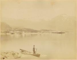
Photograph depicts an empty canoe floating beside a canoe full of fish. Hills visible on opposite shore in distance.
Handwritten annotation on verso reads: "Loaded with fish - Nass River".