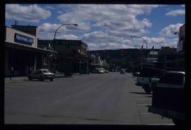
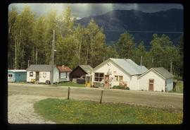
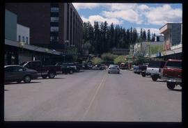
Image depicts a view of George Street with the Prince George City Hall at the corner of George Street and 7th Avenue.
Image depicts a view of George Street with the Prince George Hotel.
Image depicts a view of 3rd Avenue with the Columbus Hotel prior to the fire that destroyed it in 2008.
Image depicts a view of the corner of 3rd Avenue and Brunswick Street in Prince George, B.C.
Image depicts a view along Highway 97 in Prince George, B.C.
Image depicts the Two Rivers Art Gallery in Prince George, B.C.
Image depicts City Hall in Prince George, B.C.
Image depicts an old Swedish style house somewhere in the Pineview subdivision in Prince George, B.C.
Image depicts an old barn somewhere in the Pineview subdivision in Prince George, B.C.
Image depicts a house somewhere in the South Fort George subdivision of Prince George, B.C.
Image depicts the Exhibition Sports Centre, which used to be a drill hall army base, on Keller Street in Prince George, B.C.
Image depicts a few storage sheds somewhere in Prince George, B.C.
Image depicts a street of houses somewhere in Prince George, B.C.
Image depicts the Exhibition Sports Centre, which used to be a drill hall army base, on Keller Street in Prince George, B.C.
Image depicts a building which is a part of the Studio 2880 Arts Complex on 15th Avenue in Prince George, B.C.
Image depicts a house somewhere in Prince George, B.C.
Image depicts a street of businesses, possibly 3rd Avenue, in Prince George, B.C.
Image depicts an old telegraph cabin at Cheslatta, B.C.
Image depicts the Kenney Dam near Cheslatta, B.C.
Image depicts the old Dunster Station in Dunster, B.C.
Image depicts the interior of the old Dunster Station in Dunster, B.C.
Image depicts the train tracks at the old Dunster Station in Dunster, B.C.
Image depicts the interior of the old Dunster Station in Dunster, B.C.
Image depicts the old Dunster Station in Dunster, B.C.
Image depicts the town of Dunster, B.C.
Image depicts the old Dunster Station in Dunster, B.C.
File contains slides depicting images of fences and various other forms of log construction, ranging from 1970 to 1985.
Image depicts the corner of a log house, the slide itself labels the picture as being from Barkerville, B.C. and also indicates the corner is an example of a "round log" dovetail joint.
Image depicts a cabin at Fraser Lake, B.C. which is labelled on the slide as an example of a "square log" dovetail joint.
Image depicts a cabin at an unknown location.
Image depicts a wooden fence at an uncertain location, perhaps somewhere in the Chilcotin region.
Image depicts a wooden fence at somewhere in Meldrum Creek, B.C.
Image depicts a shed somewhere in Kitwancool Lake, B.C.