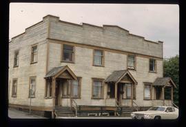
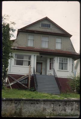
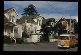
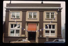
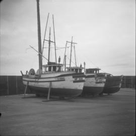
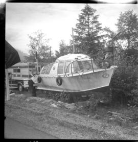
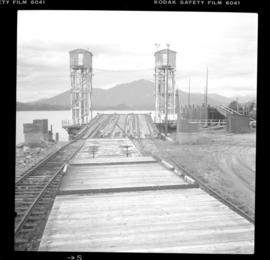
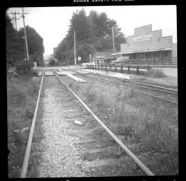
Series consists of nine photographs of Prince Rupert scenery, buildings, residents and surrounding area. Includes image of totem and dugout canoe.
Item is a print of a photograph of a building described on verso as the Post Office [?] in Prince Rupert in 1908.
Item consists of transcript and tape summary of interview with historian Frank Leonard who discusses the history of the Grand Trunk Pacific Railway, its impact on the development of Prince George and Prince Rupert. Also discusses rivalries between owners of the newspapers Fort George Herald and Fort George Tribune.
Sans titrePhotograph depicts a Gruman Goose of the Trans Provincial Airpline discharging passengers, having just landed on floats and then taxied on wheels up a ramp.
Photograph depicts a Gruman Goose of the Trans Provincial Airpline that had just landed on on floats and was emerging on wheels to climb a ramp to the seaplane base.
Photograph depicts a Gruman Goose at the Seal Cove Seaplane Base. Several of these planes were in use at this location. At least 6 in total.
Photograph depicts a steam roller on display in front of the Provincial Court House. Manufactured by "Waterous," Brantford, Canada (Waterous Engine Works Company). Similar, if not identical machine was used by the city of North Vancouver for road paving in 1912.
Photograph depicts a Coastgaurd ship, "Narwhal," at the Department of Transport wharf in Seal Cove.
Photograph depicts possibly disused fishboats found adjacent to oil wharfs in Prince Rupert.
Photograph depicts an air-sea rescue launch that may been used during World War II. It was located just beside Highway 16, about 5 miles from the centre of Prince Rupert.
Photograph depicts a ferry slip and a rail barge to Alaska. 3 tracks were used for shipping.
Photograph depicts trackage connecting the passenger depot in Prince Rupert and freight only section to a seal cove. Image captured at Cow Bay, with the Mason Way grade crossing visible. In 2003, Davies noted that the twin sets of track on the rail bridge survived, but everything else had disappeared.
Item is an audio reel to reel recording of Board of Broadcast Governors (BBG) Hearings, Prince Rupert, 1965 [?] dealing with an application fora broadcasting license for a group in Prince Rupert, BC. The Board of Broadcast Governors later became the Canadian Radio Television Commission
Image depicts an old theatre owned by Paul Aivazoff in Prince Rupert, B.C. It opened in 1935 and was closed in 1981; it has since been renovated for retail use.
Image depicts a condominium, possibly in Prince Rupert, B.C.
Image depicts a house which is possibly in Prince Rupert, B.C.
Image depicts a row of houses; it is possibly in Prince Rupert, B.C.
Image depicts an old building with a sign labelling it as a "Dining Lounge," it is possibly in Prince Rupert, B.C.
Image depicts the rail yards in Prince Rupert.
Image depicts the Kwinitsa CNR station, which is Prince Rupert's railway museum.
File contains slides depicting places in and around Prince Rupert, B.C.
File contains slides depicting places along the Skeena River on the way to Prince Rupert, B.C.
Image depicts an old building on the main street of Prince Rupert, B.C. Only half of the business name is visible: "Skeena Color [sic]."
Image depicts the waters of the Hecate Strait.
Image depicts numerous boats docked by the Prince Rupert Fishermen's Co-operative Association from the deck of a ferry, possibly as it's leaving Prince Rupert, most likely for Haida Gwaii.
Image depicts numerous boats docked in Prince Rupert, B.C.
Image depicts a large vessel docked at a grain elevator and two smaller boats at a dock in the foreground somewhere in Prince Rupert, B.C.
Image depicts several houses in Prince Rupert, B.C.
Image depicts numerous houses in Prince Rupert, B.C.
Image depicts the Pride O' the North shopping mall in Prince Rupert, B.C.
Image depicts the Bank of Nova Scotia located on "Besner Block" in Prince Rupert, B.C.
Image depicts the City Hall of Prince Rupert, B.C.
Image depicts the main street of Prince Rupert, B.C.
Image depicts a view of Prince Rupert, B.C.
Image depicts numerous buildings and a small dock somewhere in Prince Rupert, B.C. One of the buildings is labelled "Fishermen's Supply."
Image depicts a large building with numerous vehicles in the foreground.
Image depicts numerous docked boats somewhere in Prince Rupert, B.C.
Image depicts a dock in Prince Rupert, B.C.
Image depicts the Hecate Strait near Prince Rupert, B.C.
Image depicts a grain elevator in Prince Rupert, B.C.
Image depicts numerous boats docked by a buildings identified as the "Prince Rupert Fishermen's Co-operative Association."
Image depicts a boat docked inside what appears to be a type of boathouse, possibly located in Metlakatla near Prince Rupert, B.C.
Image depicts a large vessel docked in Prince Rupert, B.C. The name on its side is "Star Capella." The slide itself is labelled "superport."
Image depicts the ferry to Alaska in the port of Prince Rupert, B.C.
Image depicts a fishing boat on the water somewhere near Prince Rupert, B.C. Only half of its name is visible: "spirit."
Image depicts Metlakatla, located near Prince Rupert, B.C.
Image depicts a view of the downtown core of Prince Rupert, B.C.