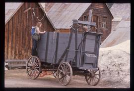
Image depicts a turbine on a large industrial vehicle somewhere in or near Fort St. John, B.C.
File contains slides depicting places along Route 80 in the USA.
Image depicts the Cariboo Road in Soda Creek, B.C.
Image depicts an unknown woman standing in front of a truck that either weighs 80 tonnes, or is capable of carrying that much; the slide is simply labelled "80 tons." It is located at the Gibraltar mine site.
Image depicts the ferry at Soda Creek, B.C.
Image depicts what appears to be a Ranch at Soda Creek, B.C.
Image depicts a dam on what is possibly the Peace River.
Image depicts a stretch of highway, possibly Highway 29 or 97.
Image depicts the Clayhurst Ferry on the Peace River.
Image depicts a building, possibly an office building, next to a set of rail road tracks in Leo Creek, B.C. An unknown individual is present, and a number of barrels and culverts are visible in the foreground.
Image depicts Highway 99 north of Squamish and near Pemberton, B.C.
Image depicts Highway 99 north of Squamish, near Pemberton, B.C.
Image depicts Highway 99 near Pemberton, B.C.
Image depicts the dock for ferries in Isle Pierre, B.C.
Image depicts a road, possibly Joffre Creek Road. The slide is simply labelled "Joffre cr."
Image depicts the ferry in Isle Pierre, B.C.
Image depicts the road to Pavilion Mountain.
Image depicts the start of Joffre Creek Road, most likely somewhere in the Joffre Lakes Provincial Park.
Image depicts a road leading into a First Nations' Reserve at the head of Harrison Lake.
Image depicts a freight wagon in Barkerville.
Image depicts the CN Railway and Station at Goat River, B.C.
Image depicts a red vehicle parked on the side of the road with a view of the McGregor Valley behind it. The slide is labelled "dam site."
Image depicts the CN Railway and Station at Goat River, B.C.
Image depicts a row of houses and the side of a train in Crescent Spur, B.C.
Image depicts the BCR tracks passing through a mill somewhere near the 100 Mile.
Image depicts the CN Station, with bundles of wood sitting near the tracks, in Giscome, B.C. Map coordinates 54°04'32.3"N 122°21'42.3"W
Image depicts a highway, and a section of mountain in the background which is bare due to clear-cut logging. It is possibly somewhere near Prince George, B.C.
Image depicts a trailer for a logging truck suspended off the ground by a wooden structure. This is used to load the trailer onto the back of the truck. The name on the truck says "Rormarniewich Trucking Ltd."
Image depicts the Canadian National Railway Yards in Prince George, B.C.
Image depicts the old Goat River Train Station in Goat River, B.C.
Image depicts the old Giscome Train Station in Giscome, B.C. It was demolished between 1976 and 1977.
Image depicts an aerial view of Highway 97 just north of Williams Lake, B.C.
Image depicts the railway running near Crescent Spur in the Rocky Mountain Trench.
Image depicts a train carrying logs somewhere in Prince George, B.c.
Image depicts a vehicle and a large group of skiers somewhere on Tabor Mountain in Prince George, B.C.
Image depicts an aerial view of the Williams Lake Airport along Highway 97, just north of Williams Lake, B.C.
Image depicts the BCR, as well as the Dunkley Lumber Mill, in Strathnaver, B.C.
Image depicts a train transporting wood planks, possibly in Prince George, B.C.
Image depicts numerous tractors at Finning Tractor and Equipment Co. Ltd. located along Highway 97 in Prince George, B.C.
Image depicts the hiking group packing their gear into two vans.
Image depicts the old, grown-over Cariboo Road at an uncertain location.
Image depicts the Gibraltar mine site north of Williams Lake, B.C.
Image depicts a number of workers putting in blasting powder at the Gibraltar mine site north of Williams Lake, B.C.
Image depicts the old, grown-over Cariboo Road at an uncertain location.
Image depicts the Cariboo Road south of Williams Lake.
Image depicts a rail road construct from Highway 97 at Mile 126; the slide is also labelled "McAlister."
Image depicts a loading truck at the Gibraltar mine site north of Williams Lake, B.C.