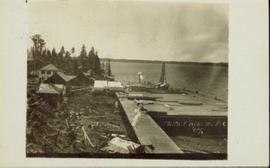
Photograph of a large dock littered evidence of lumber transportation. Small buildings and stumps are on the shoreline. Annotation on recto reads: "Prince Rupert BC, '07."
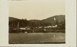
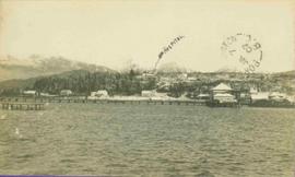
Wide angle view of Prince Rupert harbour taken from the water. Forest and mountains are visible in the background. Annotation on recto reads: "Prince Rupert BC '07."
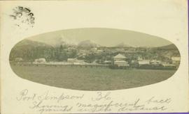
Pier, house, and tress with snowcapped mountains in background. Image has been cropped to oval shape. Handwritten annotation in pencil on verso reads: “Port Simpson B. C. showing magnificent background in the distance”, on recto: "W. I. O'Neill Es. Aberdeen B.C. Hope you are well my dear D.D. - Have written to K. and are sending you and [?] Boy each a card. [?] will wish to saw we are all ok. Yours, M.", "Yours 10derly". Recto stamped "PORT SIMPSON B.C. MR 14 07".
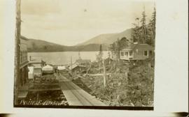
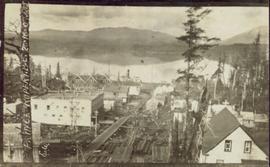
View of the road descending to the waterfront. Buildings and forested area are visible on either side of street. Annotation on recto reads: "Prince Rupert BC. '07."
Photograph of several buildings down the street in Prince Rupert, including the church. Lumber pallets are littered around the buildings. Annotation on recto reads: "Prince Rupert, BC. 20.10.07."
View of pier, cluster of houses and trees with snow topped mountains in background. Handwritten annotation on verso reads: “Hospital” with an arrow pointing to the building. Postage cancelation stamp on verso reads: "PORT ESSINGTON B.C. JUL 7 07". Handwritten annotation on recto reads: “PORT SIMPSON. Mrs. Noble Port Essington B. C. Hope you are feeling better. I am doing splendidly have not felt so well for years. Dr. advises me to stay at least another month A.W.B.”
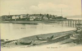
View of Pier and cluster of houses with trees in the background. Water crosses midground, canoes on beach in foreground. Printed annotation on verso reads: “Port Simpson.", handwritten in pencil: “B.C. 1907”.
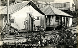
Photograph of post office and neighbouring building. Both buildings are composed of wood and tent materials. Annotation on recto reads: "Post Office & Customs House, Prince Rupert, BC."
Photograph depicts silhouette of unknown man standing in front of tent, trees in background. Poor image quality.
Image is one of 65 photos documenting a survey of the Canada-Alaska Boundary, Taku River area, May 23 to Oct. 15, 1906.
This particular photo is one of 13 found in original enclosure with the following handwritten annotation: "SOME OTHERS." See also items 2006.20.3.22 - 2006.20.3.34.
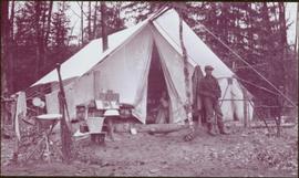
Photograph depicts miscellaneous items and supplies in front of white tent. Unknown man stands in foreground and a second man can be seen sitting in tent. Stand of trees in background. Handwritten annotation visible on negative: "[?] Oct 13".
Image is one of 65 photos documenting a survey of the Canada-Alaska Boundary, Taku River area, May 23 to Oct. 15, 1906. This particular photo is one of 9 found in original enclosure with the following handwritten annotation: "Pictures of different members of ‘our’ party.” See also items 2006.20.3.57 - 2006.20.3.65.
Item is a photograph of the post office in Prince Rupert taken between 1906 and 1908.
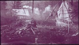
Photograph depicts man seated by campfire, duck in hand. Tent buildings can be seen in background. Handwritten annotation on negative: "Billy Pulling ducks".
Image is one of 65 photos documenting a survey of the Canada-Alaska Boundary, Taku River area, May 23 to Oct. 15, 1906.
This particular photo is one of 13 found in original enclosure with the following handwritten annotation: "Kopoka River - river scenes Aug 29 to Oct. 9 [19]06". See also items 2006.20.3.1 - 2006.20.3.13.
Photograph depicts small structure barely visible in forest. Handwritten annotation on negative: "Trappers hut near Kopoka Glacier".
Image is one of 65 photos documenting a survey of the Canada-Alaska Boundary, Taku River area, May 23 to Oct. 15, 1906.
This particular photo is one of 13 found in original enclosure with the following handwritten annotation: "Kopoka River - river scenes Aug 29 to Oct. 9 [19]06". See also items 2006.20.3.1 - 2006.20.3.13.
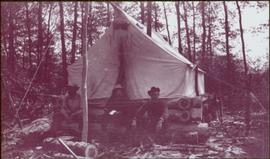
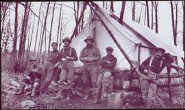
Photograph depicts three men sitting in front of tent structure with log base, trees in background. Believed to be main campsite area (see item 2006.20.3.59).
Image is one of 65 photos documenting a survey of the Canada-Alaska Boundary, Taku River area, May 23 to Oct. 15, 1906. This particular photo is one of 9 found in original enclosure with the following handwritten annotation: "Pictures of different members of ‘our’ party.” See also items 2006.20.3.57 - 2006.20.3.65.
Photograph depicts tent among trees, hills visible in background.
Image is one of 65 photos documenting a survey of the Canada-Alaska Boundary, Taku River area, May 23 to Oct. 15, 1906.
This particular photo is one of 13 found in original enclosure with the following handwritten annotation: "Kopoka River - river scenes Aug 29 to Oct. 9 [19]06". See also items 2006.20.3.1 - 2006.20.3.13.
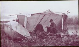
Photograph depicts man [Gilroy?] sitting with small tin cup. Canoe lies upside down in foreground. Water and opposite shore visible in background. Handwritten annotation visible on negative: "Camp. [Gilroy?] on way up from trail. 9 pm".
Image is one of 65 photos documenting a survey of the Canada-Alaska Boundary, Taku River area, May 23 to Oct. 15, 1906.
This particular photo is one of 13 found in original enclosure with the following handwritten annotation: "SOME OTHERS." See also items 2006.20.3.22 - 2006.20.3.34.
Photograph depicts small tent set up in bushes, fallen trees in foreground.
Image is one of 65 photos documenting a survey of the Canada-Alaska Boundary, Taku River area, May 23 to Oct. 15, 1906. This particular photo is one of 10 found in original enclosure with the following handwritten annotation: "From [Wahut?]-Azmuth and Koshu.” See also items 2006.20.3.47 - 2006.20.3.56.
Photograph depicts group of six men standing and sitting in forest in front of tent structure with log base. Handwritten annotation visible on negative: "[Myself?] Main Camp".
Image is one of 65 photos documenting a survey of the Canada-Alaska Boundary, Taku River area, May 23 to Oct. 15, 1906. This particular photo is one of 9 found in original enclosure with the following handwritten annotation: "Pictures of different members of ‘our’ party.” See also items 2006.20.3.57 - 2006.20.3.65.
Item is a photograph of a building with trees in front covered with snow.
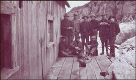
Photograph depicts group of ten men on deck of wood building, cliffs visible in background. One man is only semi-visible through hole in deck, he stands in place of missing plank.
Image is one of 65 photos documenting a survey of the Canada-Alaska Boundary, Taku River area, May 23 to Oct. 15, 1906. This particular photo is one of 9 found in original enclosure with the following handwritten annotation: "Pictures of different members of ‘our’ party.” See also items 2006.20.3.57 - 2006.20.3.65.
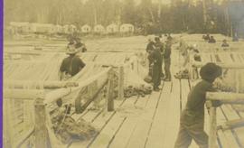
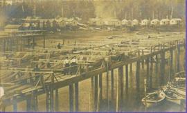
Close view of dock full of rows of nets and a few workers. Rows of bunkhouses on shore in background. Handwritten annotation in pencil on recto reads: “Port Essington B. C.”
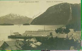
View of building, dock, harbour and small islands with snow peaked mountains in background. Printed caption on verso reads: “Port Essington B.C. Photo by P. E. Fisher”. Handwritten annotation in ink on verso reads: “up the Skeena”, in pencil on verso: “Port Essington, North Coast Commercial Coy”.
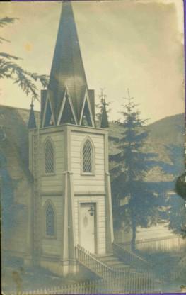
Photo of church door with spire, front door and picket fence. Handwritten annotation in pencil on recto reads: “Port Essington B. C.”
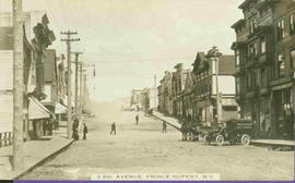
Street scene depicting people, boardwalks, horse & wagons, and delivery truck. Printed annotation on recto reads: “3rd Ave. Prince Rupert. B.C.”
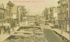
Typed annotation in red ink on recto reads: “3rd Ave. Prince Rupert. B.C.” People, boardwalks, horse & wagons and store signs are visible. Rubble and unknown material lies on ground between boardwalks. Typed annotation in red ink on recto reads: “3rd Ave. Prince Rupert. B.C.”
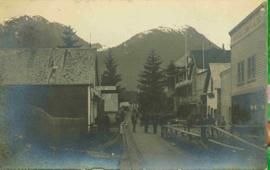
Photograph of a boardwalk street with buildings on either side, several people visible in image. Trees can be seen on street, and mountains stand in background. Handwritten annotation in pencil on verso reads: “Port Essington, North Coast Commercial Coy”.
View of dock full of rows of nets and a few workers. Sail boats are anchored near the dock and there are rows of bunkhouses in the mid ground, trees in the background. Handwritten annotation in pencil on recto reads: “Port Essington B. C.”
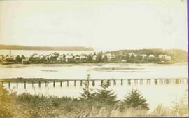
View of peninsula with houses and trees. Dock in mid ground, trees and grasses in foreground. Recto stamped “Port Simpson DE 17" and "Port Essington DE 18". Handwritten annotation on recto of photograph: "W. J. O'Neill Esq. Telegraph Point Via Pt. Essington B.C. Don't you think this pretty [Weggs & Mr. Byron?] was over last night - said he saw you and [Halie?]. Yours - BaBa".
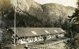
Photograph depicts the Seton Lake hatchery building constructed by the British Columbia provincial government in 1903.
Additional photographs and information about this construction is provided in the Fisheries Commissioner's Report for that year:
"In October, 1902, bids were invited for the construction of a hatchery building and Superintendent's cottage on Lake Creek, the outlet of Seton Lake, near the village of Lillooet. There were six bidders. A contract was let to W. Duguid, of Lillooet, the lowest bidder, in November. The buildings were completed and accepted in March, 1903. The hatchery building is a substantial wooden structure 210 feet long by 40 feet wide. The roof is supported by the walls, thus giving a clear floor space for the 160 hatching troughs, which are each 16 feet long, 16 inches wide and 7 inches deep. Two troughs are placed end to end and extend the width of the building, and receive the water from the head flumes which run lengthwise of the building. The equipment permits of the handling of forty million eggs. The water supply is taken from Lake Creek at a point some 1,400 feet from the hatchery, and about the same distance from Seton Lake, by means of a wooden flume three feet wide and two feet deep. A comfortable cottage for the Superintendent and a boarding-house for the other employees were constructed and furnished. The station in all its equipment is modern, and is not excelled by any other on the coast..."
Hatchery operations were terminated in Seton Creek in 1915 because the salmon runs had been almost destroyed.
File contains postcard photographs portraying life in various Northern BC Communities. Images depict buildings and streets, church structures, harbours and docks, and views of the shore from the water to name a few.
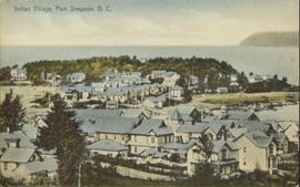
Hand coloured photograph of the surrounding lands and many residential buildings encompassing the Tsimshian village of Lax Kw'alaams (previously called Port Simpson). Printed annotation on recto reads: "Indian Village, Port Simpson, B.C."
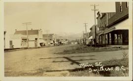
Street view photograph of buildings along the dirt road of Main Street in Smithers, B.C." Printed annotation on recto reads: "Main St. Smithers B.C." Handwritten annotation in pen on verso reads: "Town 7 miles from my place."
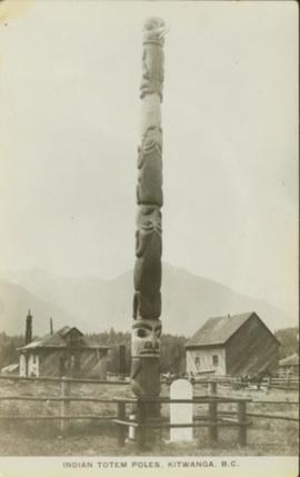
Full on photograph of a totem pole in a fenced area. Printed annotation on recto reads: "Indian Totem Poles, Kitwanga, B.C."
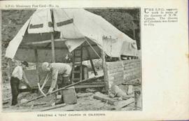
Photo of 2 men working with hand tools. Printed captions on verso read: "S.P.G. Missionary Post Card - No. 14.", "ERECTING A TENT CHURCH IN CALEDONIA.", "THE S.P.G. supports work in many of the dioceses of N.-W. Canada. The diocese of Caladonia was formed in 1879". Handwritten annotations in pencil on recto read: “PRINCE RUPERT AREA B.C.”, “The Rev S.B. Priston, Farm Cottage Farm lane, Fulham. Thankyou so very much for all you did last night. I am so sorry I did not see you after it was all over to thank you. R.A.[?] You never came to eat the [?] there are heaps.” Half pence postage stamp on recto is canceled with ink stamp reading "DE 7 04".
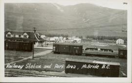
Slightly oblique front view of railway cars on a track. Buildings and hills can be seen in the background. Printed annotation on recto reads: "Railway Station and Park Area, McBride, B.C."
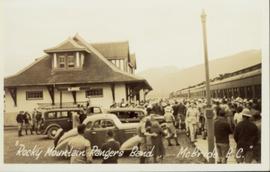
Photograph of a large crowd gathered at the McBride train station. Printed annotation on recto reads: "'Rocky Mountain Rangers Band, McBride, B.C.'"
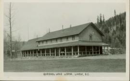
Side perspective of the Quesnel Lake Lodge. The building is in very good condition, and is surrounded by many trees. Printed annotation on recto reads: "Quesnel Lake Lodge, Likely, B.C."
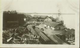
Photograph of a train traveling through Prince Rupert. Several people are gathered on the dock and around various buildings. Two small vessels are docked in the harbour. Annotation on recto reads: "Prince Rupert, Waterfront. Allen Photo May '4."
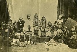
Three men stand in centre, each wearing a chief's dress and head-dress. Family members stand and sit on either side. Carved boxes and masks are positioned in foreground. The group poses in front of drapery hung against tall wooden wall.
Community members have stated that the people in this photo are from the Gitwilluyaxw clan from the wolf tribal house of Ksdiyaawak. The photo was taken at Gitlax̱t’aamiks along the Nass River.
Handwritten annotation on verso reads: "Tsimpshian Chiefs & family. Goods [for or fr.] Potlatch".
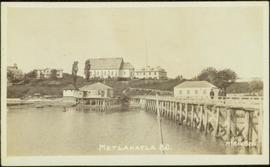
Photograph depicts large buildings on shore. Three unidentified individuals can be seen walking on dock in foreground.
Printed on image: "METLAKATLA B.C. / McRAE BROS"; handwritten annotation on verso reads: "A section of Metlakahtla, showing Church & Schoolhouse." See also item 2009.7.1.58 for similar image also featuring the new church building at Metlakatla, B.C.
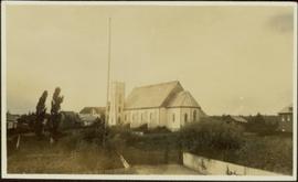
Photograph depicts fenced area in front of church building with turret. Other community buildings can be seen in background.
Handwritten annotation on verso reads: "Metlakatla Church. Replacement for larger church lost in village fire 1903?" See also item 2009.7.1.55 for similar image depicting new church building at Metlakatla, B.C.
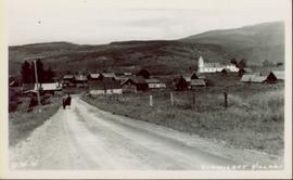
Photograph of the dirt road leading to Hagwilget Village. Residential buildings and a church are visible in the background. Printed annotation on recto reads: "W.W.W. Hagwilget Village."
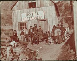
Photograph depicts group of working men and 6 dogs standing outside wood building. Hill in background.
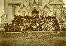
Large group of women, men, and children pose on front steps of church. Some men standing in back hold brass instruments. Bishop Ridley (with long beard) sits in front centre between W.H. Collison (on right) and his son W.E. Collison. Photograph depicts the first church built in Metlakatla, which was burned in a fire in 1901, and replaced in 1903.
Handwritten annotation below image reads: "A gathering of Missionaries and Indians in front of Metlakahtla Church During Synod"; on verso: "[Ven?] Arch Collison & Mrs Collison".
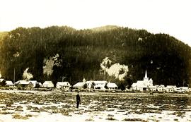
Village can be seen in distance. Large church building stands in centre, hills in background.
Handwritten annotation on verso reads: "For heading of Page 18. Kincolith or 'The Rock of Scalps.' Section of Kincolith [...]"
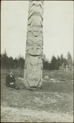
Rev. W.E. Collison sits to left of totem pole, smoking a pipe (oldest son of Marion and Archdeacon W.H. Collison). Log fence can be seen in front of forest in right background.
Handwritten annotations on verso read: “W.E. Collison at Massett, QCIs."; "Dad beside totem pole".
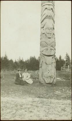
The pair sits on ground beside large totem pole, Bertha on left (wife of W.E. Collison). Log fence can be seen in front of forest in right background.
Handwritten annotation on verso reads: “Mother & Josie Edenshaw at Massett".
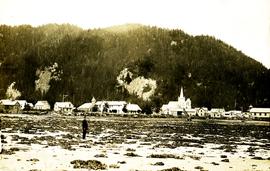
Village can be seen in distance. Large church building stands in centre, hills in background.
Handwritten annotation on verso reads: "Grand Dad on beach at Kincolith".
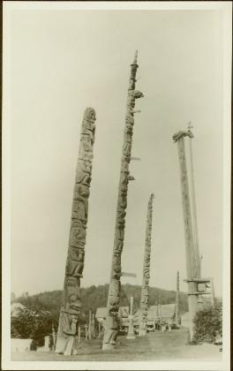
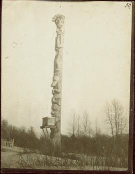
Photograph depicts a mortuary pole situated against a snowy landscape.
Handwritten annotation on verso reads: “Chapter XVIII, Nom. 1 Chief Gwaksho’s totem pole. The Great Hunter.”
