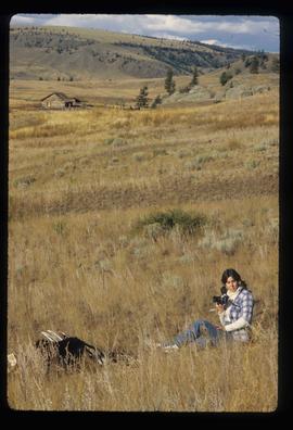
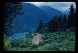
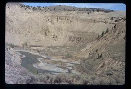
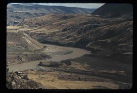
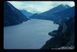
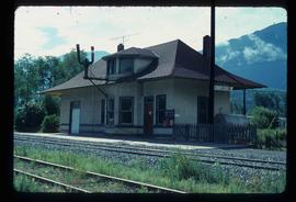
Image depicts the house of the owner of Gang Ranch.
Image depicts the Fraser River in the upper Fraser Canyon.
Image depicts an unknown woman taking pictures. Nearby are the skeletal remains of an unknown animal. The location is somewhere near the upper Fraser Canyon.
Image depicts an unknown woman with a camera. Nearby are the skeletal remains of an unknown animal. The location is the upper Fraser Canyon.
Image depicts a view of the upper Fraser Canyon. The Fraser River is visible on the left side of the image.
Image depicts a view of the upper Fraser Canyon.
Image depicts a road somewhere in the Upper Fraser Canyon, and a view of the hills and trees.
Image depicts the Upper Fraser Canyon.
Image depicts the Alkali Lake Ranch in Alkali Lake, B.C.
Image depicts an old church located somewhere in Lillooet, B.C.
Image depicts what appears to be an apartment building among several others in an uncertain location.
Image depicts Nairn Falls in Nairn Falls Provincial Park.
Image depicts Nairn Falls.
Image depicts a dirt road somewhere near Bralorne, B.C.
Image depicts an elevated view of a river near Bralorne, B.C.
Image depicts a dirt road leading through a forest with what appears to be an area for turning around at the end.
Image depicts a car on a dirt road leading through a forest.
Image depicts a camper passing under an overhang as it drives along a narrow road near a cliff; located somewhere near Bralorne, B.C.
Image depicts a river somewhere near Bralorne, B.C.
Image depicts a creek somewhere near Bralorne, B.C.
Image depicts the Lajoie Dam on the Bridge River from the upstream side.
Image depicts Bralorne, B.C.
Image depicts what is possibly an old, rundown mill in Bralorne, B.C.
Image depicts several houses in Bralorne, B.C.
Image depicts a few boarded-up buildings in Bralorne, B.C.
Image depicts an area of Barlone, B.C. surrounded by trees.
Image depicts what is possibly the Fraser River.
Image depicts a view of the landscape at an unknown location with a group of people, possibly tourists, present. It is possibly near the Fraser River.
Image depicts what is possibly the Fraser River.
Image depicts the Hecate Strait near Prince Rupert, B.C.
Image depicts numerous docked boats somewhere in Prince Rupert, B.C.
Image depicts a pulp mill in Port Edward, B.C.
Image depicts an old building on the main street of Prince Rupert, B.C. Only half of the business name is visible: "Skeena Color [sic]."
Image depicts the Bank of Nova Scotia located on "Besner Block" in Prince Rupert, B.C.
Image depicts a large vessel docked at a grain elevator and two smaller boats at a dock in the foreground somewhere in Prince Rupert, B.C.
Image depicts numerous boats docked in Prince Rupert, B.C.
Image depicts an old, abandoned church located somewhere in Seton Portage, B.C.
Image depicts a trail through the forest somewhere in or near Seton Portage, B.C.
Image depicts an individual, possibly Kent Sedgwick, standing on a trail through a forest somewhere in or around Seton Portage, B.C.
Image depicts a view of Anderson Lake near Seton Portage, B.C.
Image depicts the side of a train and the tracks it is on, somewhere in the Seton Portage area.
Image depicts a collapsing shack somewhere in the Seton Portage area.
File contains slides depicting Premier Mine in Hyder, Alaska.
Image depicts a view of the landscape surrounding Tabor Mountain in Prince George, B.C.
Image depicts Brunswick Street at 3rd Ave in -35 degree weather. Map coordinates 53°55'03.0"N 122°44'51.7"W
Image depicts the Central Business District of Prince George looking north from Connaught Hill. Map coordinates 53°54'41.4"N 122°44'58.5"W
Image depicts a view of Prince George from Gunn Point in the L.C. Gunn Park looking north. Map coordinates 53°54'26.2"N 122°43'35.8"W.
Image depicts a building by the shore of McLeod Lake.
Image depicts the CN Rail station located in Kitwanga, B.C.