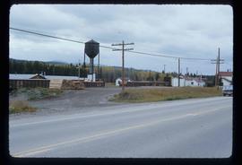
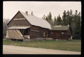
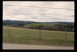
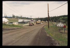
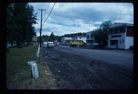
Image depicts the Endako General Store in Endako, B.C.
Image depicts a train passing through Endako, B.C.
Image depicts a row of houses in Fraser Lake, B.C.
Image depicts a group of children playing a yard in Fraser Lake, B.C.
Image depicts a few buildings in Fraser Lake, B.C.
Image depicts a couple of houses in Fraser Lake, B.C.
Image depicts a view of the Fraser Lake from Lejac, B.C.
Image depicts a view of the Fraser Lake from the Fraser Lake campsite.
Image depicts the public library in Hazelton, B.C.
Image depicts an old house in Kispiox, B.C.
Image depicts numerous totem poles in Kispiox, B.C.
Image depicts the historical village of 'Ksan in Hazelton, B.C.
Image depicts a view of a lake that is near Telkwa, B.C. The slide is labelled as "Telkwa - McClure Lake," though it is possibly Tyhee Lake.
Image depicts the dock for ferries in Isle Pierre, B.C.
Image depicts the ferry in Isle Pierre, B.C.
Image depicts a lake at an uncertain location.
Image depicts a church on a hill in Hagwilget, B.C.
Image depicts a bridge in Hagwilget, B.C.
Image depicts the Battle Hill National Historic Site in Kitwanga, B.C.. The sign located there says: "The small knoll in the valley was a native fortress. Legends maintain that it was man-made: built to repel marauding coastal tribes. The hill was the scene of local tribal battles, and at one time was crowned with the defenders' buildings. Known as Dhawdezp, the unique mound is a prominent feature in the legends and history of the Indian people."
Image depicts the Nadina Delta at Francois Lake.
Image depicts a view of Francois Lake.
Image depicts a view of the forest surrounding Francois Lake.
Image depicts the old community hall located somewhere in the Wistaria Provincial Park.
Image depicts a river, possibly somewhere in the Wistaria Provincial Park.
Image depicts a road and field somewhere near Grassy Plains, B.C.
Image depicts a field somewhere near Grassy Plains, B.C.
Image depicts Grassy Plains, B.C.
Image depicts Danskin, B.C.
Image depicts Southbank, B.C.
Image depicts the interior of the ferry at Southbank, B.C.
Image depicts Burns Lake, B.C.
Image depicts the welcome sign in Burns Lake, B.C.
Image depicts a street in Burns Lake, B.C.
Image depicts the cemetery in Hazelton, B.C.
Image depicts a tombstone in the cemetery in Hazelton, B.C.
Image depicts Hazelton, B.C.
Image depicts two bridges in Telkwa, B.C. One is for trains.
Image depicts the Royal Bank of Canada in Telkwa, B.C.
Image depicts a street in Telkwa, B.C.
Image depicts two bridges in Telkwa, B.C. One is for trains.
Image depicts the Telkwa river in Telkwa, B.C.
Image depicts the Skeena River.