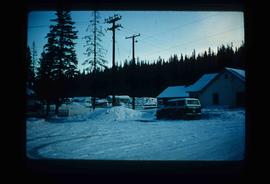
Mostrando 3113 resultados

Archival description
Houses and Three Goats
2012.13.1.87.021 · Item · [between 1975 and 1995]
Parte de J. Kent Sedgwick fonds

Image depicts several houses, and three goats standing on a narrow dirt road. The location is uncertain, likely Sinclair Mills, B.C.

Shacks and a Mountain
2012.13.1.87.028 · Item · [between 1975 and 1995]
Parte de J. Kent Sedgwick fonds

Image depicts two old shacks and a mountain in the background. Possibly located in or near Longworth, B.C.

People and Wood Boards
2012.13.1.87.035 · Item · [between 1975 and 1995]
Parte de J. Kent Sedgwick fonds

Image depicts a group of people observing splintered wooden boards at an uncertain location.

Cabin
2012.13.1.87.038 · Item · [between 1975 and 1995]
Parte de J. Kent Sedgwick fonds

Image depicts a cabin at an uncertain location.

Upper Fraser Mill
2012.13.1.87.062 · Item · [between 1975 and 1995]
Parte de J. Kent Sedgwick fonds

Image depicts the entrance to the Upper Fraser mill yard in Upper Fraser, B.C. Map coordinates 54°07'10.8"N 121°56'51.7"W

Giscome Quarry
2012.13.1.87.074 · Item · [between 1975 and 1995]
Parte de J. Kent Sedgwick fonds

Image depicts what is possibly the quarry located at Eaglet Lake in Giscome, B.C.

Eaglet Lake?
2012.13.1.87.082 · Item · [between 1975 and 1995]
Parte de J. Kent Sedgwick fonds

Image depicts a lake at an uncertain location, likely Eaglet Lake.

Giscome - Train Tracks - After
2012.13.1.87.087 · Item · [between 1975 and 1995]
Parte de J. Kent Sedgwick fonds

Image depicts the Giscome mill site in Giscome, B.C. The railroad tracks are in the foreground. Map coordinates 54°04'17.6"N 122°22'06.1"W

Giscome Dairy Farm
2012.13.1.87.141 · Item · [between 1975 and 1995]
Parte de J. Kent Sedgwick fonds

Image depicts the dairy farm in Giscome, B.C. Map coordinates 54°03'53.3"N 122°21'22.6"W

Fenced Off Forest Area
2012.13.1.87.149 · Item · [between 1975 and 1995]
Parte de J. Kent Sedgwick fonds

Image depicts two unidentified individuals standing outside a small, enclosed area somewhere in a forest. The location is uncertain.

Giscome Dairy Farm
2012.13.1.87.152 · Item · [between 1975 and 1995]
Parte de J. Kent Sedgwick fonds

Image depicts the dairy farm in Giscome, B.C. Map coordinates 54°03'53.3"N 122°21'22.6"W

Small Town
2012.13.1.87.155 · Item · [between 1975 and 1995]
Parte de J. Kent Sedgwick fonds

Image depicts a view of what appears to be a small town at an uncertain location.

House in Giscome
2012.13.1.87.159 · Item · [between 1975 and 1995]
Parte de J. Kent Sedgwick fonds

Image depicts a house in Giscome, B.C. Map coordinates 54°04'17.6"N 122°22'06.1"W

Giscome CN Station
2012.13.1.87.161 · Item · [between 1975 and 1995]
Parte de J. Kent Sedgwick fonds

Image depicts the old CN station in Giscome, B.C. Map coordinates 54°04'20.7"N 122°22'01.1"W

Open Field in Giscome
2012.13.1.87.163 · Item · [between 1975 and 1995]
Parte de J. Kent Sedgwick fonds

Image depicts an open field and Giscome, B.C. in the background. Map coordinates 54°03'52.9"N 122°22'10.0"W

2008.3.1.22.23 · Item · [ca. 1995]
Parte de Bridget Moran fonds

Photograph depicts Moran seated to right of woman on bench in foreground. Waterfall area at Moricetown Canyon can be seen below, behind booth labeled "MONITER BOOTH". Highway and houses visible on opposite shore in background.

Old House
2012.13.1.87.018 · Item · [between 1975 and 1995]
Parte de J. Kent Sedgwick fonds

Image depicts an old house missing windows and doors at an uncertain location.

Old House in Sinclair Mills
2012.13.1.87.019 · Item · [between 1975 and 1995]
Parte de J. Kent Sedgwick fonds

Image depicts an old house missing windows and doors in the foreground, and a bunkhouse in the background, in Sinclair Mills, B.C. Map coordinates 54°01'17.4"N 121°40'53.0"W

Three Children and Two Goats
2012.13.1.87.022 · Item · [between 1975 and 1995]
Parte de J. Kent Sedgwick fonds

Image depicts three unidentified children standing in the doorway of a house, with two goats ascending the porch steps. The location is uncertain, likely Sinclair Mills, B.C.

Dirt Road
2012.13.1.87.024 · Item · [between 1975 and 1995]
Parte de J. Kent Sedgwick fonds

Image depicts a dirt road leading through numerous trees toward a mountain. The location is uncertain, likely on the way to Longworth, B.C.

Dirt Road
2012.13.1.87.025 · Item · [between 1975 and 1995]
Parte de J. Kent Sedgwick fonds

Image depicts a dirt road leading through numerous trees toward a mountain. The location is uncertain, likely on the way to Longworth, B.C.

Longworth - Railway Tracks
2012.13.1.87.031 · Item · [between 1975 and 1995]
Parte de J. Kent Sedgwick fonds

Image depicts two unidentified individuals standing next to the train station, and two railway tracks running through Longworth, B.C.

A Saw
2012.13.1.87.036 · Item · [between 1975 and 1995]
Parte de J. Kent Sedgwick fonds

Image depicts a saw and numerous wooden boards at an uncertain location.

House in Upper Fraser, BC
2012.13.1.87.042 · Item · [between 1975 and 1995]
Parte de J. Kent Sedgwick fonds

Image depicts and old house and vehicle in Upper Fraser, B.C. Map coordinates 54°07'05.7"N 121°56'38.9"W

Upper Fraser General Store
2012.13.1.87.043 · Item · [between 1975 and 1995]
Parte de J. Kent Sedgwick fonds

Image depicts the Upper Fraser General Store in Upper Fraser, B.C. Two other signs indicate that it is also a post office and a place that offers propane refills. Map coordinates 54°07'10.8"N 121°56'51.7"W

Giscome Landscape
2012.13.1.87.071 · Item · [between 1975 and 1995]
Parte de J. Kent Sedgwick fonds

Image depicts an open area with Eaglet Lake in the background. It depicts the previous site of the mill at Giscome, B.C. Map coordinates 54°04'19.7"N 122°22'04.7"W

Giscome - Power Poles
2012.13.1.87.098 · Item · [between 1975 and 1995]
Parte de J. Kent Sedgwick fonds

Image depicts the remains of a street of houses in Giscome, B.C. The quarry is slightly visible in the background. Map coordinates 54°04'20.9"N 122°21'53.1"W

Driveway in Newlands, BC
2012.13.1.87.102 · Item · [between 1975 and 1995]
Parte de J. Kent Sedgwick fonds

Image depicts a driveway cordoned off by a red mesh material in Newlands, B.C. The address of the house is labelled 31951, and the name listed is "Fauchers." Map coordinates 54°06'47.8"N 122°08'22.4"W

Lake and Forests
2012.13.1.87.143 · Item · [between 1975 and 1995]
Parte de J. Kent Sedgwick fonds

Image depicts an aerial view of a lake and large, forested areas. The location is uncertain.

Giscome Houses and Giscome Mill
2012.13.1.87.156 · Item · [between 1975 and 1995]
Parte de J. Kent Sedgwick fonds

Image depicts several houses and the Giscome saw mill in Giscome, B.C. in the background. Map coordinates 54°04'20.9"N 122°21'53.1"W

Bear River?
2012.13.1.84.11 · Item · 1994
Parte de J. Kent Sedgwick fonds

Image depicts what is possibly Bear River in the Bear Glacier Provincial Park.

Mountains
2012.13.1.84.14 · Item · 1994
Parte de J. Kent Sedgwick fonds

Image depicts a mountain somewhere in Bear Glacier Provincial Park.