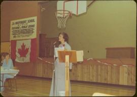
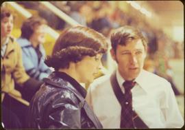
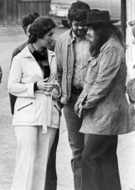
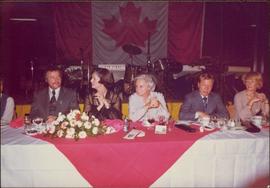
Handwritten annotation on verso reads: “Hockey”.
Iona Campagnolo smiles from back seat.
Photograph depicts Campagnolo standing behind microphone and podium in gymnasium.
Handwritten annotation on verso reads: “Terrace Fundraiser Fall 77”.
Unidentified people can be seen behind plants in public area in background.
Handwritten annotation on verso reads: “Johnny Esau - CTV + George Gross - T.O. Sun,” and “International Ice Hockey Championships, Vienna, 1977”.
Photograph depicts Iona Campagnolo with John C. Lundquist and others in front of the Stewart Historical Museum. This photograph was taken with the intention of including it in Campagnolo's householder newsletter which was regularly sent to her constituents.
Item is a hand drawn and coloured map by the City of Prince George Planning Department depicting existing land use for the Van Bow neighbourhood area.
Item is a hand drawn and coloured map by the City of Prince George Planning Department depicting existing zoning for the Van Bow neighbourhood area. Also includes two hand-drawn mylar overlays for the map; one showing "Opportunities & Constraints" such as housing age and condition and the other showing "Subdivision Activity" over decades of development in the Van Bow area.
Item is a map annotated in colour by the City of Prince George Planning Department depicting major residential development proposals from June 1975 to August 1977 in the City of Prince George. This map was drawn for the City of Prince George interim Community Plan.
Handwritten annotation on verso reads: “Hockey School, Terrace”.
Crowd sits on bleachers in background.
Handwritten annotation on verso reads: “Wally Lefebre Hovercraft at Kitimat”.
Pedestrians, vehicles, and buildings visible in background, including a Safeway business.
Handwritten notation included with photograph reads: “6/12/77, Iona, These are duplicates and rejects. Unless you want any of them I will throw them out.” (See also item 2009.6.1.177).
Photograph depicts Iona Campagnolo presenting a New Horizons program cheque to Queen Charlotte Islands senior citizens in Masset. The grant was made for the preparation of a written history of the Queen Charlotte Islands.
Distance shot of car in front of a crowd of unidentified people.
Handwritten annotation on verso reads: “Matane P.Q., Summer / 77, with P.M. on Tour”.
Campagnolo leads routine while wearing a long formal dress.
Handwritten notation included with photograph reads: “The ‘Infamous’ fitness routine, Terrace theatre festival”.
Campagnolo faces photographer. Pedestrians, vehicles and storefronts visible in background, including "Parker's LADIES WEAR".
Handwritten notation included with photograph reads: “6/12/77, Iona, These are duplicates and rejects. Unless you want any of them I will throw them out.” (See also item 2009.6.1.178).
Sign in foreground reads: “Stop Bull Shitting, [Phoney (crossed out)] Ioney”.
Handwritten annotation on verso reads: “The Kitimat Oil Port Environmental Lobby, didn’t believe I killed it. I did!”
Item is a hand drawn and coloured map by the City of Prince George Planning Department depicting zoning proposed by the Prince George City Planner for the VLA neighbourhood.
Image depicts an old, boarded-up store/office in Lamming Mills, B.C.
Item is a hand drawn and coloured map by the City of Prince George Planning Department depicting Hart Highway neighbourhood area existing land use in 1976.
Sans titreItem is a hand drawn and coloured map by the City of Prince George Planning Department depicting the Blackburn neighbourhood development area's proposed sector plan in 1976.
Item is a hand drawn and coloured map by the City of Prince George Planning Department depicting the VLA neighbourhood proposed zoning in 1976.
Item is a hand drawn and coloured map by the City of Prince George Planning Department depicting public representations at the VLA neighbourhood zoning hearing that occurred on April 12, 1976.
Item is a hand drawn and coloured map by the City of Prince George Planning Department depicting zoning proposed by Prince George Alderman A. Stauble for the VLA neighbourhood.
Semi-visible sign reads: “Supertanks - Pipelines S.O.S.”
Image depicts the old, boarded-up community hall in Lamming Mills, B.C.
Item is a hand drawn and coloured map by the City of Prince George Planning Department depicting the North Nechako and Hart neighbourhood area proposed land use in 1976.
Item is a hand drawn and coloured map by the City of Prince George Planning Department depicting existing land use for the Van Bow neighbourhood area.
Photograph depicts crowd with individuals holding protest signs.
Forest and hills visible in distance.
Handwritten annotation on verso reads: “Autographs”.
Item is a hand drawn and coloured map by the City of Prince George Planning Department depicting North Nechako neighbourhood area existing land use in 1976.
Item is a hand drawn and coloured map by the City of Prince George Planning Department depicting the College Heights and southwest (Vanway) neighbourhood area existing land use in 1976.
Photograph depicts row of houses behind trees. Power line, road, and vehicles in foreground; mountain in background.
Snow can be seen on ground, and RCMP officer is visible in crowd. Unknown building in background.
Photograph depicts Skeena MP Iona Campagnolo speaking with George Brown of Burns Lake Community Development Corporation in Burns Lake while being filmed by director Paul Rockett. Unknown man in centre.
The pair appears to be shopping in unidentified location, crowd in background.
Photograph depicts Skeena MP Iona Campagnolo speaking with George Brown of Burns Lake Community Development Corporation in Burns Lake.
Handwritten annotation on verso reads: “Fairview Opening, Prince Rupert, 1/3/75”.
Image depicts Highway 97 at 15th Ave. looking north. Map coordinates 53°54'36.0"N 122°46'55.5"W
Photograph depicts two unidentified men entering building with the sign "THE ROYAL BANK OF CANADA" above main entrance. Photographer with tripod in foreground.
Photograph depicts row of houses behind trees. Road, front yards, and vehicle in foreground, mountains in background.
Photograph depicts Skeena MP Iona Campagnolo speaking with George Brown of Burns Lake Community Development Corporation in Burns Lake while being filmed by director Paul Rockett.
Photograph depicts Skeena MP Iona Campagnolo speaking with George Brown of Burns Lake Community Development Corporation in Burns Lake while being filmed by director Paul Rockett. Unknown man in centre.
Image depicts Highway 97 at 15th Ave. looking north. Map coordinates 53°54'42.1"N 122°46'53.1"W
Handwritten notation on accompanying piece of paper reads: “Skeena Liberals, Stewart 1st Campaign, John Hanquest ('Midgie' John) + Pals.”
Series of pictures of the same political rally, originally affixed together with tape and glue as one contact sheet.
Handwritten annotation originally affixed to verso of collage reads: “‘The great rally, Terrace, 1974, M. + PET Trudeau”.
The three women stand in the Prince Rupert Masonic Temple looking at baby pictures of Selma Murray.
Handwritten annotation on verso reads: “From Left to Right, Aug/74, Gladys Blyth - Port Ed, Iona Campagnolo - ‘MP Skeena,’ Lil Schuman - Manitoba (‘Mother’ - Aunt) to Selma Murray, Masonic Temple - Pr. Rupert, B.C., Reception for Selma, looking at baby picture of Selma”.
Marcel Roy [?], Iona Campagnolo, Jeanne Sauvé, Yves Demers [?], and an unidentified woman sit at banquet table in front of a stage with musical instruments and a Canadian flag.
Handwritten annotation on verso reads: “copie pour Mme Campagnolo, 15, 1-5-, Yves Demers, Marcel Roy, Jeanne Sauvé, un discourse en français dan la circonscription de Mme S. (toute l’monde est separatiste et liberal!)”
Crowd visible in background.
Handwritten annotation on verso reads: “Campaigning 1974 Kispiox".