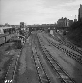
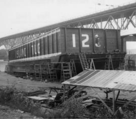
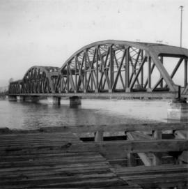
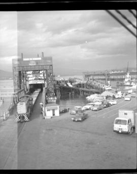
Photograph depicts the extreme west end of C.P.R. trackage at Coal Harbour, looking east towards the yards and downtown after a snowfall.
Photograph depicts the C.P.R. yards in Vancouver, just west of railway station in the downtown area. The view is looking east from Burrard St.
Photograph depicts the C.P.R. yards just west of downtown passenger station and in front of Pier B, owned by the C.P.R. The view is looking northwest from Burrard St.
Photograph depicts the B.C. Electric Railway trackage at Kerrisdale in Vancouver. The photo was taken from 49th Ave. and West Boulevard, looking north. The second track used to lie to the right of the existing one.
Photograph depicts the former B.C. Electric Railway spur running westwards along Bridgeport Rd., leading from the former main trackage. It was not in use for many years and was lifted in 1965, except for road crossings. The photo is taken from the intersection with Sexsmith Rd., looking east. The former main trackage is sited about 300 yards in the background and at right angles to the track in the foreground.
Photograph depicts a CPR ship named "Princess Elaine" at the pier opposite the CPR station in Vancouver. The ship was being stripped of its engines and was subsequently towed to Blaine, WA.
Photograph depicts the Orient Line "S.S. Oronsay" leaving Vancouver Harbour.
Photograph depicts a steam tugboat named "Master" owned by the World Ship Society (Vancouver Chapter). Photograph taken during Carnival and Regatta week in Vancouver.
Photograph depicts the ship the "Princess Louise" under tow by the Vancouver tug "La Pointe", going through the First Narrows. Just before going through the current took her at 45 degrees to the course and for a moment it looked as if she might run aground.
Photograph depicts the coasting vessel "Hecate Prince" owned by the Northland Navigation Co. Ltd. at their wharf on the southeast side of Vancouver Harbour.
Photograph depicts the steam tug "Master" on a Sunday outing near the C.P.R. rail pier at the entrance to Coal Harbour, Vancouver.
Photograph depicts Coal Harbour in Vancouver. The photo was taken nearly at the head of the harbour on the south side.
Photograph depicts the Harbour Park Development site in Coal Harbour, Vancouver. Taking rock from the scow to face fill with anti-erosion material. The site is for new high rise apartments at the edge of Stanley park between Georgia St. and the sea.
Photograph depicts a scow owned by Island Tug and Barge Ltd.
Photograph depicts a Japanese cadet sailing ship called "Kaiuo Maru" at Centennial Pier, Vancouver. Its visit was part of 1966 Vancouver Sea Festival and the ship was open to the public for inspection. Note the radar apparatus on the foremast.
Photograph depicts a Japanese sailing ship, "Kaiuo Maru" at Centennial Pier, Vancouver. Captures the stern view at sunset.
Photograph depicts the CPR main line crossing Pitt River. Taken from a timber pier that protected the swing span when it was in an open position.
Photograph taken at the east end of False Creek, looking southwest towards 1st Ave. and Manitoba Street.
Photograph depicts the Pacific Coast Terminals in North Vancouver. Shay locomotive #115 is in the yards.
Photograph depicts the "Princess of Vancouver" loading at 7 p.m. in Vancouver.
Photograph depicts a tug at Kingcome Navigation Dock in Vancouver Harbour.
Photograph depicts an island tug in Vancouver harbour.
Photograph depicts a replica of the S.S. Moyie built and photographed at Burrard Shipyard & Marine Ways Ltd. on 1729 West Georgia St., Vancouver. It was launched on June 15, 1965.
Photograph depicts the U.S.S. Cowell, a heavy destroyer in English Bay, Vancouver during the maritime festival, with a yacht from the Victoria Yacht Club alongside.
Photograph depicts the H.M.C.S. Mackenzie in English Bay in Vancouver during the maritime festival.
Photograph depicts the ship the "Princess of Vancouver" emerging westwards from the First Narrows in Vancouver.
Photograph depicts the ship the "Princess of Vancouver" passing Lions Gate Bridge in Vancouver, outward bound.
Photograph depicts the C.N.R. ship "Prince George" passing under the Lions Gate Bridge in Vancouver.
Photograph depicts the steam tug "Master" in English Bay, Vancouver during the maritime festival.
Photograph depicts a CPR rail ferry slip in downtown Vancouver.
Photograph depicts the Great Northern Railway station on Main Street, Vancouver being demolished.
Photograph depicts the Second Narrows railway bridge in Vancouver, BC
Photograph depicts the Fraser St. road bridge over the north section of the north arm of the Fraser River (ie. between Vancouver and Mitchell Island). Shot is looking northeast.
Photograph depicts the Cambie St. Bridge in Vancouver, BC, looking east and showing the north fixed span of the bridge.
Photograph depicts what is believed to be the only remaining "summer cottage" on Beach Ave. in English Bay.
Photograph depicts a former Sailor's Home at the southeast corner of the intersection at Alexander St. and Jackson St. in Vancouver, B.C.
Photograph depicts the former "Terminus Hotel" on 32 Water St., 50 yards from the center of old Vancouver.
Photograph depicts the Mussenden Building used by the Hudson's Bay Company. It is located on Water St. in Vancouver, B.C. View is from the north side looking east.
Photograph depicts an old church or school being demolished at 1701-1721 West 3rd Ave. (and Pine), in Vancouver, B.C.
Photograph depicts a stone house on 17th St. and Esquimalt St. in West Vancouver, B.C.
Photograph depicts the corner building on West Georgia and Chilco St., facing Stanley Park in Vancouver B.C. View looking south across Georgia St.
Photograph depicts a general view of Coal Harbour in Vancouver, taken from its head in Stanley Park, looking east. The Bayshore Inn is shown on the extreme left of the image.
Photograph depicts an empty site at 1000 Beach Ave. in Vancouver, B.C.
Photograph depicts a view of Indian Arm, looking south from Granite Falls.
Photograph depicts the upper end of Coal Harbour, on the south shore looking southwest and taken from the dock of the Vancouver Shipyards Ltd.
Photograph depicts a view looking northeast towards Coal Harbour from Alberni St. (Chilco-Gilford block) with West Georgia St. in the middle distance.
Photograph depicts a general view of Coal Harbour in Vancouver, looking southeast and taken from Royal Vancouver Yacht Club premises. Photo shows the Bayshore Hotel on the extreme left.
Photograph depicts the construction of a new deep sea wharf on the site of an old Hastings mill in Vancouver, B.C. The forepart is to be dirt filled. The view is looking northeast.