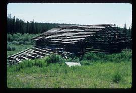
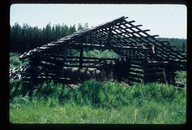
Image depicts a log house located somewhere on Kerry Street in Prince George, B.C.
Image depicts two trains in Prince George, B.C.
Image depicts two mills; the Intercontinental Pulp Mill is on the right in the foreground, and the Prince George Pulp and Paper Mill is on the left in the background. The picture is taken from the South, possibly off Yellowhead Bridge in Prince George, B.C.
Image depicts the Two Rivers Art Gallery in Prince George, B.C.
Image depicts the Seymour Subdivision in Prince George, B.C.
Image depicts the Nechako Subdivision in Prince George, B.C.
Image depicts downtown Prince George, B.C.
Image depicts the Courthouse in Prince George, B.C.
Image depicts the Ramada Hotel in Prince George, B.C.
Image depicts a Lakewood view of Spruceland in Prince George, B.C.
Image depicts College Heights, particularly along Gladstone Drive, in Prince George, B.C.
Image depicts Prince George, with the picture looking North-Northeast from University Way.
Image depicts Prince George from University Way, with the P.G.I pulp mill in the distance.
Image depicts Prince George from University Way, with the P.G.I. Pulp Mill in the distance.
Image depicts a sawmill in the Danson Industrial Park in Prince George, B.C.
Image depicts the Ramada Hotel in Prince George, B.C.
Image depicts Prince George from University Way, with the P.G.I. Pulp Mill in the distance.
Image depicts the Carter Industrial Area in Prince George, B.C.
Image depicts a trailer park by either the Fraser or Nechako River in Prince George, B.C.
Image depicts the intersection of 15th Ave and Highway 97 in Prince George, B.C.
Image depicts an aerial view of downtown Prince George, B.C.
Image depicts an aerial view of the BC Rail, in Prince George, B.C. It is now known as CN Rail.
Image depicts the Aquatic Centre in Prince George, B.C.
Image depicts the Prince George Civic Centre.
Image depicts Glenview Drive near the Hart Highway in Prince George, B.C.
Image depicts an aerial view of Pine Centre Mall and Masich Place Stadium in Prince George, B.C.
Image depicts a the Danson Industrial Park in Prince George, B.C.
Image depicts the power lines in the Hixon area south of Prince Georg, B.C.
Image depicts the Prince George Multiplex.
Image depicts the Prince George Public Library.
Image depicts the Prince George Public Library from 7th Ave.
Image depicts Mud River, also known as the Chilako River, at Blackwater Road, Prince George, B.C.
Image depicts a house on Blackwater Road.
Image depicts the interior of an abandoned, deteriorating cabin on Blackwater Road.
Image depicts an abandoned, deteriorating cabin on Blackwater Road.
Image depicts an abandoned cabin and shed on Blackwater Road.
Image depicts a shed on Blackwater Road.
Image depicts a house, most likely on Thompson Drive in Prince George, B.C.
Image depicts the rubble of a demolished house at Island Cache, with several other buildings in the background.
Image depicts a junk pile of bottles, cans and bags, as well as the gutted frame of an old car, at Island Cache.
Image depicts a number of small houses at Island Cache.
Image depicts some fallen trees at Island Cache.
Image depicts two dogs and numerous chickens in a yard at Island Cache.
Image depicts a number of small houses at Island Cache.
Image depicts an area of cut trees at Island Cache.
Image depicts numerous houses, and an unknown child standing in a street at Island Cache.
Image depicts a house at Island Cache.