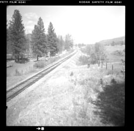
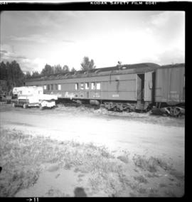
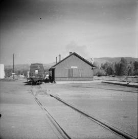
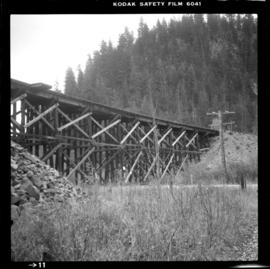
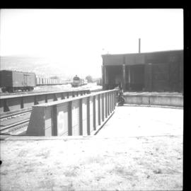
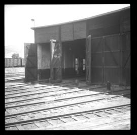
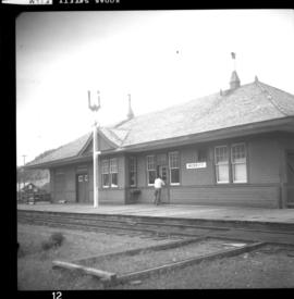
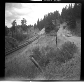
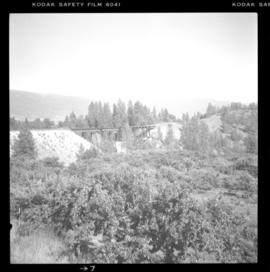
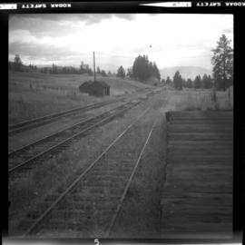
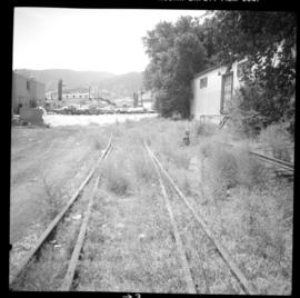
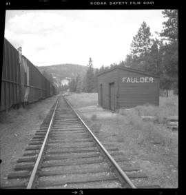
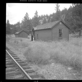
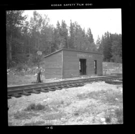
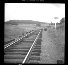
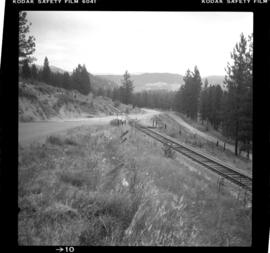
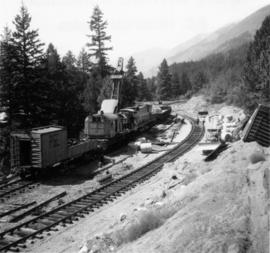
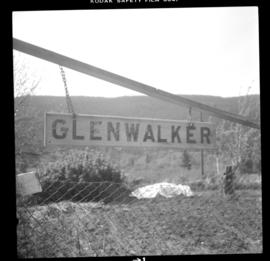
Photograph depicts the ex CPR Glenwalker station on the Merritt Subdivision. It is located at mile 49.2 from Spences Bridge and used to consist of a passing loop, spur, and section house. The sign is located in the yard of a ranch belonging to the Glenwalker Cattle Co. Ltd.
Photograph depicts the CPR line at about mile 50.5 from Spences Bridge, on the Merritt Subdivision. This point is south of Glenwalker and carries 3 freights per week. Monday, Wednesday, and Friday is northbound, and Tuesday, Thursday, Saturday is southbound. The view is looking north.
Photograph depicts a CPR work train at Princeton. It shows passenger car #411375, used as cook, dinner, and sleeper. It was built in May 1929. The LT weight is 178, 000.
Photograph depicts the CPR Princeton depot. The view is looking east.
Photograph depicts a trestle bridge on the old CPR Kettle Valley Railway. It is about 5 miles southeast of Brookmere, between Thalia and Spearing on the Princeton Subdivision.
Photograph depicts a CPR work car at Princeton. It is #42238 and originally marked "Auto Mobile." It was built in June 1923. The length is 40'6", width 8'6", and height 10'. The weight LT is 46, 200.
Photograph depicts a snowplow extra on the CPR line at Kingsvale, on the Princeton Subdivision at about mile 119. The snowplow extra was running south from Merritt with a plough, 2 locomotives and a caboose. Towards Brookmere summit the snow was 9 to 12 inches deep.
Photograph depicts a CNR slip in Penticton on Okanagan Lake. It shows two rail sets being bolted together.
Photograph depicts a CNR slip in Penticton on Okanagan Lake. The first two cars are being removed from a barge. There is a gas driven winch on the after port of the barge. A cable is taken around a pulley (white in the middle ground) and then attached to the frame of the 1st car- as shown in this photo. This gets the cars moving and gravity plus the brakes does the rest.
Photograph depicts a CNR slip in Penticton on Okanagan Lake. It shows a general view of the slip and unloading operations, plus a road and rail tractor.
Photograph depicts a CNR slip in Penticton on Okanagan Lake. The two gentleman are conferring as to where the cars are to be switched.
Photograph depicts a CNR slip in Penticton on Okanagan Lake. It shows a general view of the sidings leading from the barge slip . The tractor could move two cars on the level, but did not move cars to and from the barge. The winch was used to pull all cars, including tank cars, onto the barge.
Photograph depicts an all steel refrigerated car in the CPR yard in Penticton.
Photograph depicts two of the three snowplows in stationed din the CPR Penticton yard.
Photograph depicts service car #409780 in the CPR Penticton yard. The car had no building date.
Photograph depicts a scraper car in CPR Penticton yard. It has the blade of a snowplow, showing at right.
Photograph depicts a turntable at the CPR Penticton yard. The view is looking east.
Photographed depicts part of a deserted roundhouse in the CPR Penticton yard. It is a 5 bay house, which all lead to the turntable that is still in use. The view is looking northeast.
Photograph depicts a dead end stop at the CPR Penticton yard.
Photograph depicts the West Summerland CPR station in the Okanagan. The station often was used but not permanently manned. It was located at mile 9.5 from Penticton. The view is looking south.
Photograph depicts the CPR depot at Merritt. When the Spences Bridge to Merritt branch line was first built its principal traffic was coal taken from the mines on the south edge of the city. As late as 1923 Middlesborough Mine produced 75,862 tons/year.
Photograph depicts the West Summerland CPR station in the Okanagan, located 9.5 miles from Penticton. The cloud in the middle distance is stone dust from a crusher on the east side of the track. The spur to the right leads to an old crusher but does not appear to be used.
Photograph depicts the CPR line approximately 1 mile south of Belfort depot and 4 miles north of Princeton. The view is looking north.
Photograph depicts the Trout Creek CPR bridge near Summerland, about 9 miles north of Penticton. It is about 620 ft. long and the creek is 240 ft. below it. It was first crossed by the Chief Engineer's train on October 25, 1913. The view is looking south east.
Photograph depicts the disused CPR Kettle Valley Railway line in Penticton. The trackage leads from the lakefront to the main yards. All the track was removed by July 1981. The view is looking northeast to the lake and the Incola Hotel.
Photograph depicts the CPR rail Belfort depot passing point, approximately 5 miles north of Princeton, on the Princeton to Penticton line. The view is looking south.
Photograph depicts the disused CPR Kettle Valley Railway line in Penticton. The trackage leads from the Okanagan Lake CPR wharf to the main yards. All the trackage was obliterated by July 1981. The photo was taken about 1 block away from the lake and near Brunswick St. The view is looking southwest.
Photograph depicts the Trout Creek CPR bridge near Summerland, about 9 miles north of Penticton. It is about 620 ft. long and the creek is 240 ft. below it. It was part of the Kettle Valley Railway.
Photograph depicts the CPR Kettle Valley Railway mainline in downtown Penticton. It is in the vicinity of Pickering St. and Haywood St. The view is looking southwest.
Photograph depicts the Penticton CPR depot. The view is looking northwest.
Photograph depicts the CPR Kettle Valley Railway line at about mile 20 from Penticton, on the Princeton Subdivision. The view is looking east, downgrade.
Photograph depicts the CPR Kettle Valley Railway line at Faulder, BC. It is located at mile 15.5 from Penticton on the Princeton Subdivision. A very small and unused depot shelter lays behind the camera. The siding has a 70 car capacity being used as storage. The elevation here is 2122 ft. and the view is looking west.
Photograph depicts the CPR Faulder depot on the Kettle Valley Railway. It is located at mile 15.5 from Penticton, on the Princeton Subdivision.
Photograph depicts a CPR crane at Osprey lake on the Kettle Valley Railway line. It is located at mile 38.8 on the Princeton Subdivision. The crane is #414204, manufactured by Browning in Cleveland, Ohio.
Photograph depicts a CPR crane at Osprey lake on the Kettle Valley Railway line. It is located at mile 38.8 on the Princeton Subdivision. The crane is #414204, manufactured by the Browning Crane and Shovel Co. in Cleveland, Ohio. It is model NL 300 locomotive crane, with a boom length of 38 to 55 ft. and a lifting capacity with a varying radius from 30 T to 40 T.
Photograph depicts the CPR Kettle Valley Railway line at Osprey Lake, approximately 38.8 miles from Penticton, at the summit between Penticton and Princeton. The passing line was removed between 1956 and 1966. A small spur holding 5 cars remains and it was used to store a heavy crane to replace bridge members. The elevation at this point is 3, 606 ft.
Photograph depicts the CPR Kettle Valley Railway line at about mile 60.5 from Penticton on the Princeton Subdivision. The view is looking northeast and upgrade to the Jura passing loop, just out of sight to the right. The name board here advises the proximity of the siding. The CPR is replacing all the ties along this subdivision.
Photograph depicts the CPR Kettle Valley Railway line at about mile 67 from Penticton on the Penticton Subdivision. This is halfway between Belfort and Princeton and is used by freight about 3 times a week. The view is looking south.
Photo depicts a close up view of the rear of the locomotive #703. It was stopped at the head of a freight onn the main line portion of the loop awaiting a southbound loaded freight. Its tracks were derailed, fuel tranks ruptures and a sliver of steel from the box car was forced into its forward tracks. The left side of the cab was also sheared.
Photo depicts the general view of a derailment, looking eastward. The derailed locomotive #703 was found beside a squashed box car. By this time, a PGE bulldozer had prepared a road bed for the wreck.
Photo depicts a derailment in Seton Portage at the Pacific Great Eastern broken switch on mile 139.8.
Photo depicts the interchange of passengers of a northbound dayliner around the wreckage of a derailment. Two budd car units from Vancouver can been seen in the background. Passengers were being transferred to a "scratch" train assembled at Lillooet and consisting of a budd car, caboose and a diesal switcher.
Photo depicts the transfer of a Vancouveer to Lillooet dayliner to the unit made up at Lillooet wich consisted of a budd car, caboose and switcher. The scene of the Seton Portage derailment was found 100 yards behind the photo.
Photo depicts a shoo-fly that had been built around the Seton Portage wreck. locomotive #703 had stood at this spot just before the switch when the cars of the southbound freight piled into it.
Photo depicts a Pacific Great Eastern working train approaching Seton Portage. It had been diverted from the derailment to fill in a burnt out wooden culvert on the edge of Anderson Lake.
Photo depicts the removal of about 70 bales from a box car.
Photo depicts a distant view of the Seton Portage wreck,. Squamish Shops crane was standing on the minor line of the loop. The crane was self-propelled and after its launch it had broken its drive axle. This was replaced by a standard axle and, therefore, was propelled by a switcher.
Photo depicts the general view of the clean up of the derailment in Seton Portage. The track in which a speeder stands a gondola car with rolls were the two tracks of the loop. They were both severed and respliced in making the "second edition" of the shoo-fly.
Photo depicts the largest crane on the Pacific Great Eastern and is stationed in Prince George.