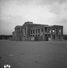
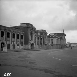
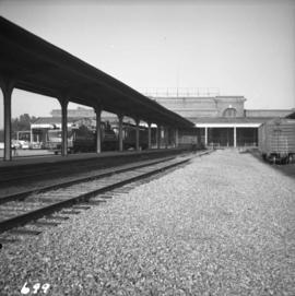
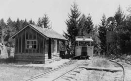
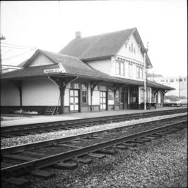
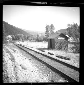
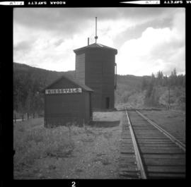
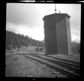
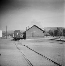
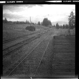
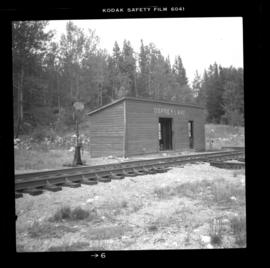
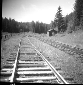
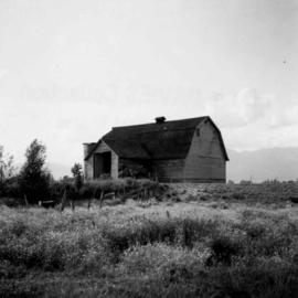
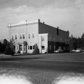
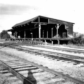
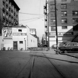
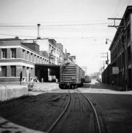
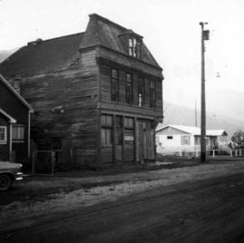
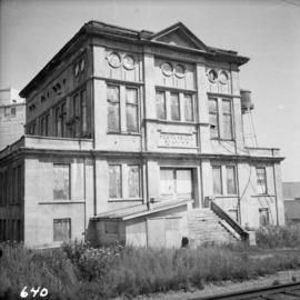
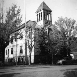
Photograph depicts the derelict electricity station of the B.C. Electric Railway at Cloverdale.
Photograph depicts the track transfer transporter at the Canadian National Railway (CN) repair shops at Port Mann, showing the east face of the main building.
Photograph depicts Canadian National Railway (CN) freight crossing Powell St. near Raymur Ave.
Photograph depicts the Canadian National Railway (CN) depot at Spences Bridge, from a view looking southwest.
Photograph depicts the Canadian National Railway (CN) depot in Vernon, which is no longer used for passenger traffic.
Photograph depicts Canadian National Railway (CN) track crew sheds on Lulu Island at the south end of the Fraser St. road-vehicle bridge, near the intersection of #5 Rd. and Vulcan Way. The track is well used. The view is looking west.
Photograph depicts the demolition of a Great Northern Railway depot in Vancouver.
Photograph depicts a partially demolished Great Northern Railway depot and Canadian National Railway (CN) depot behind it, in Vancouver.
Photograph depicts the rear of the Great Northern depot on Main St. in Vancouver, that is now demolished.
Photograph depicts a railcar and possible shed or depot. Location and details unknown.
Photograph depicts the Mission City CPR depot located at mile 87.3 from North Bend in Cascade Substation. It was built in 1902 and add onto in 1909. It has living quarters on the 2nd floor that are still in use, which is quite rare for BC in 1973. It is 41.7 miles from Vancouver and 2, 839.6 miles from Montreal.
Photograph depicts an outhouse on Notch Hill in the Shuswap. Helper locomotives were stationed here to lift heavy trains over Notch Hill. It was presumably used by waiting engine crews.
Photograph depicts the CPR Mission Bridge on the Huntingdon Branch. It shows the final box span of the bridge on the south shore, as viewed from the opened swing span. The span opened for river traffic every 2 or 3 days. The view is looking south, with downstream to the right.
Photograph depicts the Mission City rail and road bridge. It is owned by the CPR and was opened in 1891. It was used by road vehicles between 1 July 1927 and the 23 June 1973, using a one way flow system. On the latter day, a new high level road bridge was unofficially opened. By early July 1973, the CPR had removed the wooden deck planking.
Photograph depicts the CPR line at Coalmont, BC, located about 12 miles north of Princeton and at mile 82.2 from Penticton. Close by was the former Blakeburn Coal Mine, which operated until 1940. The view is looking south.
Photograph depicts the CPR line at Kingsvale, at mile 120.2 on the Princeton Subdivision between Brookmere and Merritt. It has a loop for 19 cars and sees one freight a day on Tuesday and Thursday. The view is looking north.
Photograph depicts the CPR line at Kingsvale, at mile 120.2 on the Princeton Subdivision between Brookmere and Merritt. It has a loop for 19 cars and sees one freight a day on Tuesday and Thursday.
Photograph depicts the CPR Princeton depot. The view is looking east.
Photograph depicts the CPR rail Belfort depot passing point, approximately 5 miles north of Princeton, on the Princeton to Penticton line. The view is looking south.
Photograph depicts the CPR Kettle Valley Railway line at Osprey Lake, approximately 38.8 miles from Penticton, at the summit between Penticton and Princeton. The passing line was removed between 1956 and 1966. A small spur holding 5 cars remains and it was used to store a heavy crane to replace bridge members. The elevation at this point is 3, 606 ft.
Photograph depicts the CPR depot at Chute Lake, on the Carmi Subdivision. It is located at mile 106.5 and 13.5 miles north of Penticton. The photo shows the passing track and the base of a former water tower is just behind the camera at the left. The rail here is dated 1942.
Photograph depicts a home at 673 Selby St. in Nanaimo, B.C. on Vancouver, Island.
Photograph depicts the Canadian Bank of Commerce in Ladysmith, B.C. on Vancouver Island. Building is estimated to be built between 1901-1905.
Photograph depicts the office of the Central Coal Co. Ltd., located on the south outskirts of Nanaimo, B.C. beside the Esquimalt and Nanaimo Railway. The building is one of the last pieces of evidence of coal distribution in Nanaimo.
Photograph depicts a church in Arrow Park on Arrow Lakes in southeastern B.C.
Photograph depicts a derelict but genuine log cabin beside the lower Arrow Lake near Fauquier, B.C.
Photograph depicts the St. Helen's Anglican Church on Old Yale Rd. (overlooking the Patullo Bridge) in South Westminster, Surrey.
Photograph depicts a home located at 1459 Robson St., at the northeastern intersection of Robson and Nicola, in Vancouver B.C.
Photograph depicts a store 50 yards south of the B.C. Electric Railway on the west side of the Vedder crossing road in Sardis, Chilliwack, B.C.
Photograph depicts a barn in the Upper Fraser Valley, west of the Vedder crossing and southwest of Atchelitz.
Photograph depicts the city hall in Pitt Meadows in the Fraser Valley.
Photograph depicts a disused lumber storage and rail loading shed beside the Pacific Great Eastern, on the property of the Lions Gate Lumber Co. at the foot of Lloyd St. in North Vancouver.
Photograph depicts Hamilton St. in Vancouver, looking northeast.
Photograph depicts a former C.P.R. connection between the False Creek yards and the south side of Vancouver harbour on West Pender St. in Vancouver, B.C. This spur used daily to get cars into the B.C. Electric Rail yard at the Georgia Viaduct from the C.P.R. False Creek yards.
Photograph depicts Mainland St. in Vancouver, B.C. , looking northeast with Helmken St. intersecting.
Photograph depicts the Kaslo city hall built in 1898.
Photograph depicts St. Margaret's Anglican Church on Bradner Rd., 3 miles northeast of Aldergrove in the Fraser Valley.
Photograph depicts a fire hall for fire float VFD "J.H. Carlisle" at False Creek. It is on the north shore and in line with Willow St., Vancouver.
Photograph depicts the house opposite an 1876 church in Nicola village, 7 miles northeast of Merritt. It may be the manse.
Photograph depicts a church built in 1876 in Nicola, 7 miles northeast of Merritt. It was originally a Presbyterian church and is one of the oldest in the interior, though it is now infrequently used.
Photograph depicts a derelict building on the old Main St in Slocan City, northwest of Nelson.
Photograph depicts the derelict Langham Hotel at Kaslo, B.C. on Kootenay Lake.
Photograph depicts a church on Wood St. in Greenwood, which is between Oliver and Grand Forks. The church may have been Roman Catholic.
Photograph depicts stores in Kaslo on Kootenay Lake, 40 miles northeast of Nelson. This town still has 15 miles of dirt road leading to it.
Photograph depicts a cattle shelter/ barn at the head of Nicola Lake, 20 miles east of Merritt, near the Douglas Lake road turnoff.
Photograph depicts the city hall in Rossland, B.C. built in 1990, during its heyday.
Photograph depicts the C.P.R. pier A.1. (now 12A) at Vancouver, B.C., slightly right of the foot of Thurlow St. It was built in 1890 and it is still in use. The view shows its east face.
Photograph depicts the seaward end of C.P.R. pier A1 (now 12A), showing its rotted condition. The pier was built in 1890 and is still in use except at this outer face. C.P.R. pier B1 is in the background.
Photograph depicts the church of His Presence in Halfmoon Bay, Sechelt. It was built in 1962 by Cannon Greene, a former seafaring minister of the Columbia Coast Missions and the subject of a C.B.C. T.V. production in early April 1966.
Photograph depicts St. Hilda's Anglican Church in Sechelt on the Sechelt Peninsula. Tall tree on left just coming into flower is a dogwood.