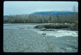
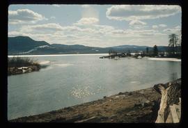
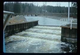
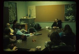
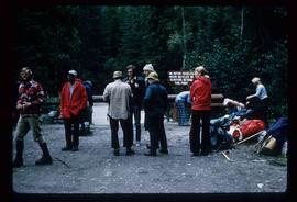
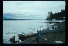
Image depicts several unknown individuals on the shore of Babine Lake.
Image depicts a drill for blasting holes at a mine site somewhere in Granisle, B.C.
Image depicts numerous bags of blasting powder at a mine site somewhere in Granisle, B.C.
Image depicts the Fulton River.
Image depicts the mouth of the Kispiox River.
Image depicts the Bulkley River running through Moricetown Canyon.
Image depicts several unidentified individuals walking along the snow-covered Upper Fraser Road with numerous buildings on either side. Map coordinates 54°07'05.7"N 121°56'38.9"W
Image depicts a vehicle parked beside a small, wooden house in Upper Fraser, B.C. Map coordinates 54°07'05.7"N 121°56'38.9"W
Image depicts the Fraser River and the Grand Trunk Pacific Bridge from Cottonwood Island Park.
Image depicts Prince George at night from the cutbanks.
Image depicts an esker at Bednesti Lake, B.C.
Image depicts the entrance of the Nautley River in Fort Fraser, B.C.
Image depicts an old, collapsing house at the Nautley site in Fort Fraser, B.C.
Image depicts a general store in Quick, B.C.
Image depicts Skeena Crossing, B.C.
Image depicts a man, possibly Kent Sedgwick, leaning against a sign forbidding public traffic on the Stewart Access Road from between 5 am to 8 pm. Located in Hazelton, B.C.
Image depicts a stretch of road somewhere at Burns Lake, B.C.
Image depicts a boat on Babine Lake, taken from Granisle, B.C.
Image depicts a large, electric shovel at a mine site somewhere in Granisle, B.C.
Image depicts a number of people standing at what appears to be a farm fishery [?] on the Fulton River.
Image depicts the Fulton River.
Image depicts the entrance of the Fulton River.
Image depicts a large gathering of people in the interior of a First Nations' longhouse located in the historical village of 'Ksan in Hazelton, B.C.
Image depicts a valley of fossil beds, possibly the Bulkley Valley.
Image depicts a view of Bulkley Valley.
Image depicts the 'Ksan historical village in Hazelton, B.C.
Image depicts numerous individuals seated around a table and apparently having a meeting at an uncertain location in Mackenzie, B.C.
Image depicts the Nechako River on Cottonwood Island.
Image depicts a horse on Cottonwood Island.
Image depicts the Nechako River from Cottonwood Island.
Image depicts a green car among some trees on Cottonwood Island.
Image depicts a nature trail on Cottonwood Island.
Image depicts a large group of individuals preparing to hike up Mt. Robson.
Image depicts a man on the hiking trail near Mt. Robson, with a river in the background; it is possibly the Robson River.
Image depicts a river, possibly the Robson River.
Image depicts a camp and what is likely Mt. Robson in the background.
Image depicts two unknown individuals standing near a waterfall somewhere near Mt. Robson.
Image depicts a group of people standing on the foot of a glacier, possibly the Robson Glacier.
Image depicts a group of people hiking on a glacier, possibly the Robson Glacier.
Image depicts three unknown individuals at a campsite.
Image depicts a campsite somewhere near Berg Lake.
Image depicts an unknown individual crouching by a lake somewhere near Mt. Robson.