Showing 54161 results

Archival description
21791 results with digital objects Show results with digital objects
2020.4.2.1.10 · File · Apr. 1974
Part of G. Gary Runka fonds

File consists of a speech given by Gary Runka entitled "Physical Resource Data Needs in Land Use Planning" which was given at a technical workshop to develop an integrated approach to base data inventories for Canada's Northland.

Commentary on this speech by Barry Smith of the Ministry of Agriculture and Lands:
"While the speech is not related to agriculture or farmland preservation directly, GGR emphasises the importance of data collection and mapping and its use in the planning process. The general principles he discusses were those employed in the development of the Agricultural Land Reserve.

The proceedings of the workshop were published in 1979 by Environment Canada." The proceedings are available online at: https://www.geostrategis.com/PDF/1974-04-17%20remote%20sensing%20for%20northen%20surveys%20and%20environmental%20monitoring-jean%20Thie%20CCRS%20copy.pdf
2020.4.2.1.09 · File · 1974
Part of G. Gary Runka fonds

File consists of a speech given by Gary Runka entitled "Land Use Planning as it affects the Vegetable Industry".

Commentary on this speech by Barry Smith of the Ministry of Agriculture and Lands:
"GGR gives this speech as a representative of the B.C. Land Commission and is directed at vegetable industry reps.

The ALR is mentioned a number of times and it is noted that only 1 - 2% of BC is suitable for vegetable production. Several examples (8) of pressures on agricultural land are given.

GGR draws his audience's attention to the impact of speculation when stating:
"Substantial capital gain from land development or speculation unfortunately can to some degree subvert even the best planning. .... Fortunately, this type of speculation is now on somewhat shaky ground because of the Land Commission Act in B.C."

The overall message is that vegetable producers should involve themselves in land use planning."

2020.4.2.1.08 · File · 21 Aug. 1973
Part of G. Gary Runka fonds

File consists of a speech given by Gary Runka to the Agricultural Institute of Canada entitled "Managing Our Land Resources for Survival and Pleasure".

Commentary on this speech by Barry Smith of the Ministry of Agriculture and Lands:
"This speech is aimed at land use planning and planners, and GGR provides his definition of "ecology" which includes:
"...the basic characteristics of the land - its geology, soils, climate, vegetation, and animal life, including the devil that does the most damage, man. It also includes the interrelationships within these basic characteristics and of course this is where the word "complexities" comes in. There are no two places where these components combine in exactly the same manner and each ecological unit, if you like, is unique."

GGR mentions the importance of considering options.

This package includes a copy of the speech as well as a second, 2 page document, with the same title in which GGR is noted as 'Manager of the BC Land Commission'. This second document is largely a summary of the more formal speech."

2020.4.2.1.07 · File · 14 Nov. 1972
Part of G. Gary Runka fonds

File consists of a speech given by Gary Runka to the Kelowna Chamber of Commerce Environment Committee entitled "The Canada Land Inventory, Land Capability Analysis and the Chamber of Commerce".

Commentary on this speech by Barry Smith of the Ministry of Agriculture and Lands:
"GGR makes the point in opening that the Chamber of Commerce may not be a group the public normally associates with concern for the environment but he feels it is time to correct this fallacy.

This speech is of value, if for nothing else, for the outline provided of the origin of the Canada Land Inventory (page 2).

Interestingly in the light of a future Land Commission publication, GGR uses the phrase "...with proper inventory information perhaps we would have left some of our options open". The 15 page B.C. Land Commission booklet published in March 1975 [was titled 'The B.C. Land Commission: Keeping the Options Open']."

2020.4.2.1.06 · File · Mar. 1972
Part of G. Gary Runka fonds

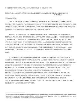
File consists of a speech given by Gary Runka to the BC Federation of Naturalists in Vernon entitled "The Canada Land Inventory, Land Capability Analysis and the Planning Process".

Commentary on this speech by Barry Smith of the Ministry of Agriculture and Lands:
"This speech largely avoids technical detail and an outlining of the mechanics of land capability analysis but does provide several practical examples that allow for a better understanding of the application of the analytical work.

The summary on page 11 is particularly important (in part):
"Planning must anticipate desirable land use patterns, not merely react to the pressure of short run expedients. Above all else let's not forget that land use planning should be people-oriented as well as resources-oriented. Hopefully, facts rather than short term
economics, politics, or emotions will play an increasing role in decision-making."

The speech was accompanied by slides.

(Note: Via a handwritten amendment the title was changed from "Land Capability Analysis and the Planning Process" to 'The Canada Land Inventory, Land Capability Analysis and the Planning Process"

2020.4.2.1.04 · File · 15 Mar. 1971
Part of G. Gary Runka fonds

File consists of a speech given by Gary Runka at UBC entitled "Integrated Land Use - BC Experience".

Commentary on this speech by Barry Smith of the Ministry of Agriculture and Lands:
"The speech provides insight into GGR's concept of integrated land use as opposed to multiple land use.

Agriculture noted as often the 'primary use for land designated in the ALR'. On page 5 GGR reflects on this concept when stating that integrated land use planning is a useful first step "... to indicate the primary physical capability of each landform based on inherent soil and climatic characteristics".

The speech was accompanied by slides."

2020.4.2.1.03 · File · 19 Oct. 1970
Part of G. Gary Runka fonds

File consists of a speech given by Gary Runka to the Canada Soil Survey Committee in Ottawa entitled "Land Capability Analysis".

Commentary on this speech by Barry Smith of the Ministry of Agriculture and Lands:
"This is a fairly technical speech explaining the history, and mechanics of the evolving land capability analysis process in BC. It gives insight into this early period in which there was a fair amount of trial and error to develop the best techniques to display and utilize information.

From an agricultural perspective the speech notes (p.5) that compatibility between agriculture and other sectors is not high. The speech demonstrates what would emerge as an important link between Land Capability Analysis and the ALR. On page 7 "possible predictions that will result in land use conflicts but perhaps better long range planning" are insightful and in the case of this statement, reads like a tentative foreshadowing of the BC farmland preservation program that would emerge in about two years.

"(1) Agriculture - "(c) Conservation of agricultural land through rural zoning of those high capability and high productivity soils, near markets."

It is unknown if the use of the acronym C.S.S.C was intended to refer to the "Canada Soil Survey Committee", which held its eighth meeting in Ottawa in 1970, or to the "Canadian System of Soil Classification. Regardless, for more information on the subject a copy of the 1998 / 187 page report by the Soil Classification Working Group entitled, "The Canadian System of Soil Classification" can be found here: https://sis.agr.gc.ca/cansis/publications/manuals/1998-cssc-ed3/cssc3_manual.pdf "

2020.4.2.1.02 · File · [ca. 1970]
Part of G. Gary Runka fonds

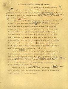
File consists of a speech given by Gary Runka entitled "BC's Land Use and the Current Land Inventory".

Commentary on this speech by Barry Smith of the Ministry of Agriculture and Lands:
"Although page 4 of this speech is missing (or possibly intentionally deleted), this document provides a detailed explanation of the CLI ratings and may well have been the basis of interpretation guidelines for agricultural capability mapping used by the ALC.

GGR at the time was the B.C. Land Inventory Field Coordinator.

It appears that slides at one point accompanied this speech."

2020.4.2.1.01 · File · [ca. 1969]
Part of G. Gary Runka fonds

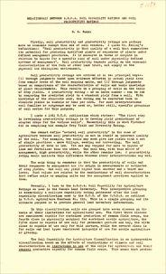
File consists of a speech given by Gary Runka entitled "Relationship Between A.R.D.A. Soil Capability Ratings and Soil Productivity Ratings".

Commentary on this speech by Barry Smith of the Ministry of Agriculture and Lands:
"This is a very useful overview of the agricultural capability ratings.

While no mention is of course made in this (circa) 1969 speech to the BC farmland preservation program, its value rests in the importance of the BCLI in the original designation the ALR and its future administration.

For anyone that is or has been involved with the farmland preservation program, this single sentence within the speech, made about 4 or 5 years before the designation of the ALR, provides an important insight into the value of the CLI and its relationship to farmland preservation. "For example. Class 5 soils while restricted in use to pasture or hay can produce very high yields."

2012.13.2.21.04 · File · 1973-1978
Part of J. Kent Sedgwick fonds

File consists of proposals and documents by Kent Sedgwick regarding Cottonwood Island. Includes: "Proposal for Cottonwood Island as a Park Reserve" and "Some Comments on the Cottonwood Island Park Designation of the Official Community Plan".

Photographs
2012.13.1 · Series · [before 2011]
Part of J. Kent Sedgwick fonds

Series consists of photographs taken and collected by Kent Sedgwick that primarily depict communities within the Central Interior of British Columbia, especially Prince George, Giscome, and the East Line area. Kent Sedgwick used photography to document the development and history of the natural and built landscape of the British Columbia Central Interior. The photographs depict geographic features, landscapes, previous settlements, architectural history, and industrial history.

2012.13.2.21.03 · File · 1973-2001
Part of J. Kent Sedgwick fonds

File consists of records created and collected by Kent Sedgwick regarding Cottonwood Island. Includes: "Welcome to Cottonwood Island Nature Park" brochure [197-?]; "A Brief History of Cottonwood Island Park" by Kent Sedgwick (2001); "History of Cottonwood Island Park and Side Channel Restoration" (2001?); a Regional District of Fraser-Fort George "Notice of Public Hearing" (1973); an outline for "Cottonwood Island Brief" (1973); an original copy of the "Cottonwood Island Study" by the Regional District of Fraser-Fort George (1975); annotated hand-drawn small maps of Cottonwood Island; photocopied aerial photographs; and photocopied newspaper clippings about Cottonwood Island and Island Cache. Also includes 15 colour photographic prints and accompanying negatives taken of Cottonwood Island by Bob Nelson.

Photographic negatives
2012.13.1.135.02 · File
Part of J. Kent Sedgwick fonds

File consists of a printed email correspondence between Ramona Rose, Florence Smith, and Sue Sedgwick regarding an additional donation of photographic negatives. The file includes photographs depicting photographs of Knox United Church and historic Prince George.

2012.13.2.21.02 · File · 1970-1979
Part of J. Kent Sedgwick fonds

File consists of records created and collected by Kent Sedgwick regarding the removal of Island Cache residents after the 1972 flood and suggestions for creation of park on Cottonwood Island. The majority of the file consists of reproduced City of Prince George records. Includes memoranda to and from the mayor, city manager, and aldermen; meeting minutes of the Flood Committee; city reports on Cottonwood Island and the flooding situation; a listing of Cottonwood Island properties offered for sale to the municipality; a report entitled "Cottonwood Island - A report on desirable land use" (Nov. 1970); a "Proposal for Cottonwood Island as a Park Reserve" (1973); a document from the Cottonwood Island Study Committee; correspondence from Mary Fallis; and a City of Prince George memorandum regarding a Public Hearing.

2012.13.2.21.01 · File · 1983-1991
Part of J. Kent Sedgwick fonds

File consists of records created or collected by Kent Sedgwick relating to various community projects associated with river parks. Example projects included in the file are a proposed Carrier village at Hudson Bay Slough, a Cottonwood Island park, proposed commercial boat tours on the Nechako and Fraser River, and the Quesnel Paddlewheel Park. Includes a project proposal document by the Fort George Band entitled "Establishing a Permanent Carrier Village in Prince George" (1990); a 1991 meeting package of the Nechako and Fraser River Valleys Committee (regarding the Cottonwood Island property and development of the Heritage River Trails System); a 1991 memorandum entitled "Prince George River Runners - Proposed commercial boat tours on the Nechako and Fraser River"; a 1983 "Submission to Rivers Committee Public Hearings by Heritage Advisory Committee, City of Prince George" describing the various river-adjacent heritage sites in Prince George; and documentation from the Quesnel Paddlewheel Association.

Log house
2012.13.1.135.5.24 · Item · 2010
Part of J. Kent Sedgwick fonds

Photograph depicting a small log cabin with a front porch and a sign reading "Happy 150th Anniversary Cariboo Gold Rush 1859-2009", presumably taken in Quesnelle Forks.

Log house
2012.13.1.135.5.23 · Item · 2010
Part of J. Kent Sedgwick fonds

Photograph depicting a log house, presumably in the campground in Quesnelle Forks.

Campground
2012.13.1.135.5.22 · Item · 2010
Part of J. Kent Sedgwick fonds

Photograph depicting a river with rocks lining the shore and trees in the background, presumably at the campground in Quesnelle forks.

Campground
2012.13.1.135.5.20 · Item · 2010
Part of J. Kent Sedgwick fonds

Photograph depicting a campground with log cabins and an open field surrounded by trees, presumably in Quesnelle Forks.

Campground
2012.13.1.135.5.21 · Item · 2010
Part of J. Kent Sedgwick fonds

Photograph depicting a campground with log cabins and an open field surrounded by trees, presumably in Quesnelle Forks.

Campground
2012.13.1.135.5.19 · Item · 2010
Part of J. Kent Sedgwick fonds

Photograph depicting a campground and open field surrounded by trees, presumably in Quesnelle Forks.

Log cabin
2012.13.1.135.5.18 · Item · 2010
Part of J. Kent Sedgwick fonds

Photograph depicting a log cabin with a woman sitting on the front porch, presumably Sue Sedgwick. The photograph is presumably taken in Quesnelle Forks.

Camp ground
2012.13.1.135.5.17 · Item · 2010
Part of J. Kent Sedgwick fonds

Photograph depicting a camp ground, with fifth wheel's and vehicles parked in front of a lake, presumably taken at Quesnelle Forks campground.

Large stone
2012.13.1.135.5.16 · Item · 2010
Part of J. Kent Sedgwick fonds

Photograph depicting a large stone surrounded by trees and two people sitting on top of it.

Landscape
2012.13.1.135.5.15 · Item · 2010
Part of J. Kent Sedgwick fonds

Photograph depicting a landscape with a lake and a mountain in the background.

Large stone
2012.13.1.135.5.14 · Item · 2010
Part of J. Kent Sedgwick fonds

Photograph depicting a large stone surrounded by trees in an unknown location.