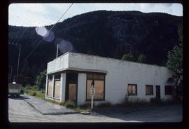
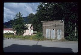
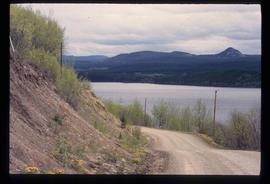
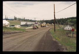
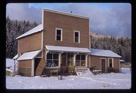
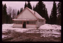
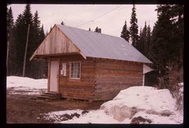
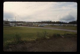
Image depicts a trailer park somewhere in Mackenzie, B.C.
Image depicts numerous vehicles in the parking lot of a mall in Mackenzie, B.C.
Image depicts the Nation River somewhere south of Manson Creek, B.C.
Image depicts the gas station at Manson Creek, B.C.
Image depicts a creek with a half collapsed shack in the background somewhere in Manson Creek. The slide is labelled "Manson workings."
Image depicts several ships on the water in Prince Rupert, B.C.
Image depicts a view of Prince Rupert, B.C.
Image depicts the interior of a mall in Prince Rupert, B.C. It is possibly the Pride O' the North shopping mall.
Image depicts a view of the downtown core of Prince Rupert, B.C.
Image depicts the main street of Stewart, B.C.
Image depicts a boarded up building in Stewart B.C. There is also a sign that reads: "No U Turns."
Image depicts the old telegraph station in Stewart, B.C.
Image depicts a row of houses in Granduc, near the Granduc Mine and located north of Stewart, B.C.
Image depicts Stewart, with a section of Mt. Shorty Stevenson dominating the background.
Image depicts several buildings along the main street in Stewart, B.C.
Image depicts a view of Bear Pass, likely from Glacier Highway and somewhere in or near Bear Glacier Provincial Park, located north-east of Stewart, B.C.
Image depicts a section of road running through the Bear River Gorge.
Image depicts the Bear River.
Image depicts an old, boarded up school, possibly the Central Fort George Traditional School in Prince George, B.C.
Image depicts a view of Francois Lake.
Image depicts a road and field somewhere near Grassy Plains, B.C.
Image depicts Grassy Plains, B.C.
Image depicts Danskin, B.C.
Image depicts a street in Burns Lake, B.C.
Image depicts the cemetery in Hazelton, B.C.
Image depicts a tombstone in the cemetery in Hazelton, B.C.
Image depicts Hazelton, B.C.
Image depicts the Telkwa river in Telkwa, B.C.
Image depicts the Skeena River.
Image depicts a turbine on the back of an industrial vehicle, located somewhere in Fort St. John, B.C. The slide is labelled "Site one dam; turbine prop. (Russian.)"
Image depicts an old, boarded up store in Isle Pierre, B.C.
Image depicts the boundary line between British Columbia and Alberta at the Yellowhead Pass.
Image depicts a forest service cabin somewhere near Tête Jaune Cache, B.C.
Image depicts what is possibly the CN Station in Dome Creek, B.C.
Image depicts the CN Station in Dome Creek, B.C.
Image depicts a Catholic Church in Dome Creek, B.C.
Image depicts the community hall in Dome Creek, B.C.
Image depicts a small shack that became the later post office in Dome Creek, B.C.
Image depicts a horse and a barn in Dome Creek, B.C.
Image depicts a strangely shaped orange vehicle somewhere in Dome Creek, B.C.
Image depicts a crowded cafeteria, most likely somewhere in Hudson's Hope, B.C. The slide is labelled "Camp at H.H."
Image depicts a large group of people sitting and eating near a bridge at an uncertain location, though possibly near Hudson's Hope, B.C.
Image depicts numerous individuals who appear to be searching among the rocks on a ledge at an uncertain location in the Peace River Region.
Image depicts a number of townhouses in Chetwynd, B.C.
Image depicts an obstructed view of Moberly Lake, located north of Chetwynd and south of Hudson's Hope, B.C.
Image depicts a large group of people in a room at an uncertain location in the Peace River Region.
Image depicts an unidentified man in a yellow hat who appears to be speaking to large group of people. It is possibly an educational event.
Image depicts an unidentified man in a yellow hat who appears to be speaking to large group of people and showing them small pieces of wood. It is possibly an educational event.
Image depicts an unidentified man holding what appears to be a broken screen of honeycombs. The group is likely at an educational event.