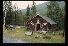
Image depicts a blue truck and a camper in the wooded area surrounding the townsite of Keithley Creek, B.C.
Image depicts the dirt road leading to Keithley Creek.
Image depicts an old, half-collapsed house in Likely, B.C.. The slide labels it as "Bullion house."
Image depicts the Cariboo Lake, with the roof of an old log cabin visible.
Image depicts the town of Horsefly, B.C.
File contains slides depicting places in and around Mackenzie Town.
Image depicts numerous individuals seated around a table and apparently having a meeting at an uncertain location in Mackenzie, B.C.
Image depicts the Mackenzie Reservoir in Mackenzie, B.C.
Image depicts a row of houses in Mackenzie, B.C.
Image depicts a small section of Mackenzie, with the Mackenzie Curling Rink visible on the right side of the image.
Image depicts St. Peter's Church in Mackenzie, B.C.
Image depicts a truck parked on a beach in Mackenzie, B.C.
File contains slides depicting places in and around Manson Creek.
Image depicts a camper parked on the shore of Nation Lakes, south of Manson Creek, B.C.
Image depicts the road to Manson Creek, B.C.
Image depicts the Omineca Museum in Manson Creek, B.C.
Image depicts a bridge over the Omineca River near Germansen Landing, B.C.
Image depicts a helicopter in Germansen Landing, B.C.
Image depicts a child in the foreground, and the Germansen Landing trading post in the background in Germansen Landing, B.C.
File contains slides depicting the McGregor River and its surrounding areas.
Image depicts the McGregor River at an uncertain location.
Image depicts the McGregor from the point of view of a bridge.
Image depicts a farm at an uncertain location; possibly somewhere in the McGregor Valley.
Image depicts Eaglet Lake, north-east of Prince George, B.C.
Image depicts a bridge over the McGregor River. A sign in the image reads: "Danger. The river is not navigable for any type of boat. Down stream falls and rapids impassible!"
Image depicts a view of what is possibly the Pine Pass located near the Murray Ridge.
Image depicts a view of Murray Ridge.
Image depicts a forested mountain side somewhere near Murray Ridge.
Image depicts a man at a campsite somewhere near Murray Ridge.
Image depicts an unknown woman pointing towards some faded First Nations' rock paintings.
Image depicts the Skeena River somewhere near Prince Rupert, B.C.
Image depicts the Skeena River.
Image depicts the interior of the Pride O' the North shopping mall in Prince Rupert, B.C.
Image depicts a view of the port in Prince Rupert, B.C. The slide is labelled "superport."
Image depicts numerous docked boats in Prince Rupert, B.C.
Image depicts the BC Packers Ltd. cannery in Prince Rupert, B.C.
Image depicts Metlakatla, located near Prince Rupert, B.C.
Image depicts a fishing boat on the water somewhere near Prince Rupert, B.C. Only half of its name is visible: "spirit."
Image depicts a large vessel docked in Prince Rupert, B.C. The name on its side is "Star Capella." The slide itself is labelled "superport."
Image depicts the main street of Prince Rupert, B.C.
File contains slides depicting places on Haida Gwaii, formerly known as the Queen Charlotte Islands.
Image depicts a woman standing on a rocky shore somewhere on Haida Gwaii, B.C.
Image depicts Kent Sedgwick walking along the coastline of Haida Gwaii, B.C.
Image depicts numerous trees in the coastal forest of Haida Gwaii, B.C.