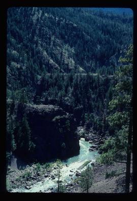
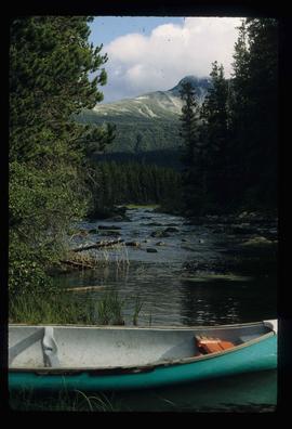
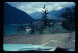
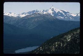
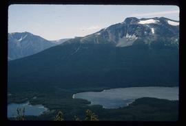
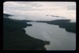
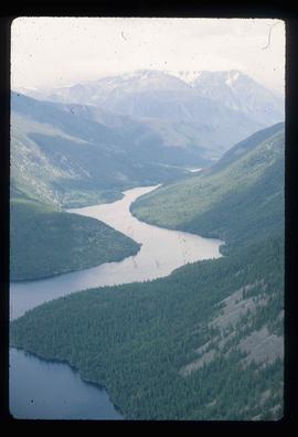
Image depicts the Fraser River, and a sign pointing towards Gang Ranch, in the Upper Fraser Canyon.
Image depicts the Fraser River, and a sign pointing towards Gang Ranch with an unknown individual hugging it, in the Upper Fraser Canyon.
Image depicts Gang Ranch in the Upper Fraser Canyon.
Image depicts the Gang Ranch House in the Upper Fraser Canyon.
Image depicts a stream and field at Gang Ranch in the Upper Fraser Canyon.
Image depicts a view of the Upper Fraser Canyon.
Image depicts the Fraser River near Lillooet, B.C.
Image depicts a train in an uncertain location.
Image depicts the inside of a mine with an unknown individual present. It is possibly the inside of the closed Britannia Mine.
Image depicts a number of old buildings, possibly located at the closed Britannia Mine.
Image depicts an old building, possibly located at the closed Britannia Mine.
Image depicts a view of Nairn Falls Provincial Park.
Image depicts a farm at an uncertain location.
Image depicts a river on the left of the image and a range of mountains in the distance, located somewhere near Bralorne, B.C.
Image depicts a camper parked on the side of a narrow road along a cliff as another car approaches; located somewhere near Bralorne, B.C.
Image depicts a creek somewhere near Bralorne, B.C.
Image depicts a hotel in what appears to be a small community, possibly an outlying area of Bralorne, B.C.
Image depicts a row of houses in Bralorne, B.C.
The item is a photograph depicting the centennial fountain in Prince George.
Image depicts the Hixon School building in Hixon, B.C.
Image depicts a historic building in Fort St. James, B.C.
Image depicts the Hudson's Bay Company historic site in Fort St. James, B.C.
Image depicts the interior of a church, likely in Fort St. James, B.C.
Image depicts a cemetery at an uncertain location, possibly in Fort St. James, B.C.
Image depicts an old, and seemingly incomplete chess set somewhere in Wells, B.C.
Image depicts the old Jack O' Clubs Hotel Sign in Wells, B.C. A small label on it reads "The Jack O' Clubs Hotel sign was taken down in April," it is uncertain if the following year listed is 1960 or 1980. The hotel itself burned down on February 14th in 1994.
Image depicts many houses somewhere in Wells, B.C.
Image depicts Wells, B.C.
Image depicts an old pool hall, crowded with unknown individuals, somewhere in Wells, B.C.
Image depicts an old beer advertisement for Alexandria Lager, somewhere in Wells, B.C.
Image depicts a building somewhere in Wells, B.C. There is a sign in one window which reads "Lon Oddfrey Insurance Realty LTD."
Image depicts the interior of the Centennial Hall in Wells, B.C.
Image depicts a small section of Turner Lake, with what is most likely Glacier Mountain in the distance; they are located in South Tweedsmuir Park, B.C.
Image depicts an aerial view of what is likely Glacier Mountain in South Tweedsmuir Provincial Park. The two lakes present are possibly Vista and Junker.
Image depicts an aerial view of a lake in South Tweedsmuir Provincial Park.
Image depicts an aerial view of a waterfall in South Tweedsmuir Provincial Park.
Image depicts an aerial view of a lake in South Tweedsmuir Provincial Park. It is possibly Lonesome Lake.
Image depicts an aerial view of a waterfall in South Tweedsmuir Provincial Park.
Image depicts an aerial view of South Tweedsmuir Provincial Park.
Image depicts a view of South Tweedsmuir Provincial Park. An unidentified man stands on the side of the image.
Image depicts a canoe on a river somewhere in South Tweedsmuir Provincial Park.
Image depicts a camp on the shore of a lake in South Tweedsmuir Provincial Park. The man sitting in the bottom right corner is possibly Kent Sedgwick.
Image depicts Kent Sedgwick (the man with a pipe in green) and an unknown individual sitting around a campfire somewhere in South Tweedsmuir Provincial Park.
Image depicts a lake in South Tweedsmuir Provincial Park. An unknown individual is walking along the shore.
Image depicts an unidentified man lighting a fire somewhere in South Tweedsmuir Provincial Park.
Image depicts a forest; the image is possibly taken from somewhere near the Cottonwood Rail Road Bridge.
Image depicts a sawmill somewhere in Quesnel, B.C.
Image depicts the St. Joseph's Mission in Williams Lake, B.C.
Image depicts 153 Mile House.
Image depicts a small, abandoned house in Woodpecker, B.C.