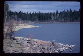
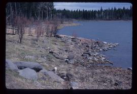
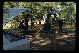
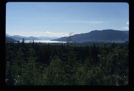
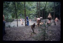
Image depicts a large group of people enjoying the Mount Layton Hot springs in the Lakelse Lake Provincial Park north of Kitimat, B.C.
Image depicts a view of the forest and lake around Kitimat, B.C.
Image depicts the Alcan smelter in Kitimat, B.C.
Image depicts two individuals seated at a picnic table while a third stands closer to the water on a beach somewhere in Kitimat, B.C. What appears to be a harbour can be seen on the water.
Image depicts three picnic tables, one of which is occupied with three unknown individuals, on a beach somewhere in Kitimat, B.C.
File contains slides depicting places in Kitimat, B.C.
Image depicts the altar inside the St. Joseph's Roman Catholic Church in Kamloops, B.C.
Image depicts the St. Joseph's Roman Catholic Church, in Kamloops, B.C.
Image depicts the old Kamloops Residential School which operated until either 1977 or 1978 before becoming part of the Secwepemc Musem in 1982.
Image depicts a tombstone, with the name and inscription written in what appears to be Chinese. It is most likely located somewhere in or near Kamloops, B.C.
Image depicts a representation of the crucified Christ in the St. Joseph's Roman Catholic Church in Kamloops, B.C.
Image depicts a large crowd of people seated inside the St. Joseph's Roman Catholic Church in Kamloops, B.C.
Image depicts the old Kamloops Residential School which operated until either 1977 or 1978 before becoming part of the Secwepemc Musem in 1982.
Image depicts a street, possibly in Kamloops, which has been closed for a Sunday morning Farmer's Market.
Image depicts a close-up of the carriage step. It is possibly located in Kamloops, B.C.
Image depicts a red carriage labelled in yellow "B.C. Express Co. No. 20." It is possibly located in Kamloops, B.C.
Image depicts what is possibly either the Fraser or the Thompson River.
Image depicts an old and abandoned, collapsing church at an uncertain location.
Image depicts a small graveyard at an uncertain location.
Image depicts numerous grave markers at an uncertain location.
Image depicts what is possibly either the Fraser or the Thompson River.
Image depicts the interior of an old, abandoned church at an uncertain location; possibly somewhere between Lillooet and Kamloops.
Image depicts Sue Sedgwick standing on the bank of a river.
Image depicts Sue Sedgwick standing next to a camper.
Image depicts a river at an uncertain location in either the Lillooet or Kamloops area.
Image depicts a ferry on a river, possibly the Fraser River in the Lillooet area.
File contains slides depicting places in and around the Kamloops and Lillooet regions.
Image depicts a camper and a man and woman at an uncertain location, possibly somewhere near Meldrum Creek, B.C. The woman in the image is Sue Sedgwick.
Image depicts two campers at an uncertain location, possibly somewhere near Meldrum Creek, B.C.
Image depicts two women at a table; the one on the right is possibly Sue Sedgwick. The image may have been taken in Meldrum Creek, B.C.
Image depicts a yellow building in Meldrum Creek.
Image depicts a ranch house in Meldrum Creek, B.C.
Image depicts an old, collapsing shack in Meldrum Creek, B.C.
Image depicts a ranch house in Meldrum Creek, B.C.
Image depicts fenced-in cattle on a farm or ranch in Meldrum Creek, B.C.
Image depicts a barnyard of cattle and chicken on a farm or ranch in Meldrum Creek, B.C.
Image depicts the rocky shore of an unidentified body of water, possibly near Meldrum Creek, B.C.
Image depicts a view of an unidentified body of water, possibly near Meldrum Creek, B.C.
Image depicts the rocky shore of an unidentified body of water, possibly near Meldrum Creek, B.C.
Image depicts what appears to be a small ranch. The slide is labelled "Becher's Prairie," possibly meaning Becher's Prairie Provincial Park in B.C.
Image depicts what is possibly the Fraser River.
Image depicts a view of the landscape at an unknown location with a group of people, possibly tourists, present. It is possibly near the Fraser River.
Image depicts a group of unknown individuals sitting around a camp fire at an uncertain location.
Image depicts what is possibly the Fraser River.