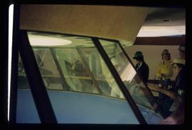
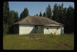
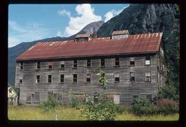
The item is a photograph depicting an NT Air airport hanger located in Prince George.
Image depicts what appears to be a saw mill belonging to Northwood. The location is uncertain.
Image depicts the Northwood Bridge in Prince George, B.C.
Image depicts the Northwood Bridge crossing in Prince George B.C.
Image depicts the Northwood pulpmill in Prince George B.C.
Image depicts the Northwood Pulpmill in Prince George, B.C. taken from above the Nechako River looking east. Map coordinates 53°56'00.0"N 122°44'29.7"W
Image depicts the Northwood pulpmill in Prince George B.C.
Image depicts the office at the Northwood Upper Fraser Saw Mill and a sign which reads "Have a safe, quality day." Map coordinates 54.117916, -121.943351
File consists of a photocopy of "Note on the distribution of some of the more important trees of British Columbia" by George Dawson, circa 1880.
File consists of clippings and reproductions of obituaries of Fred J Shearer, a pioneer realtor; Carl Strom; Ronald Joseph Seymour; Stan Carling, former government agent; Sarah Reid, a pioneer resident; Joe Novak, an innovator at Dunkley Lumber; William Jarvie Aitken, a dentist; Ernst Huber; Hartley Fawcett; Gustaf Albert Lund; Ray Williston, previous MLA for the Prince George area; Aberdina Cornelia Nielsen, wife to John Nielsen and instrumental in building the Summit Lake Sawmills; Frank Gordon Hewlett; Roy Wing Yip, a pioneer businessman; Holger Nielsen, one of the cities oldest residents at the time; Monica Marguerite Becott, long time city councillor; Alfred W. Holdner, advocate for senior citizens; Ted Williams, historian; Violet Baxter, historian; Ellen Agnes Garland, pioneer; and other pioneers and prominent figures in Prince George.
Image depicts the Oblates of Mary Immaculate Catholic Church in Aleza Lake, B.C. Map coordinates 54°07'08.2"N 122°02'00.0"W
Image depicts a group of unidentified individuals look through an observatory window at an uncertain location, possibly in Fort St. John, B.C.
Image depicts an oddly shaped tree branch that appears to have grown downwards, and is covered in green, mossy growths. Located somewhere on Haida Gwaii.
The photograph depicts a metal office door in the interior of the CN roundhouse in Prince George, BC. Door states, "Locomotive Foreman & General Office." Reproduction of photograph from 1984.
The photograph depicts a newspaper article discussing the Grand Trunk Pacific Railway being built at Stuart River. Annotation on slide states, "Stuart R. ad."
File contains slides depicting the Okanagan Brigade Trail.
File contains slides depicting the Okanagan Kettle Valley.
Image depicts an old abandoned cabin at an uncertain location.
Image depicts an old, abandoned church located somewhere in Seton Portage, B.C.
Image depicts an old, abandoned log house somewhere in Quesnelle Forks, B.C.
Image depicts a view of Old Aiyansh.
Image depicts an Anglican church in Old Aiyansh.
Photograph depicts a weathered barn along a body of water, presumed to be in the North Thompson area.
Image depicts an old beehive burner at an uncertain location.
Image depicts an old, boarded-up school building at an uncertain location.
Image depicts several old buildings. The location is uncertain.
Image depicts several old buildings at an uncertain location. The slide is simply labelled "Spring house?"
Image depicts a couple of old buildings, and a field full of tree trunks and dead wood. Located somewhere in or around the Upper Fraser Canyon.
Image depicts an old cabin in the woods at an uncertain location.
Image depicts several old log cabins, possibly at McLeod Lake.
Image depicts an old, collapsing cabin which is sloped sideways. The location is uncertain.
Image depicts Sue Sedgwick and a dog standing next to an old, collapsing cabin which is sloped sideways. The location is uncertain.
Image depicts an old, boarded up hotel in Stewart, B.C.