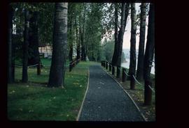
Image depicts a section of the Heritage Trail on Cottonwood Island in Prince George, B.C.
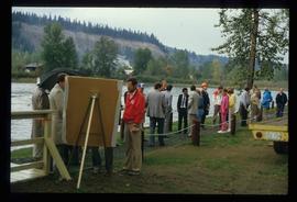
Image depicts a crowd of people on a section of the Heritage Trail on Cottonwood Island in Prince George, B.C.
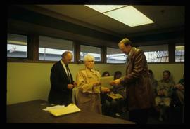
Image depicts a woman holding a sheet of paper in a room with numerous other unidentified individuals. The man standing behind her is possibly Elmer Mercier, a former Mayor of Prince George, B.C.
File contains slides depicting scenery at various locations.
Photograph depicts a residential building at 1722 7th Avenue. Annotation on verso: "1722 - 8th Ave".
Photograph depicts a residential building at 1770 5th Avenue. Annotation on verso: "1770 - 5th Ave".
Photograph depicts a residential building at 1651 5th Avenue. Annotation on verso: "1651 - 5th Ave".
Photograph depicts residential buildings along 4th Avenue east of Winnipeg Street. Annotation on verso: "series on s. side of, 4th east from Winnipeg, (railway houses)".
File consists of a printed email correspondence between Ramona Rose, Florence Smith, and Sue Sedgwick regarding an additional donation of photographic negatives. The file includes photographs depicting photographs of Knox United Church and historic Prince George.
Photograph depicts a weathered barn along a body of water, presumed to be in the North Thompson area.
Photograph depicts a weathered barn along a body of water, presumed to be in the North Thompson area.
Photograph depicts Businesses in downtown in the North Thompson region, including a business called 'Something old & Something new'.
Photograph depicts Businesses in downtown in the North Thompson region, including a sign reading "Welcome to historic George Street" and a business called "Lizard River".
Photograph depicts people sitting on chairs in a circle in a backyard.
Photograph depicts people sitting on chairs in a circle in a backyard.
Photograph depicts Trelle Morrow standing in the Soda Creek cemetery. Annotation on verso: "Trelle M. at cemetery, Soda Creek, 2010.'
Photograph depicts Frank Odin's headstone in the Soda Creek cemetery. The headstone reads "In loving memory of Captain Frank Odin of the Steamboat Charlotte Born at Point Roberts Washington March 24, 1863 Died June 7 1899". Annotation on verso: "Capt. Odin monument Soda Creek cemetery, 2010".
File consists of photographs depicting Fort St. James.
Photograph depicts a wooden building presumably at the Fort St. James historic site. The photograph is close up to the building, depicting an open door and the wooden panels along the building.
Photograph depicts an abandoned and worn out grain elevator, with three buildings in a row and the elevators going down towards the ground.
Photograph depicts an abandoned and worn out wooden building in a flat field.
Photograph depicts an abandoned and worn out wooden building in a flat field.
Photograph depicts a section of railway trackage with a pile of locks stacked beside the rail line, presumed to be located within or nearby Sinclair Mills, BC.
Photograph depicts the Sinclair Mills community hall, it includes a sign in front of the building reading "Welcome to Sinclair Mills, Community Hall".
Photograph depicts an open field and a dirt road surrounded by trees in an unknown location.
Photograph depicting a campground with log cabins and an open field surrounded by trees, presumably in Quesnelle Forks.
Photograph depicting a dirt road winding between grass and trees in Soda Creek.
Photograph depicting a garden and backyard in someone's personal residence.
Photograph depicting a garden and backyard in someone's personal residence.
Photograph depicting Kent Sedgwick and a dog in someone's garden and personal residence.
Photograph depicting a dog laying in the grass in someone's backyard of a personal residence.
File consists of clippings, notes, and reproductions relating to the incorporation of the city of Prince George. Includes: "Looking back 90 years" in Prince George Citizen Saturday Report (5 Mar. 2005); "Prince George Public Library Historical Costume Workshop - 1915" Workshop description by Jannice Closson (Jan. 1990); "The Three Georges" maps of Prince George, Fort George, and South Fort George at Incorporation of the city of Prince George in 1915 (Feb. 2000); "Incorporation dates" notes by Sedgwick on the incorporation of Prince George dates; and a photocopy of the Fort George Incorporation Act, "An Act to Incorporate the City of Fort George" (6 Mar. 1915).
Map depicts to Canadian federal electoral districts for the 1993 federal election.
Index print contains 25 photographs of a yard, a blue house and 5 portraits. The photographs were taken by Kent Sedgwick.
Photograph depicts a mayoral portrait of John Backhouse.
The Canada Chart depicts Canadian federal and provincial and government information and graphics.
File consists of clippings and notes on population data and census in the city of Prince George and the surrounding region. Includes the following clipped articles from the Prince George Citizen newspaper: "City is still a spring chicken: UNBC professor"; "Nation's lifeblood flows from overseas: Census data shows immigration fueling Canada's G8-leading growth" (2006); "Students could skew numbers" (14 Mar. 2007); "Census finds fewer residents" (14 Mar. 2007); "Aboriginal Population up in Prince George" (22 Jan. 2003); and "Population declining" (13 Mar. 2002). Also includes printed graphs entitled "Prince George Population Pyramid 1981 Census" (1981) and "Municipal population based on 1986 Census" (1988).
The item is the millennium edition of The Prince George Free Press. The "Millenium Report" was one of two different inserts in an unknown December 1999 issue. The edition contains information about Prince George's past and speculation as to where Prince George will be in the future.
File consists of notes and clippings relating to the history of Prince George from 1930-1939. Includes the following clipped articles from the Prince George Citizen newspaper: "City council coped with requests for additional relief during Depression" (Nov. 2008); "Means to correct a wounded economy debated in 1933" (Apr. 2007); "City's development continued through Depression-era" (June 2003); and "Depression years weren't pretty ones for most living in P.G". (June 2004).
File consists of clippings, notes, and reproductions relating to architects working in Prince George. Includes the following clipped articles from the Prince George Citizen newspaper: "Paul Zanette: Designs for life" (July 2010) and "Look of city nothing to brag about" (Nov. 1989).
The item is a front exterior photograph of an aged white and aqua coloured house at 1562 Gorse Street, Prince George. The house was the former home of Henry Wilson.
The item is a front exterior photograph of an aged white and aqua coloured house at 1562 Gorse Street, Prince George. The house was the former home of Henry Wilson.
File consists of notes, reproductions, and letters relating to the street names in Prince George. Includes: "Canadian Permanent Committee on Geographical Names" typescript document; email from Ramona Rose to Kent Sedgwick (8 Dec. 2000); "Future entrance sign on Tyner Boulevard" typescript letter to Mr. Hamer from Ruth Iversen (10 Jan. 1995); "South Fort George gardens plan of subdivision" reproduced map depicting subdivision lots along the Fraser River in Prince George (2011); and "Porter Creek" letter from the Province of British Columbia to Kent Sedgwick (16 May 1989).
File consists of clipping, notes, and reproductions relating to the Natural Resources Security Company, the company was responsible for a land-selling campaign, selling lots for the townsite to later be Central Fort George, which was owned and ran by George John Hammond in Fort George. Includes: "The sales campaign of George J. Hammond and the Natural Resources Security Company" typescript research essay by Anna Bumby (30 Apr. 1981); "Fort George and its tributary territory" photocopied article from British Columbia Magazine (1912); "Facts, what British Columbia offers you" reproduction of a pamphlet produced by the Natural Resources Security Company, Ltd. (1910); and reproduced excerpts from an unidentified pamphlet issued in 1912 by the Natural Resources Security Company, Ltd.
File consists of notes and reproductions relating to land surveyors working in British Columbia. Includes material on Rupert Williams Haggen who became a land surveyor in 1911 and surveyed Prince George, Quesnel, Bowron River, and the Fraser River area below Quesnel; Henry Fry who worked in Victoria between 1871 and 1897; Otto Julius Klotz who surveyed the Alaska-British Columbia boundary and also surveyed for the Canadian Pacific Railway between 1871 to 1927; James Herrick McGregor who worked in the Kootenays and assisted for the survey of the British Columbia Alberta border between 1891 and 1903; and Forin Campbell who came to Prince George in 1908.
File consists of notes, clippings, and reproductions relating to James C. Anderson and engineer J. Gill. James Anderson arrived in Fort George in 1912. Anderson did topographical surveys of the Fort George area for the Grand Trunk Pacific Railway between 1912 and 1913. Engineer J. Gill did a topographical survey of the Indian reserve for the Grand Trunk Pacific in 1912. Includes "Grand Trunk Pacific Maps" typescript document by Kent Sedgwick (3 June 1980).
The item is a reproduction of a section of survey map drafted on 18 March 1915 and revised on 23 May 1916. The reproduction was likely created in 1990. The Plan Number is 1268 and highlights the area along the Nechako and Fraser Rivers. The map details subdivisions East of Carney Street, North of Twentieth Avenue and South of Ninth Avenue. Annotations in pencil state different map scale variations and "cemetery setback."
The item is a reproduction of a section of survey map drafted in 1915. The reproduction was likely created in 1990. The Plan Number is 1268 and highlights the area along the Nechako River. The map details subdivisions East of Carney Street and North of Fifth Avenue. Some original street and avenue names have been crossed out and replaced with handwritten names. Annotation on reverse side of map states, "D.L. 343 Pl. 1268."
The item is a reproduction of a survey map drafted in July 1914. The reproduction was likely created in 1990. The area covered is along the Fraser River and east of Guelph Street. Annotations state, "PL 1409 D. L. 417 HBCo." and highlight different scales of measurement and changed street names.
The item is a reproduction of a survey map drafted in 1 Oct. 1913. The reproduction was likely created in 1990. The area covered is along the Fraser River and west of Linooln Avenue, south of Jackson Street and North of McKinley Street. Annotations state which maps and lots are adjacent to this one. An illegible signature is highlighted.


