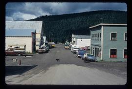
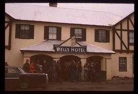
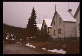
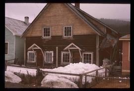
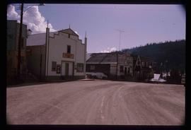
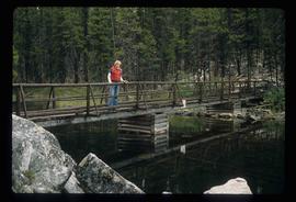
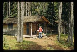
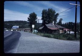
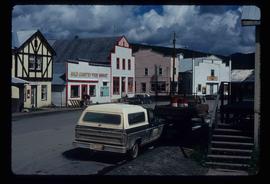
Image depicts a street in Wells, B.C. The Sunset Theatre and Gold Country Food Market are both present in the image.
Image depicts a street in Wells, B.C.
Image depicts a row of houses, as well as a United Church of Canada on the right side of the image, located in Wells, B.C.
Image depicts a building in Wells, B.C. It possesses the letters "W.V.F.B." on it.
Image depicts a row of houses somewhere in Wells, B.C.
Image depicts Wells, B.C.
Image depicts many houses somewhere in Wells, B.C.
Image depicts a row of houses somewhere in Wells, B.C.
Image depicts the abandoned and crumbling Forman's General Store somewhere in or near either Barkerville or Wells, B.C.
Image depicts Wells, B.C.
Image depicts an old pool hall somewhere in Wells, B.C.
Image depicts an old pool hall, crowded with unknown individuals, somewhere in Wells, B.C.
Image depicts an old beer advertisement for Alexandria Lager, somewhere in Wells, B.C.
Image depicts the original bank building in Wells, B.C.
Image depicts a building somewhere in Wells, B.C. There is a sign in one window which reads "Lon Oddfrey Insurance Realty LTD."
Image depicts the abandoned Cariboo Rooms, and a liquor store in Wells, B.C.
Image depicts the interior of the Centennial Hall in Wells, B.C.
Image depicts Wells, B.C.
Image depicts a street in Wells, B.C. The Wells Hotel is present in the image.
Image depicts the Centennial Hall in Wells, B.C.
Image depicts a crowd of people outside the Wells Hotel in Wells, B.C.
Image depicts the post office in Wells, B.C.
Image depicts a row of houses in Wells, B.C.
Image depicts a duplex in Wells, B.C.
Image depicts a street in Wells, B.C. The Sunset Theatre is located on the left of the image, and the Jack O' Clubs Hotel is the building with the green roof on the right. The hotel burned down on February 14th in 1994.
Image depicts an old, boarded up school in Island Cache, B.C.
Image depicts an old, boarded up school, possibly the Central Fort George Traditional School in Prince George, B.C.
Image depicts a bridge over Telegraph Creek.
Image depicts the Okanagan Kettle Valley, with the Kettle Rail Road faintly visible among the trees
Image depicts an abandoned cabin in Quesnelle Forks, B.C.
Image depicts part of a path leading to some abandoned cabins in Quesnelle Forks, B.C.
Image depicts a boarded up church in Shelley, B.C.
Image depicts a hallway in an unknown building somewhere in Wells, B.C.
Image depicts a church in Wells, B.C.
Image depicts an old, boarded up building labelled as "Cariboo Rooms" in Wells, B.C.
Image depicts an old and abandoned duplex somewhere in Wells, B.C.
Image depicts a souvenir and gift shop for both Barkerville and Wells, B.C.
Image depicts the Wells Museum in Wells, B.C.
Image depicts an unidentified man standing on a wood bridge somewhere in South Tweedsmuir Provincial Park.
Image depicts an unknown individual in the J. Edwards Camp in South Tweedsmuir Provincial Park.
Image depicts an unknown individual eating in a camp somewhere in South Tweedsmuir Provincial Park.
Image depicts the original main street of Quesnel, B.C.
Image depicts a rail road construct from Highway 97 at Mile 126; the slide is also labelled "McAlister."
Image depicts a number of buildings at an uncertain location; the slide labels the older building in the image as potentially being the "original road house."
Image depicts the Watson Mansion at Mile 108 of Highway 97. It was built by Captain Geoffrey Watson in 1904, and was burned down by a chimney fire in 1983.
Image depicts a view of the Dunkley Lumber Mill in Strathnaver, B.C.