Showing 1378 results

Archival description
2000.1.1.3.13.04 · Item · [before 1970]
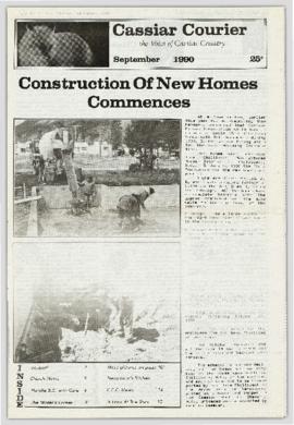
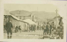
Part of Cassiar Asbestos Corporation Ltd. fonds

Photograph depicts the Cassiar townsite behind shadow in foreground. Plantsite can be seen including the mill, dry rock storage building, tailings pile, and many other buildings. Mountains in background. Handwritten annotation on recto: "<- 13 1/2" ->". (This photograph was made into a promotional poster.)

2009.5.2.58 · Item · [ca. 1913]
Part of Taylor-Baxter Family Photograph Collection

Photograph depicts Catholic church, with rectory on its left, and First United Church behind. A wood boardwalk crosses midground, and a man can be seen riding a bicycle near church. Power lines and rough cleared land in foreground, hills and mountains in background. Handwritten annotation on recto of photograph: "Church in Rupert."

2011.3.2.09 · Item · 1913
Part of North Coast & Central BC Postcard Collection

Printed annotation on recto reads: “Central Avenue Fort George B.C. Copyright Canada June 25th 1913”. Handwritten annotation in ink on recto reads: “Hotel Fort George; Pool room; Men’s furnishing; General store; Bank Vancouver; Telephone office; Temperance House; Trust-company; Grand stand & fair grounds; Hospital; Ware house and general store.” Cancelled 1 cent Canadian stamp on verso is dated: "Fort George BC Jul 14 13". Handwritten message in ink on verso is addressed to Mr. Chas H Wilson 94 Gould St Toronto: "Fort George. B.C> Box 65, July 13/ 13. Dear Father, This is a 'bird's eye view' of our main street - ha! ha! some class alright. We live right behind the bakery lunch room on the right hand side of the picture, on 1st avenue, some people eh? Will be moving to Cassiar Ave soon. How are all the folks. Mae is writing. Peace. M."

2009.7.1.300 · Item · 1 July 1909
Part of Archdeacon W. H. Collison fonds

Photograph of Centre Street in Prince Rupert on Dominion Day. The Union Bank of Canada is located on the left side of the street, and a decorative arch can be seen in the background. Annotation on recto reads: "Centre Sr. Prince Rupert Dominion Day Celebrations 1909 Allen Photo July 09."

Centre Street Prince Rupert
2009.7.1.251 · Item · ca. 1880-1920
Part of Archdeacon W. H. Collison fonds

Photograph of residents in motion on Centre Street in Prince Rupert. Buildings are visible on either side of the street and a railway track runs down the length of the road. Annotation on recto reads: "Centre Street, Prince Rupert, BC. 1664."

2009.6.1.553 · Item · [1992?]
Part of The Honourable Iona Campagnolo fonds

Left to right: Charles Jago and unidentified woman, David Fish, Dennis Macknak, Deborah Poff, unidentified woman and child, Iona Campagnolo, Lee Morrison, Ellen Facey, two unidentified women. Teepees visible in background. Photograph was taken during the chancellor's tour of Xats'ull Heritage Village, Soda Creek First Nation, Williams Lake, B.C.

2009.5.3.24 · Item · [ca. 1914]
Part of Taylor-Baxter Family Photograph Collection

Photograph depicts four men standing near fully packed horse-drawn cart in front of wood buildings, including a long building with a porch and chairs. Trees on hill visible in background. Handwritten annotation on recto of photograph: "Changing teams on the Cariboo Road".

Children at play
2009.7.1.164 · Item · [ca. 1910]
Part of Archdeacon W. H. Collison fonds

Seven young boys enjoying a game of tug-a-war alongside a wooden track. Track runs along a picket fence through a village. A small girl watches the fun from the sidelines and older woman carries a basket in the background. Handwritten annotation in pen on verso reads: “Native children at play”.

2009.7.1.056 · Item · [between 1874 and 1901]
Part of Archdeacon W. H. Collison fonds

Several unidentified individuals can be seen on front steps of church and a group of small children in white stand in line below steps. Other community buildings are visible in background, white fence crosses foreground. Photograph depicts the first church built in Metlakatla, which was burned in a fire in 1901, and replaced in 1903.

Handwritten annotation on verso reads: "Church (of England) at Metlakahtla - British Columbia. Built by the people of the village - largest church then on the pacific coast."

2009.7.1.057 · Item · [between 1874 and 1901]
Part of Archdeacon W. H. Collison fonds

Several unidentified individuals can be seen on front steps of church and a group of small children in white stand in line below steps. Other community buildings are visible in background, white fence crosses foreground. Photograph depicts the first church built in Metlakatla, which was burned in a fire in 1901, and replaced in 1903.

Handwritten annotation on verso reads: "Old church at Metlakatla Before fire. Built by Fr. Duncan & the village people".

2009.5.3.29 · Item · [ca. 1912]
Part of Taylor-Baxter Family Photograph Collection

Photograph depicts two men standing in street at the Fort George Reserve. A church with steeple stands in midground, on left side of street. Forest in background. Handwritten annotation on verso and recto of this photograph reads: "Fort George Temple." See item 2009.5.3.28 for photograph depicting this reserve which belonged to the Lheidli T'enneh Band.

2023.5.1.29 · Item · 1 Nov. 1993
Part of UNBC School of Planning and Sustainability fonds

This map is part of Schedule B of the 1993 Official Community Plan, Bylaw No. 5909 for the City of Prince George. This particular map depicts the northeast area of the City of Prince George, including the industrial areas on Prince George Pulpmill Road and Northwood Pulpmill Road along the Fraser River.