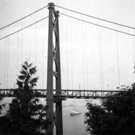
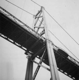
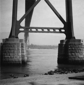
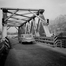
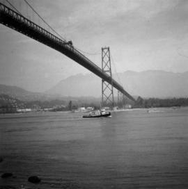
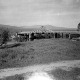
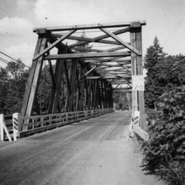
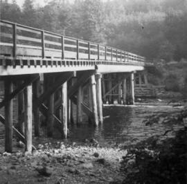
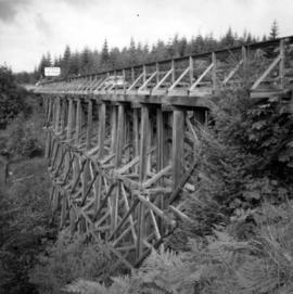
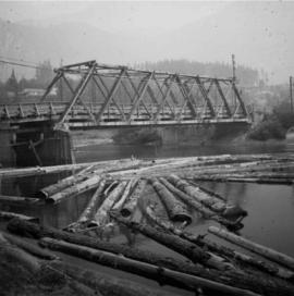
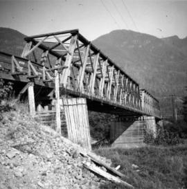
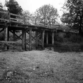
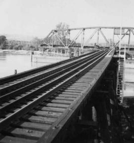
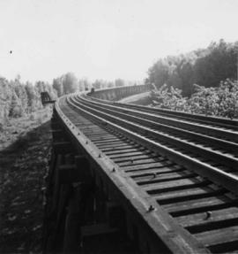
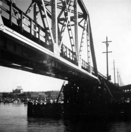
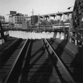
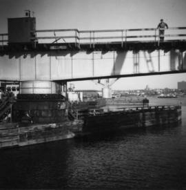
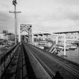
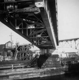
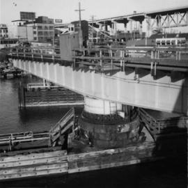
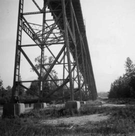
Photograph depicts the decking and piers of the northern section of the Lions Gate Bridge, looking north from the shore of North Vancouver, BC
Photograph depicts the south tower of the Lions Gate Bridge looking east with the SS Prince George in the background.
Photograph depicts the piers of the south tower on the Lions Gate Bridge in Vancouver, BC
Photograph depicts the Lions Gate Bridge on west side looking south from the shore of North Vancouver, BC
Photograph depicts the south tower and a segment of decking of the Lions Gate Bridge in Vancouver, BCPhotograph taken from the east side.
Photograph depicts the southern granite piers of the Lions Gate Bridge in Vancouver, BC
Photograph depicts a road bridge at Squamish B.C., looking north onto the road leading into the village.
Photograph depicts the Lions Gate Bridge in Vancouver, BCfrom the southeast side.
Photograph depicts a bridge over the Alouette River, 3.5 miles north of Port Hammond in the Fraser Valley.
Photograph depicts a former logging railroad trestle west of Port Alberni, BC
Photograph depicts a wooden bridge over the Salmon River near Sayward, near Kelsey Bay, on North Vancouver Island.
Photograph depicts bridge over the Alouette River, 3.5 miles north of Port Hammond and close to Dewdney Truck Road in the Fraser Valley.
Photograph depicts a bridge over the Nanaimo River on the road between Nanaimo and Cedar-by-the-Sea, looking west, downstream to river.
Photograph depicts bridge crossing over the Campbell River, 1 mile west of downtown Campbell River.
Photograph depicts a road trestle bridge for cars about halfway between south Wellington and Nanaimo Lake, southwest of Nanaimo.
Photograph depicts a road bridge at Squamish B.C. from the north bank.
Photograph depicts a truss bridge over the Salmon River near Kelsey Bay, North Vancouver Island.
Photograph depicts a wooden bridge crossing a stream on the north side of Vedder Mountain near Belrose.
Photograph depicts a C.N.R. swing bridge over the north arm of the Fraser River, approximately 5 miles southeast of New Westminster, looking north.
Photograph depicts a trestle on the south bank of the north arm of the Fraser River leading from the C.N.R. swing bridge, approximately 5 miles southeast of New Westminster, looking south.
Photograph depicts the B.C. Electric Railway swing bridge connecting Lulu Island to the mainland at New Westminster, looking north and taken from Lulu Island. The swinging span is left open except for the passage of freight trains.
Photograph depicts a wooden bridge over the Salmon River near Sayward, near Kelsey Bay, North Vancouver Island.
Photograph depicts a C.N.R. swing bridge over the north arm of the Fraser River, approximately 5 miles southeast of New Westminster, looking northeast.
Photograph depicts a wooden truss bridge in north Washington, probably somewhere east of Everett.
Photograph depicts the C.N.R. rail swing bridge on the north arm of the Fraser River, approximately 5 miles southeast of New Westminster, looking north.
Photograph depicts a trestle of the Great Northern Railway, main line to Blaine, curving towards the southwest from the south end of the New Westminster rail bridge.
Photograph depicts the fixed span of the B.C. Electric Railway swing bridge at False Creek looking south.
Photograph depicts the B.C. Electric Railway trestle bridge swinging span at False Creek.
Photograph depicts the B.C. Electric Railway swing bridge at False Creek on the west side looking east as it is about to swing open.
Photograph depicts the B.C. Electric Railway trestle bridge over False Creek looking north at the fixed span. The fixed span can be removed by floating it onto a scow on rising tide to allow large and newly launched ships to get out to sea.
Photograph depicts the under face of the B.C. Electric Railway swing bridge at False Creek looking north.
Photograph depicts the False Creek Trestle bridge open and the Granville Bridge looking east.
Photograph depicts the B.C. Electric Railway swing bridge at False Creek.
Photograph depicts a former C.N.R. station at Youbou on Lake Cowichan on Vancouver Island. The track is still used to serve the plywood lumber mill at Youbou.
Postcard depicts the Canadian Pacific Railway line where the Great Divide between BC and Alberta.
Postcard taken along the CPR line, at a camp in Yoho Valley.
Postcard depicts the Great Divide between Alberta and British Columbia, along the CPR line.
Photograph of a large crowd gathered in front of a Grand Trunk Pacific train. Residential buildings atop a hill are visible in the background. Annotation on recto reads: "First Train Leaving Prince Rupert June 14 1911"
Photograph depicts a Chevrolet pickup truck on highway to right of Mud Lake, at Km 632 on the Stewart-Cassiar Highway. Forest on hillside in background.
View of a sternwheeler in the distance making its way down Fort George Canyon. Printed annotation on recto reads: "Fort George Canyon."
Photograph depicts a large ship behind dock buildings. Railroad crosses foreground, hills visible on shore in background.
Handwritten annotation on verso reads: "Ship in Pr. Rupert dry dock during Great War 1915?".
Five unidentified men sit with dog in canoe. One man stands on dock in foreground.
Handwritten annotation on verso reads: "Freighting by canoe on skeena river".
Canoe with mast floats close to shore in foreground, mountains visible across river in background.
Handwritten annotation on verso reads: "Arch. W.H. Collison & wife with native friends en route up Skeena River."
Rev. William Edwin Collison stands in centre of boat, with wife Bertha and daughters Muriel and Katherine seated behind. Unknown man and woman are also seated in boat, and an unknown man stands on shore holding rope.
Handwritten annotation on verso reads: "Will Collison with wife & children leaving Metlakatla to catch steamship en route to England (1910)".
Group of five unidentified men stand on shore to right of large dugout canoe, handling their rifles. Forest and snow-capped mountains stand on opposite shore in background.
Handwritten annotation on verso reads: "Mrs Collison (wife of Arch. Collison in Canoe en route to Hazelton B.C."
Handwritten annotation on recto of postcard reads: “Were there’s a will there’s a way, 5th Street, Prince Rupert, B.C., F. Button photo Pr. Rupert. No. 514.” Handwritten annotation in pen on verso of postcard reads: “Miss Belding, 33 Marlbro Avenue, Hull Yorkshire, England. S.S. Prince George. Dec. 1918. Dear Bertha, This is a street in the centre of the town Prince Rupert. There is a capacity list of passengers on board. The boat is registered to hold 384. We left at midnight and exped to arrive in Vancouver tomorrow at 3:30 pm. Love from Edie.”
Photograph depicts Slim Williams and four members of his dog team in the centre of the image, with a group of men, women and children standing behind him looking towards the camera. Handwritten annotation along bottom of photograph reads: "'Slim' Williams and Dog Team From Alaska to Chicago 1933". It is believed this photograph was taken in Hazelton, BC. and documents Slim Williams on his way to the Chicago Fair.
Photograph depicts two, four-horse stagecoaches laden with passengers parked outside the Hotel Northern in South Fort George. A group comprised of primarily men watch the stagecoaches from the veranda of the hotel. Handwritten annotation in bottom right corner of photograph reads: "Cariboo Stage at South Ft. George, BC. Oct 19-1911."
Photograph depicts lane in front of tent buildings flooded with water, and a man standing near doorway to first building. It is believed that this photograph may depict the Island Cache in flood, at Prince George, BC.
Photograph depicts lane in front of tent buildings flooded with water, forest trees in background. Photograph taken from canoe, portion of canoe visible in foreground. It is believed that this photograph may depict the Island Cache in flood, at Prince George, BC.