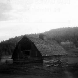
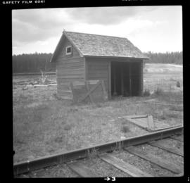
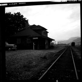
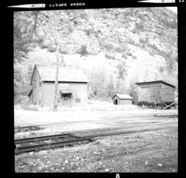
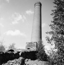
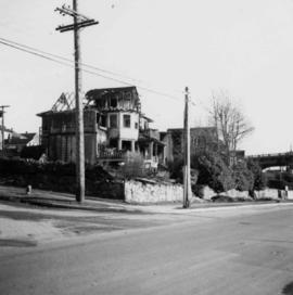
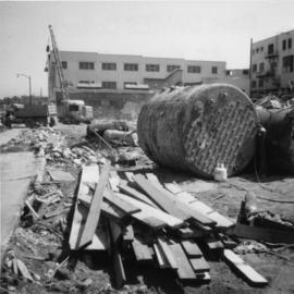
Photograph depicts the demolished site of Nelson Laundries Ltd. The boiler in the foregorund was having tubes removed by a wrecker. The site was to be occupied by a Ford motor dealer.
Photograph depicts buildings of the former Vancouver-Lansdale ferry. They appeared to now be used by Kingcome Navigation Co. as well as other businesses.
Photograph depicts a mill and beehive burner.
Photograph depicts a 120 ft. stack of the former B.C. Copper Company in Anaconda, on the outskirts of Greenwood. It was built sometime between 1903 and 1909 and replaced a steel stack built on 1900, immediately below it.
Photograph depicts a log cabin that was inhabited by an older aboriginal man who is visible in the window. The cabin was perhaps 100 years old.
Photograph depicts a disused rural school in the village of Cormi.
Photograph depicts a meat hanging shed on a ranch on Granby River Road, Grand Forks.
Photograph depicts an abandoned settlement.
Photograph depicts a former dance hall, now barn in the centre of Keremeos Centre. Only 2 buildings of the original village survived which included the dance hall and a hotel across the street.
Photograph depicts a barn of the Glenwalker Ranch. Built in 1890-1910.
Photograph depicts a small barn that had just been built within the last 12 months.
Photograph depicts a barn located in Aspen Grove.
Photograph depicts a section shanty at the CPR McCulloch depot located at mile 76.6 on the Carmi Subdivision. The rail here is Canada Algoma, 85 lbs. and dated to 1940. The view is looking southeast, with Hydraulic Lake in the background.
Photograph depicts the Midway CPR depot located at the eastern terminus of Kettle Valley Railway. It was a subdivisional point with way freights originating at Nelson and Penticton, and running west and east respectively to Midway. There are two to 3 freights weekly from Nelson and 1 to 2 from Penticton. It lost its agency in June 1969 and all small freight [
Photograph depicts the CPR line at Greenwood. There is no representative of the CPR in Greenwood now and the agency expired in June 1969. There appears to be 2 to 3 way freights per week from Nelson to Midway. The view is looking north and shows the depot house.
Photograph depicts the CPR line at Eholt, located at mile 108.7 from Nelson on the Boundary Subdivision. It was a formerly bustling junction with the left-hand spur leading to Phoenix. Nor it only has 3 way freight trains a week from Nelson to Midway. The view is looking west.
Photograph depicts a freight shed at the Nelson CPR depot. There is a terminal spur on the south side of the shed and road trucks on the north side. The road side of the main depot building can be seen in the left rear of the photo. The view is facing east.
Photograph depicts the Nelson CPR depot . All the freight traffic work is handled at this office for a wide area. The view is looking west.
Photograph depicts a replacement rail bridge. Forms sat on a temporary pile of dirt, which in turns sat on a road bed of a new highway that had just been cut.
Photograph depicts a new CN overpass in Campbell Creek. The grade crossing at the newly created service/business road was built on the south side of a road/rail complex.
Photograph depicts a grain elevator which Wynndel was famous for.
File consists of documentary photographs taken by David Davies of railway maintenance of way buildings in British Columbia.
Photograph depicts an abandoned section in Wasa, on the CPR Windermere Subdivision. Built in 1914-20. Very rare at this date. The only known of the same type was in Brookmere (private and lived in).
Photograph depicts a tool house on a CNR curve in Armstrong. Not in frequent use.
Photograph depicts a former gang car 'garage' in a station building.
Photograph depicts railway track previously owned by BCER. It led onto the east end of Lulu Island and then to Annacis Island. Looking from the Naew West River Walk to the Queensborough bridge that was protected by signals and had a high chain link fence to deter pedestrians. It was likely that the rail was only used at night. Originally built by Canadian Northern Railway to reach Steveston, circa 1917.
Photograph depicts a CPR swing bridge in Harrison Mills. Looking east, towards Kilby Store. Swing section in the foreground. It was rarely used.
Photograph depicts a CPR swing bridge in Harrison Mills. Taken on the downstream side of Harrison River.
Photograph depicts a courthouse on Howe St. in Vancouver, B.C. There are paintings on the fence surrounding the forecourt.
Photograph depicts the First Narrows looking east from the base of Point Atkinson lighthouse.
Photograph depicts a dredge working on the shoreline of a new apartment site on the south side of Coal Harbour, Vancouver, B.C. Photograph taken from Stanley Park, looking east. The Bayshore Inn Hotel is shown in the rear center.
Photograph depicts a house fire on 1000 Beach Block and Thurlow St. on December 18, 1964. A wrecking gang accidently set fire to the house and it took one hour to get the fire under control.
Photograph depicts homes on 1000 Beach Ave., looking northeast.
Photograph depicts homes on 1000 Beach Ave., looking northeast. House #1053 on the left has been demolished at this point and then set on fire one night by kids.
Photograph depicts homes on 1000 Beach Ave. in Vancouver, B.C.
Photograph depicts the inside of the suite at 925 Cadero St. in the west end of Vancouver, B.C.
Photograph depicts a general view of the upper and south shore section of Coal Harbour in Vancouver, B.C.
Photograph depicts a general view of the last 300 yards of the upper neck of Coal Harbour in Vancouver, B.C. The view is looking west and taken from the south side.
Photograph depicts the west end of Coal Harbour looking south to West Georgia St. and Chilco-Gilford block beyond. The old pilings exposed at low tide.
Photograph depicts Simon Fraser University in Burnaby, B.C. The view is looking northeast towards the northwest corner of the Academic Quadrangle.
Photograph depicts Simon Fraser University in Burnaby, B.C. The view is looking northwest from the science complex towards the gymnasium.
Photograph depicts a swimming pool at Second Beach in Stanley Park, Vancouver, B.C. The snow in the foreground is 16 inches deep and there is a gathering snowstorm in the background coming in from the west.
Photograph depicts a view of the Fraser River from the Albion Ferry from Haney to Fort Langley. The ferry is approaching the south bank of Fort Langley. Gulls sat on logs floating downstream; too heavy to rise after eating candlefish.
Photograph depicts a horse drawn hay rack in a field on the north slopes of Vedder Mountain, near Yarrow.
Photograph depicts the fire hall at Lillooet, including an old hand drawn hose reel carrier.
Photograph depicts Craigellachie station, a famous spot on the C.P.R. line. The trans-continental line was joined here on November 7, 1885, about 250 yards down the track just beyond the right hand colour aspect signal. The depot house is not manned, used by the line side crews to store equipment. In former days it was a passing point, but there are very few houses in the area now.
Photograph depicts the end of the old Coal Harbour extension of the C.P.R. line from Vancouver. It was disused for several years. The view is looking east with Woodward's Marina behind.
Photograph depicts the C.P.R. depot at Princeton, looking east.
Photograph depicts the Bowser water tower on the Esquimalt and Nanaimo Railway, 25 miles south of Courtenay. The view is looking north.
Photograph depicts the C.P.R. station in Abbotsford, looking south.