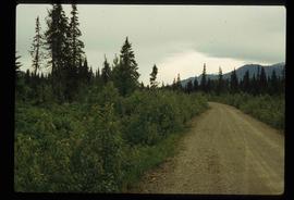
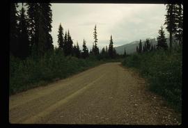
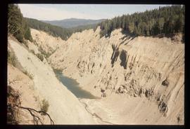
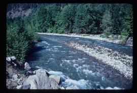
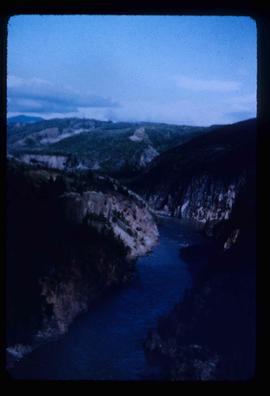
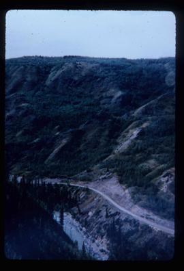
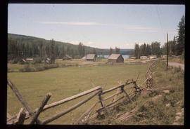
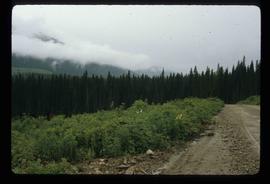
Image depicts a dirt road and power-lines running through the woods, possibly near Quesnelle Forks.
Image depicts the townsite of Keithley Creek, B.C.
Image depicts a woman standing next to a steam shovel, located in Quesnelle Forks.
Image depicts the Cariboo River.
Image depicts the old log buildings of the town of Hydraulic, B.C.
Image depicts numerous felled trees somewhere in the McGregor Valley.
Image depicts a man, possibly Ted Faulkner, looking at a creek.
Image depicts a ditch of water at an uncertain location.
Image depicts a view of Giscome with a train passing through.
Image depicts the site of Giscome's first quarry, with Eaglet Lake located in the foreground.
Image depicts an eastern view over Eaglet Lake.
Image depicts what is possibly the McGregor River.
Image depicts a gravel road somewhere in the McGregor Valley.
Image depicts a view of McGregor Valley.
Image depicts numerous burned tree stumps somewhere in the McGregor Valley.
Image depicts a faded First Nations' rock painting.
File contains slides depicting Seton Portage and its surrounding areas.
Image depicts what is possibly an irrigation channel somewhere in Seton Portage, B.C.
File consists of a typescript document titled "Railway and Geological Surveys in North-central British Columbia during the 1870s" by Frank Leonard.
The map depicts plans for Fort George Park in Prince George.
Image depicts a lake and a mountain in the distance. The location is uncertain.
Image depicts numerous docked boats, as well as many houses on the shore in the background; located in Kitimat, B.C.
Image depicts a hotel in Likely, B.C.
Image depicts a view of the small town of Likely, B.C.
Image depicts the Keithley Creek, with several unknown individuals walking along the banks.
Image depicts a sign on the dirt road leading to Barkerville from Keithley Creek. The sign reads: "Barkerville 40 (via Yanks Peak) Maximum elevation 6200 FT. Summer road only. Steep grades and switchbacks not recommended for other than 4-wheel drive vehicles. You are entering an isolated mountain area; you will be on your own."
Image depicts the Bullion Pit in Likely, B.C. It is a man-made canyon from the days of the gold-rush, formed by the use of hydraulic monitors. The gold-mine operated from 1892 to 1942.
Image depicts a bridge, and the town of Likely on the the other side of a river.
Image depicts a dirt road and a densely forested treeline, possibly in the McGregor Valley.
Image depicts a hammer sitting in dirt at an uncertain location.
Image depicts a view of McGregor Valley.
Image depicts a what is possibly the McGregor River in the McGregor Valley.
Image depicts the site of Giscome's first quarry, with a train passing by and Eaglet Lake located in the foreground.
Image depicts a view of McGregor Valley.
File contains slides depicting areas along the North Thompson Highway.
Image depicts a small river somewhere in or near Seton Portage, B.C.
Image depicts a type of gate system for the river water, possibly controlling irrigation, located somewhere in Seton Portage, B.C.
File contains slides depicting the Sunshine Coast.
File contains slides depicting Telegraph Creek.
Image depicts the Telegraph Creek.
Image depicts a bridge over Telegraph Creek.
Image depicts the Telegraph Creek Road, as well as the Creek itself.
File contains slides depicting a trail, and other areas, near Rossland, B.C.
Image depicts a chasm full of trees at an unknown location.
Image depicts a powerhouse in Prince George, B.C.