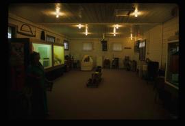
Image depicts an unidentified man in a greenhouse, possibly somewhere in Fort St. John, B.C.
Image depicts two unidentified individuals in hard hats leaning against the railing of a large, open space inside an unknown concrete structure. It is possibly located in Fort St. John, B.C.
Image depicts a yellow turbine inside an unknown concrete structure, possibly somewhere in Fort St. John, B.C.
Image depicts numerous wood crates and large pieces of machinery in an unknown concrete structure, possibly somewhere in Fort St. John, B.C.
Image depicts a tunnel, possibly located somewhere in Fort St. John, B.C.
Image depicts a group of unidentified individuals wearing hard hats inside an unknown concrete structure, possibly located in Fort St. John, B.C.
Image depicts two individuals at work inside what appears to be a piece of machinery. It is possibly located somewhere in Fort St. John, B.C.
Image depicts a piece of machinery shaped like a large metal cylinder. It is possibly located somewhere in Fort St. John, B.C.
Image depicts what appears to be a computer room at an uncertain location, possibly in Fort St. John, B.C.
Image depicts a group of unidentified individuals look through an observatory window at an uncertain location, possibly in Fort St. John, B.C.
Image depicts an orange turbine in Fort St. John, B.C.
Image depicts a view of Pine Pass on the border between Alberta and British Columbia in the Rocky Mountains.
Image depicts what appears to be a saw mill belonging to Northwood. The location is uncertain.
Image depicts a woman standing next to a model of a ship in glass case in what appears to be a museum. The location is uncertain.
Image depicts the W.A.C. Bennett Dam on the Peace River in Hudson's Hope, B.C.
Image depicts a large building which is labelled "Alberta Pool Elevators Ltd. Dawson Creek," located in Dawson Creek, B.C.
Image depicts the interior of what is possibly a heritage building in Dawson Creek, B.C.
Image depicts the Station Museum in Dawson Creek, B.C.
Image depicts a large building which is labelled "Alberta Pool Elevators Ltd. Dawson Creek," located in Dawson Creek, B.C.
Image depicts the Station Museum and the "Alberta Pool Elevators Ltd." building in Dawson Creek, B.C.
Image depicts the interior of the Station Museum in Dawson Creek, B.C.
Image depicts stuffed wildlife exhibits inside the Station Museum in Dawson Creek, B.C.
Image depicts a field of yellow plants at an uncertain location.
Image depicts an old abandoned cabin at an uncertain location.
Image depicts an old, collapsing cabin which is sloped sideways. The location is uncertain.
Image depicts Sue Sedgwick and a dog standing next to an old, collapsing cabin which is sloped sideways. The location is uncertain.
File contains slides depicting the Ram Glacier.
File contains slides depicting areas in and around the Rockies, Icefield Highway, and Jasper, Alberta.
File contains slides depicting the Kootenay Plains and surrounding areas in Alberta.
File contains slides depicting places in Saskatchewan.
File contains slides depicting places around and between Skagway, on the Alaska border, Atlin and Miles Canyon.
Image depicts the road to Skagway, Alaska. Possibly located on the Klondike Highway in British Columbia with Tutshi Lake on the left.
Image depicts the small town of Fraser, B.C. Located on the Klondike Highway.
Image depicts a railway bridge, possibly in the small town of Fraser, located on the Klondike Highway in B.C.
Image depicts the Duchess engine, which was built in 1878 and taken out of service in 1919. It was part of a matched set with the Duke and is now a tourist attraction in Carcross, Y.T.
Image depicts half of a ship, which is named the Tutshi, in Carcross, Y.T.
Image depicts the Caribou Hotel and the Matthew Watson General Store in Carcross, Y.T.
Image depicts the train station in Carcross, Y.T.
Image depicts old machinery, at the Atlin Museum in Atlin, B.C.
Image depicts the travel infocentre at the Atlin Museum. The slide labels it as having once been a school.
Image depicts an Anglican Church at the Atlin Museum.
Image depicts the Pine Tree Restaurant in Atlin, B.C. It is possibly part of the Atlin Museum.
Image depicts the Moose Hall in the Atlin Museum. A sign above the door reads: "In 1905 this building was the new Arctic Brotherhood Hall in Discovery. Some years later it was hauled here in two parts by horses to become the Moose Lodge and Community Hall."
Image depicts Atlin Lake as well as a small section of Atlin, B.C. The mountain is possibly Atlin Mountain.
Image depicts a back street in Atlin, B.C.
Image depicts the fire hall in Atlin, B.C.
Image depicts the government liquor store in Atlin, B.C.
Image depicts a house with stairs up to a small patio area on its roof in Atlin, B.C.