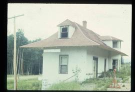
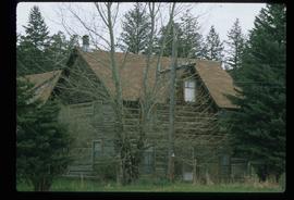
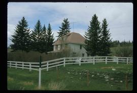
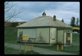
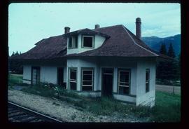
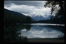
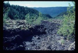
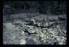
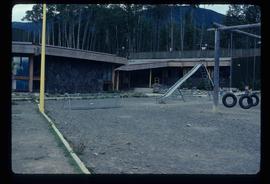
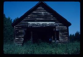
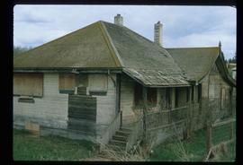
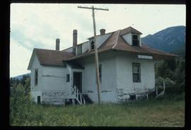
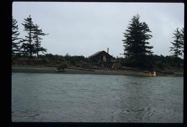
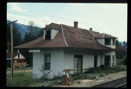
Image depicts an old, rundown building in Dunster, B.C. Possibly a disused Rail Station.
Image depicts the 137 Mile House.
Image depicts a house in 127 Mile House, B.C.
File consists of "The Spruce Needle" newspaper, vol. 1 no. 5 (14 Sept. 1982). The serial described itself as having "Prince George Community News and Views".
File contains slides depicting the Columbia River in Interior Washington, USA.
Image depicts a boulder protruding from layers of sediment with a hammer beside it for size reference. It is located somewhere in Soda Creek, B.C.
Image depicts the old school at 150 Mile House, with what is likely the modern school visible in the background.
Image depicts the Flying U Ranch at 70 Mile House, B.C.
File contains slides depicting places on Haida Gwaii, formerly known as the Queen Charlotte Islands.
Image depicts a woman standing on a rocky shore somewhere on Haida Gwaii, B.C.
Image depicts Kent Sedgwick walking along the coastline of Haida Gwaii, B.C.
Image depicts numerous trees in the coastal forest of Haida Gwaii, B.C.
Image depicts Kent Sedgwick sitting with a dog on a log on the shore of Haida Gwaii, B.C.
Image depicts a downward view of a small section of the shore of Haida Gwaii.
Image depicts an aerial view of the coastline of Haida Gwaii, B.C.
Image depicts numerous boats docked by the Prince Rupert Fishermen's Co-operative Association from the deck of a ferry, possibly as it's leaving Prince Rupert, most likely for Haida Gwaii.
Image depicts the waters of the Hecate Strait.
Image depicts the waters of the Hecate Strait, possibly on approach to Haida Gwaii, B.C.
Image depicts a row of houses in the village of Masset on Haida Gwaii.
Image depicts a tall pine tree somewhere on Haida Gwaii.
Image depicts an individual walking on a path through a forest somewhere on Haida Gwaii.
Image depicts a view of the coast of Haida Gwaii.
Image depicts a shed on the shore somewhere on Haida Gwaii.
Image depicts a pile of dead trees in a forest somewhere on Haida Gwaii.
Image depicts a slug on the forest floor somewhere on Haida Gwaii.
Image depicts a trail through the forest somewhere on Haida Gwaii.
Image depicts a house on the shore somewhere on Haida Gwaii.
Image depicts the community of Skidegate on Haida Gwaii.
Image depicts the old Dunster Station in Dunster, B.C.
Image depicts the interior of the old Dunster Station in Dunster, B.C.
Image depicts the old Dunster Station in Dunster, B.C.
Image depicts two bridges over the Fraser River, located somewhere in Lillooet, B.C.
Image depicts the Tseax Lava Flow.
Image depicts what is possibly Melita Lake. The mountain in the background is possibly Tseax Cone, the volcano responsible for the existence of the Tseax lava flow.
Image depicts the Tseax Lava Flow.
Image depicts the Tseax Lava Flow, with mountains in the distance.
Image depicts the Tseax Lava Flow.
Image depicts the north aspect of Oscar Peak overlooking Lava Lake in the Nass Valley.
Image depicts a stream running through the Tseax lava flow.
Image depicts a school and playground, possibly in New Aiyansh, B.C.
Item is an original 1982 map depicting the Bowron River in British Columbia, published by the Province of British Columbia Ministry of Environment.
Item is an original 1982 map depicting Prince George British Columbia, published by the Department of Energy, Mines and Resources in Ottawa. Map includes pen markings.
Image depicts the old school in Woodpecker, B.C.
Image depicts an old government building, believed to have once housed the RCMP, in 150 Mile House, B.C.
Image depicts the 132 Mile House Ranch.