File consists of clippings, letters, notes, and reproductions relating to the development and use of a coat of arms for the city of Prince George. Includes: "Coat of arms committee minutes" (9 Dec. 1994); printed photos of the proposed coat of arms and flag for the city of Prince George (Jan. 1995); "Ceremony for the Presentation of Armorial Bearings and Letters Patent to the City of Prince George" (29 July 1996); an invitation from the office of the mayor (29 July 1996); "Proposed armorial bearings for the city of Prince George"; "Symbolism in the armorial bearings of Prince George, B.C". (12 May 1995); and "The Canada Chart". Also includes a poster entitled "The Canada Chart". Includes the following clipped articles from the Prince George Citizen newspaper: "Coat of arms tell own story"; "City, CNC join old tradition" (30 July 1996); "Coat of arms carved for chamber" (19 Nov. 1996).
File consists of notes and reproductions relating to George Dawson and the Geological Survey of Canada. Includes: "Museum Mirror" Fraser-Fort George Regional Museum newsletter vol. 1 no. 2 (June 1986). File also includes photographs depicting various sights around British Columbia from George Dawson's explorations (1983 reproduced).
File consists of notes, clippings, and reproductions relating to the Fraser-Fort George Museum Society Museum Publications committee consisting of Kent Sedgwick, Keith Gordon, and Denise McCallum and publishing local histories through the museum. The file primarily consists of material regarding the re-publication of "History of Prince George" by Rev. F.E. Runnalls. Includes photographs titled "Runnall's Book" and depicting historical Prince George and Rev. Runnalls.
Item is an original 1983 map depicting Salmon River in British Columbia, published by the Province of British Columbia Ministry of Environment. The map includes pen and pencil annotations.

Image depicts the Prince George Public Library (Bob Harkins Branch). Map coordinates 53°54'43.1"N 122°44'56.4"W

Image depicts the Fort George Regional Museum (now known as The Exploration Place) in Prince George, B.C. Map coordinates 53°54'18.6"N 122°44'09.8"W

Image depicts the Four Seasons Leisure Pool, and the Centennial Fountain in Prince George, B.C. Map coordinates 53°54'48.5"N 122°44'49.2"W
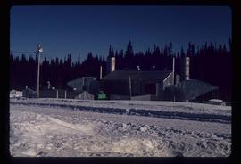
Image depicts a gas compression station located at Summit Lake, north of Prince George, B.C.
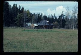
Image depicts an old log cabin in Salmon Valley.
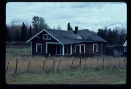
Image depicts an old log house with a collapsing roof in Salmon Valley.

Image depicts the BC Liquor Store in Prince George, B.C.

Image depicts a fence somewhere in Anahim Lake, B.C.

Image depicts numerous campers and other vehicles in Tumbler Ridge, B.C.
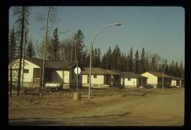
Image depicts a row of houses in Tumbler Ridge, B.C.
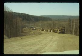
Image depicts a road somewhere in Tumbler Ridge, B.C. There are numerous construction vehicles present.

Image depicts a bridge under construction in Tumbler Ridge, B.C.
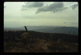
Image depicts a view of the scenery in Tumbler Ridge, B.C.

Image depicts a Cariboo Ranch style house at College Heights in Prince George, B.C.

Image depicts a house on Blackwater Road.
Subseries consists of materials collected by Kent Sedgwick for research relating to Lheidli T'enneh First Nations. The Lheidli T'enneh are a sub-group of the Dakelh people whose traditional territory includes the city of Prince George, British Columbia. These files primarily consist of material regarding the original Lheidli T'enneh reserve and cemetery, the reserve relocation, and the desecration of the cemetery.
File primarily consists of material regarding the L'heidli T'enneh Cemetery and the 1914 Royal Commission on Indian Affairs report on Prince George in relation to the "Fort George Tribe" and their lands and cemetery. Includes: photocopies from BC Archives of the Royal Commission transcripts; a report entitled "Archival Research Project - Fort George Park, up to 1998" prepared by Sites N Sounds Consulting for the Fraser-Fort George Regional Museum (1998); "Archaeological Impact Assessment, Fraser-Fort George Regional Museum, Lot 2, District Lots 343 and 417, Plan 32450, Cariboo District, City of Prince George, Permit 1998-218" prepared by Sites N Sounds Consulting (1998); "Indian Cemetery Fort George Park Prince George" typescript document by Kent Sedgwick for the Heritage Advisory Committee (23 Mar. 1983); a photocopied "Indian Cemetery in Fort George Park" plan drawn by the City of Prince George Public Works Department (Dec. 1978); and burial records for the L'heidli T'enneh Cemetery from the City of Prince George Cemetery System.
The Canada Chart depicts Canadian federal and provincial and government information and graphics.
The item is a photographic reprint originally taken in 1936. The photograph depicts the Fraser River flood in Prince George in June 1936. Buildings are shown among the raised flood waters. Annotations on the reverse side of the photograph state, "983.11.3 slide 6.3 x 9.5" crossed out is "6 1/2 x 10."
The item is a photographic reprint originally taken in 1936. The photograph depicts the Fraser River flood in Prince George in June 1936. A man on a raft is portrayed near a woman on a bridge with water coming up to the bottom of the bridge. Annotations on the reverse side of the photograph state, "983.16.5 slide 5.7 x 9.5" and crossed out is "6 x 10."
File consists of notes, clippings, and reproductions relating to Mcbride and Dunster. Includes photographs depicting the Croyden cemetery and the Dunster ferry site (2005).
File contains slides depicting Tumbler Ridge.

Image depicts the Tumbler Ridge School.
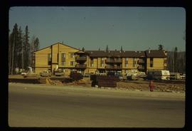
Image depicts an apartment building in Tumbler Ridge, B.C.
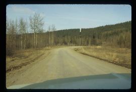
Image depicts a road somewhere in Tumbler Ridge, B.C.
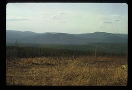
Image depicts a view of the scenery in Tumbler Ridge, B.C.
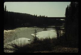
Image depicts a river in Tumbler Ridge, B.C. The bridge crossing it appears to be either half-missing or incomplete.

Image depicts a fence somewhere in Anahim Lake, B.C.
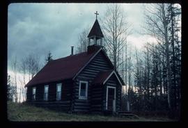
Image depicts an old Catholic church in Salmon Valley.
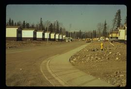
Image depicts a number of trailer homes in Tumbler Ridge, B.C.

Image depicts numerous campers and other vehicles in Tumbler Ridge, B.C.
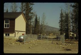
Image depicts a construction area somewhere in Tumbler Ridge, B.C.
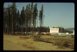
Image depicts Quadra Ventures Industrial Lodge in Tumbler Ridge, B.C.
File consists of notes, clippings, and reproductions relating to proposed heritage buildings in Prince George. Includes: "A heritage to remember" typescript document prepared by the Prince George Joint Heritage Advisory Committee (Dec. 1983); "Heritage aspects of 886 Vancouver Street" typescript letter sent to Alderman Monica Becott from Kent Sedgwick (2 May 1991); and "House at 1677 - 7th Ave". typed letter to Ed Chanter from Kent Sedgwick (9 Sept. 1994). Also includes photographs depicting houses at the addresses 1651 Fifth Avenue, 1085 Vancouver Street, 983 Vancouver Street, 1675 Fifth Avenue, 1643 Fifth Avenue, 886 Vancouver Street, 1734 Twelfth Avenue (1991).
File consists of notes and reproductions relating to oral history interviews in Prince George. Includes material regarding an oral history workshop conducted by the Prince George Oral History Group; Pioneer interviews conducted by the Prince George University Women's Club; oral interview holdings at the Prince George Public Library; oral interview holdings by the Exploration Place; and proper conduct for oral history interviews.
File consists of notes, clippings, and reproductions relating to secondary sources of Prince George's development and historiography. Includes: "Ted Williams Slides" notes by Kent Sedgwick; "Nechako River cutbanks" card with a painting depicting the Nechako River cutbanks in Prince George; "Historic Timeline of Prince George" typed document created by Kent Sedgwick (2009); "Historiography of Northern British Columbia Project" typed document sent out to College Height Secondary School by Ted Renquist regarding a project to develop a historiography of Northern British Columbia (15 Apr. 1991); and "Canadian Encyclopedia" typed letter from Adriana Bryenton with the Canadian Encyclopedia requesting review of the Prince George article for the Canadian Encyclopedia (29 June 1994).

Image depicts downtown Prince George looking northwest. Map coordinates 53°54'48.7"N 122°44'45.6"W

Image depicts a view of Prince George from City Hall looking northeast along George Street. Map coordinates 53°54'46.3"N 122°44'41.9"W
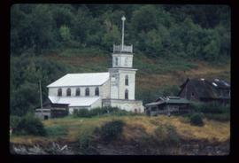
Image depicts an Anglican church in Old Aiyansh.
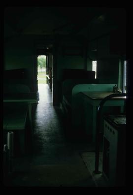
Image depicts the interior of what is possibly a heritage building in Dawson Creek, B.C.

Image depicts the Station Museum in Dawson Creek, B.C.
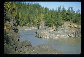
Image depicts the Fraser River in Fort George Canyon Provincial Park, B.C.
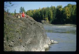
Image depicts the Fraser River, along with an unknown individual and his dog, in Fort George Canyon Provincial Park, B.C.
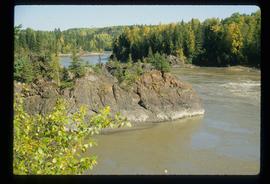
Image depicts the Fraser River in Fort George Canyon Provincial Park, B.C.
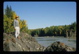
Image depicts the Fraser River, along with an unknown individual, in Fort George Canyon Provincial Park, B.C.
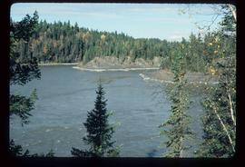
Image depicts the Fraser River in Fort George Canyon Provincial Park, B.C.