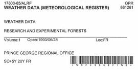
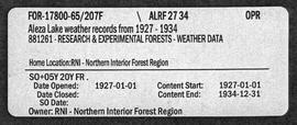
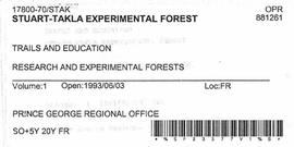
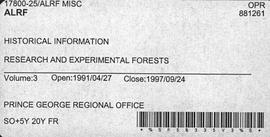
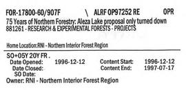
Showing 2849 results

Archival description
Aleza Lake Maps
2007.1.80.1 · File · 1949-1998
Part of Aleza Lake Research Forest fonds

File contains datelines, small maps consisting of ecological site types, handwritten notes, overheads, terrain resource management information digital map data, and trail system maps.

2007.1.80.1.11 · Item · [after March 1992]
Part of Aleza Lake Research Forest fonds

Map reflects forest type boundary line, bogs and swampy non-forested areas, creeks, lakes, rivers, tree species labels of spruce, balsam, and birch, stand descriptions, historical timber sale boundaries, stand history symbol, gravelled secondary roads, unimproved old roads, management compartment boundary, research forest boundary, ecological reserve boundary, and old growth emphasis areas.

2007.1.80.1.15 · Item · Sept. 1998
Part of Aleza Lake Research Forest fonds

Map commissioned from Ministry of Forests Prince George Region from Madrone Consultants shows Aleza Lake Research Forest Management Compartments and Administrative Boundaries. Map is 1 of 6. Map shows the Aleza Lake Ecological Reserve, Natural Forest Reserve, the Special Management Area, and Riparian Management Research Area.

2007.1.80.1.20 · Item · Sept. 1998
Part of Aleza Lake Research Forest fonds

Map commissioned from Ministry of Forests Prince George Region from Madrone Consultants shows Aleza Lake Research Forest terrain themes. Map is 6 of 6. Map shows the following types of terrain units: typic, slope, percipitous, gullied, hummocky, rocky, alluvial, and organic. Ecosystem classification and mapping by Oikos Ecological Services Ltd.

Cannery buildings
2004.2.1.72 · Item · 1898-1920
Part of Reverend R.W. Large fonds

Photograph depicts cannery buildings on pilings with a body of water in the foreground and tree covered mountains in the background.

Tow of cannery fishing boats
2004.2.1.104 · Item · 1898-1920
Part of Reverend R.W. Large fonds

Photograph depicts a tug boat hauling a line of small fishing boats across the water with a mountain in the background. Annotation on verso of photograph states: "Tow of Cannery Fishing boats"

2009.5.2.44 · Item · 25 July 1939
Part of Taylor-Baxter Family Photograph Collection

Photograph depicts a large structure in center of mining area in riverbed, equipment and supplies scattered throughout. Buildings and forest in background. Handwritten annotation on verso of photograph: "Spruce Creek, Lower Shovel Workings 6/25/39.", on recto: "Atlin".

2009.5.2.51 · Item · [ca. 1910?]
Part of Taylor-Baxter Family Photograph Collection

Photograph depicts two log buildings in fenced area on lake shore, forest trees in background. A man can be seen standing near docking area and small boat pier extending into water in foreground. Handwritten annotation on recto of photograph: "Fur Farm Red Rock Lake". This location is believed to at mile 27, north of Summit Lake.

2009.5.3.38 · Item · [ca. 1913]
Part of Taylor-Baxter Family Photograph Collection

Photograph depicts three men standing with oars in small boat, forest slash at their feet. More slash lies in foreground behind bushes and plants on swampy shore. Trees in background. These men are believed to be members of the Bourchier forestry crew.

2009.5.3.157 · Item · [ca. 1910]
Part of Taylor-Baxter Family Photograph Collection

Photograph depicts men on river boat and small canoe floating just off shore. Men sit and stand on shore among square bales and large cut lumber. Forest in background. Handwritten annotations on recto of photograph: "Fort Fraser wooding up at Giscome Portage", "Chilco at Giscome Portage".