Affichage de 4134 résultats
Archival description
Three diversion tunnels

Coffer dam

W.A.C. Bennett Dam
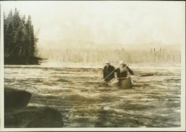
Ray Williston canoeing the Parsnip/Peace system
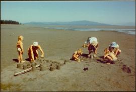
Building sand castles

Forest in Bangladesh
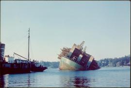
Self-dumping log barge
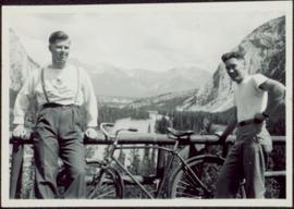
Ray Williston and Bruce Brown
Photographs
Photographs
Snowy slope where both sheep and goats were seen

Lone man surveying the landscape from a snowy peak

Map showing Jasper Park, Fraser River and Prentiss Gray's 1926 adventure
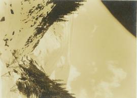
Snow-covered mountain peaks seen through a mountain pass near Jasper Park
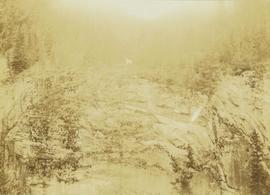
Roche Myette along Davona Creek near a campsite
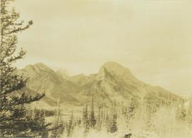
Rocky Mountain vista seen across a forested plateau
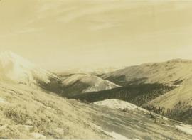
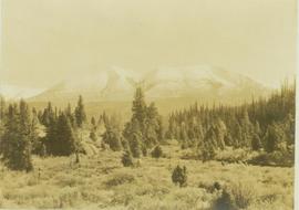
Vista from the Canadian Rockies
Mountain goat along the edge of the deeply cut banks of an unseen river
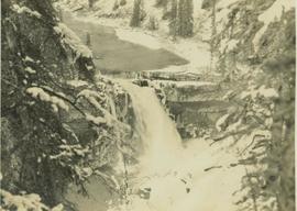
Snake Indian Falls
Mountain goat walks along a steep precipice

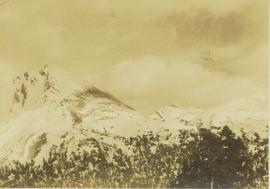
Craggy mountain peak covered with coniferous trees and snow

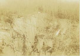
Peace River Canyon

Main Street of Rolla
Vanderhoof, geographical centre of British Columbia
Vanderhoof, geographical centre of British Columbia
Maps
Maps
Central British Columbia Map
Central British Columbia Map
British Columbia Climatic Regions
British Columbia Climatic Regions
Cariboo Estate Map
Cariboo Estate Map
Kitimat City Centre
Kitimat City Centre
Preemptor's map Sheet No. 3 Valleys of Fraser, Salmon & Willow Rivers in Fort George and Peace River Land Recording Districts
Preemptor's map Sheet No. 3 Valleys of Fraser, Salmon & Willow Rivers in Fort George and Peace River Land Recording Districts
British Columbia Biotic Regions
British Columbia Biotic Regions
Pre-emptor's map of Fort George
Pre-emptor's map of Fort George
British Columbia Mountains
British Columbia Mountains
Colonial exploration maps
Colonial exploration maps
A look at Canada
A look at Canada
Highway 16 West: Gateway to Alaska
Highway 16 West: Gateway to Alaska
Centennial Map of Canadian History and Achievements, 1867 to 1967
Centennial Map of Canadian History and Achievements, 1867 to 1967
B.C. Ghost Town Map
B.C. Ghost Town Map
Stuart Lake, Fort St. James, and Fraser Lake area map
Stuart Lake, Fort St. James, and Fraser Lake area map
Omineca Road and Omineca Gold Rush
Omineca Road and Omineca Gold Rush
Stikine River
Stikine River
Yukon Telegraph
Yukon Telegraph
Judge Ferry with binoculars looking over mountainous terrain
Judge Ferry with binoculars looking over mountainous terrain
Port Essington, B.C.
Port Essington, B.C.
Bob Harkins interviews Ted Williams
Bob Harkins interviews Ted Williams
Plans and Legal Records
Plans and Legal Records
Plan of Subdivision of S.W. 1/4, D.L. 4041 : Cariboo District
Plan of Subdivision of S.W. 1/4, D.L. 4041 : Cariboo District
Latest Map of Fort George District
Latest Map of Fort George District
Port Essington: A Town Remembered
Port Essington: A Town Remembered
Plan of Port Essington
Plan of Port Essington
Plan of Lot 7392 - Range 5, Coast District - Port Essington, B.C
Plan of Lot 7392 - Range 5, Coast District - Port Essington, B.C