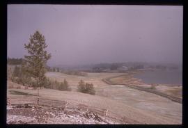
Image depicts a dog in a forest, possibly somewhere near Woodpecker, B.C.
Image depicts a tree line in Woodpecker, B.C.
Image depicts a view south, possibly of an abandoned grade for the BCR; possibly somewhere near Woodpecker, B.C.
Image depicts a north view of a road somewhere in Woodpecker, B.C.
Image depicts the Telegraph Creek.
Image depicts a cliff face near Telegraph Creek.
Image depicts the Telegraph Creek.
Image depicts a road somewhere in Tumbler Ridge, B.C. There are three bush planes in the image.
Image depicts a view of the scenery in Tumbler Ridge, B.C.
File contains slides depicting Turner Lake and other areas of the South Tweedsmuir Provincial Park.
Image depicts an aerial view of a "glaciated valley" in South Tweedsmuir Provincial Park. Glacier Mountain is present in the image.
Image depicts an aerial view of South Tweedsmuir Provincial Park. The lake is possibly Lonesome Lake.
Image depicts an aerial view of a chain of lakes in South Tweedsmuir Provincial Park.
Image depicts a lake in South Tweedsmuir Provincial Park.
Image depicts an unidentified man standing on a wood bridge somewhere in South Tweedsmuir Provincial Park.
Image depicts a lake in South Tweedsmuir Provincial Park. There is an unknown individual present in a canoe with the camera-man.
Image depicts a man in a canoe on a river somewhere in South Tweedsmuir Provincial Park. The man is possibly Kent Sedgwick.
Image depicts a waterfall somewhere in South Tweedsmuir Provincial Park.
Image depicts an unknown individual in the J. Edwards Camp in South Tweedsmuir Provincial Park.
Image depicts a road located somewhere near Birken, B.C.
Image depicts the Place Glacier.
Image depicts an unknown individual at the Place Glacier.
Image depicts the mostly frozen Place Creek Falls.
File contains slides depicting Mud River.
Image depicts the Mud River.
Image depicts a rail road bridge over the Mud River.
Image possibly depicts the Fraser River from Highway 97 near Quesnel, B.C.
Image depicts a stretch of land from Highway 97 near Williams Lake, B.C.
Image depicts the Gibraltar mine site north of Williams Lake, B.C.
Image depicts a number of workers putting in blasting powder at the Gibraltar mine site north of Williams Lake, B.C.
Image depicts the BCR tracks passing through a mill somewhere near the 100 Mile.
Image depicts an aerial view of Williams Lake, B.C.
Image depicts an aerial view of some scenery near Williams Lake, B.C. The highway and BCR tracks are visible among the trees.
Image depicts an aerial view of the Fraser River near Soda Creek, B.C.
Image depicts an aerial view of the Gibraltar mine site's pits and waste dumps, north of Williams Lake, B.C.
Image depicts the cutbanks of the Fraser River at Soda Creek, B.C.
Image depicts the a flock of ducks on Big Bar Lake north of Clinton, B.C..
Image depicts a section of disturbed ground at an unknown location.
Image depicts the Fraser Valley, looking north, possibly from Marguerite, B.C.
Image depicts a formation of rock; presumably solidified lava, as the slide is simply labelled "lava." The location of the image is uncertain.
Image depicts a river and a hillside at an unknown location.
Image depicts a bridge at Soda Creek, B.C. There are numerous unknown individuals present.
Image depicts 108 Mile Ranch, B.C.