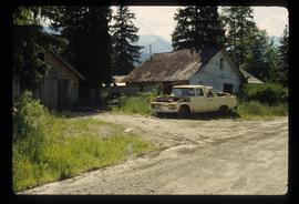
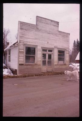
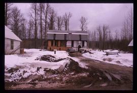
Mostrar 2470 resultados

Archival description
1595 resultados com objetos digitais Mostrar resultados com objetos digitais
Man and Monument
2012.13.1.51.115 · Item · June 1979
Parte de J. Kent Sedgwick fonds

Image depicts a man, possibly Kent Sedgwick, standing next to a monument which states: "In honour of the pioneers of the Ootsa Lake Valley, first settled in 1905." Located somewhere in either the Francois Lake Provincial Park or the Wistaria Provincial Park.

Chimney Lake
2012.13.1.52.01 · Item · May 1979
Parte de J. Kent Sedgwick fonds

Image depicts Chimney lake with a number of houses near the shore, and a child in the foreground.

Gang Ranch Sign
2012.13.1.52.04 · Item · 1980
Parte de J. Kent Sedgwick fonds

Image depicts the sign to Gang Ranch, located in the Upper Fraser Canyon, with graffiti on it.

McBride - Engine Services
2012.13.1.85.59 · Item · [2004?]
Parte de J. Kent Sedgwick fonds

Image depicts a machine shop somewhere in McBride, B.C. The sign above the door reads "McBride Air Cooled Engine Services Ltd."

Crescent Spur
2012.13.1.86.06 · Item · 1975
Parte de J. Kent Sedgwick fonds

Image depicts a beehive burner in the community of Crescent Spur, B.C.

Snowy Road and Houses
2012.13.1.87.011 · Item · [between 1975 and 1995]
Parte de J. Kent Sedgwick fonds

Image depicts a snow-covered road with vehicle tracks, and several houses. The location is uncertain.

House in Penny, B.C.
2012.13.1.87.023 · Item · [between 1975 and 1995]
Parte de J. Kent Sedgwick fonds

Image depicts a small house with brightly coloured door and window frames in Penny, B.C.

Longworth? - A House and a Mountain
2012.13.1.87.030 · Item · [between 1975 and 1995]
Parte de J. Kent Sedgwick fonds

Image depicts a house surrounded by trees and a mountain in the background; it is most likely located somewhere in or near Longworth, B.C.

Teepee?
2012.13.1.87.037 · Item · [between 1975 and 1995]
Parte de J. Kent Sedgwick fonds

Image depicts what appears to be a teepee at an uncertain location.

Upper Fraser Residences
2012.13.1.87.047 · Item · [between 1975 and 1995]
Parte de J. Kent Sedgwick fonds

Image depicts an older building with numerous vehicles parked out front in Upper Fraser, B.C. Map coordinates 54°07'03.5"N 121°56'34.4"W

Open Field in Giscome
2012.13.1.87.069 · Item · [between 1975 and 1995]
Parte de J. Kent Sedgwick fonds

Image depicts a field in Giscome, B.C. On the right side of the image, in the background, is a grey strip that appears to be a mine, possibly the quarry at Eaglet Lake in Giscome, B.C. Map coordinates 54°03'52.9"N 122°22'10.0"W

Houses in Giscome
2012.13.1.87.072 · Item · [between 1975 and 1995]
Parte de J. Kent Sedgwick fonds

Image depicts the Giscome B.C. townsite from across the railroad tracks looking southeast. Map coordinates 54°04'19.7"N 122°22'04.7"W

House - Elevated Main Floor
2012.13.1.87.079 · Item · [between 1975 and 1995]
Parte de J. Kent Sedgwick fonds

Image depicts a house with the main floor and entrance high off the ground. The location is uncertain, likely Giscome, B.C.

Giscome Dairy Farm
2012.13.1.87.083 · Item · [between 1975 and 1995]
Parte de J. Kent Sedgwick fonds

Image depicts a large, old and collapsing barn, as well as a nearby house of the dairy farm in Giscome, B.C. Map coordinates 54°03'53.3"N 122°21'22.6"W

Giscome Mill Foreman's House and Eaglet Lake
2012.13.1.87.095 · Item · [between 1980 and 2000]
Parte de J. Kent Sedgwick fonds

Image depicts the Giscome mill foreman's house on the hill, with Eaglet Lake in the background and numerous piles of logs in the foreground. Map coordinates 54°04'28.0"N 122°22'05.8"W

Buildings in Newlands, BC
2012.13.1.87.101 · Item · [between 1975 and 1995]
Parte de J. Kent Sedgwick fonds

Image depicts several old buildings in a field, one of which has a caved-in roof, in Newlands, B.C. Map coordinates 54°06'28.2"N 122°12'01.0"W

A House and Three People
2012.13.1.87.108 · Item · [between 1975 and 1995]
Parte de J. Kent Sedgwick fonds

Image depicts three people standing at the front door of a house at an uncertain location.

A Kitchen
2012.13.1.87.110 · Item · [between 1970 and 1990]
Parte de J. Kent Sedgwick fonds

Image depicts the interior of a kitchen at an uncertain location.

In Memory Of - Grave-Marker
2012.13.1.87.150 · Item · [between 1975 and 1995]
Parte de J. Kent Sedgwick fonds

Image depicts a grave-marker with several names, it reads: "In Memory of Edith Golder, Winnifred Golder, Baby Pelton, Mrs. Nazarek, Baby Nazarek, Baby Wazylyk 1915 - 1929." It is located in the Willow River Cemetery.

Giscome Sawmill
2012.13.1.87.167 · Item · [between 1975 and 1995]
Parte de J. Kent Sedgwick fonds

Image depicts the mill site at Giscome, B.C. Map coordinates 54°04'19.7"N 122°22'04.7"W

Giscome Sawmill
2012.13.1.87.171 · Item · [between 1975 and 1995]
Parte de J. Kent Sedgwick fonds

Image depicts the mill site at Giscome, B.C. A sign in the foreground reads "Maynard's Industrial Auctioneers." Map coordinates 54°04'19.7"N 122°22'04.7"W

Giscome Sawmill Food Stand
2012.13.1.87.172 · Item · [between 1975 and 1995]
Parte de J. Kent Sedgwick fonds

Image depicts a food stand at the mill site at Giscome, B.C. Map coordinates 54°04'19.7"N 122°22'04.7"W

Giscome Street Scene
2012.13.1.87.173 · Item · [between 1975 and 1995]
Parte de J. Kent Sedgwick fonds

Image depicts a street in Giscome B.C. The Giscome Store is located on the left side of the image with the church in the background. Map coordinates 54°04'18.5"N 122°21'57.7"W